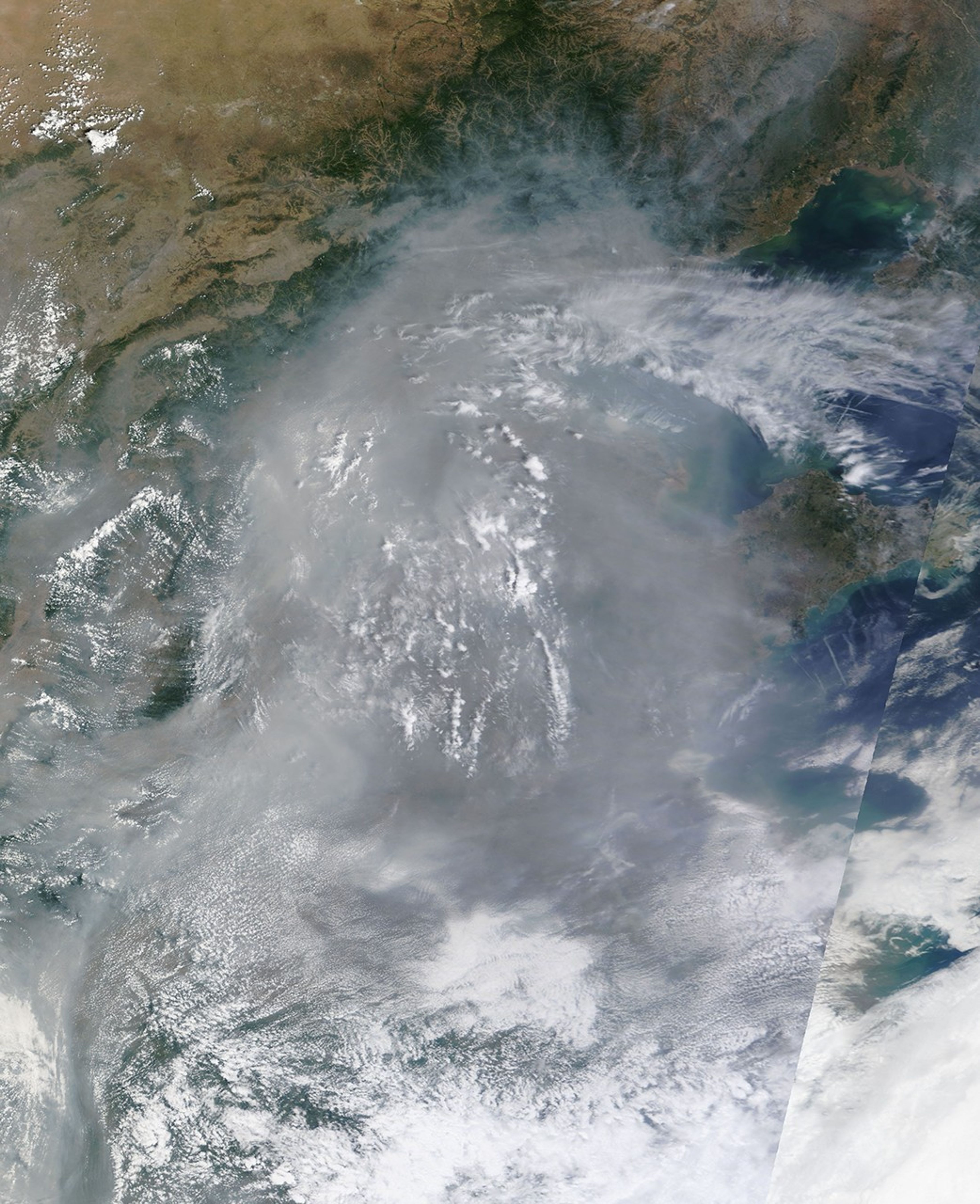
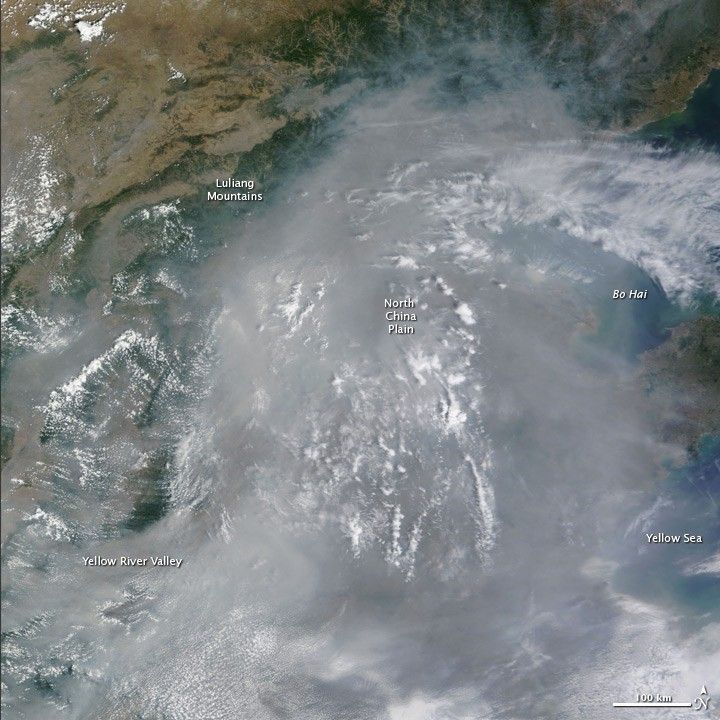
Thick haze hung over eastern China on June 25, 2010. The Moderate Resolution Imaging Spectroradiometer (MODIS) on NASA’s Terra satellite captured this true-color image at 11:35 a.m. local time (3:35 UTC). The smooth gray haze lies low over the land, seeping into the valleys of the Luliang Mountains on the west and north sides of the plain. The path of the Yellow River between the Luliang Mountains and the Qin Ling Mountains to the south is a channel for haze flowing between the North China Plain and locations south and west. The river itself is hidden beneath the opaque air. Scattered white clouds hang over the haze throughout the scene.
The large image is the highest-resolution version of the image. Images of eastern China are available twice daily in a variety of resolutions from the MODIS Rapid Response Team.
References & Resources
NASA image courtesy the MODIS Rapid Response Team at NASA GSFC. Caption by Holli Riebeek.