


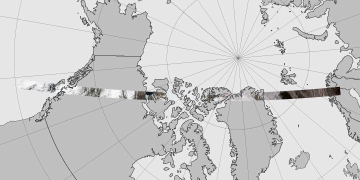
On February 11, 2013, the Landsat 8 satellite rocketed into space to extend a four-decade legacy of Earth observations. A few months after launch, we published a composite of images that spanned 9,000 kilometers of land from Russia to South Africa. In celebration of the satellite’s second anniversary, the mosaic concept returns with a chilly twist, this time featuring a slice of the Arctic Circle.
The Operational Land Imager (OLI) on Landsat 8 acquired this unbroken swath of images on June 21, 2014—the summer solstice—when the Sun stays above the horizon of the Arctic for at least 24 hours. While much of the region is still frozen in June, the ice is in various stages of melting.
The Landsat 8 swath begins in Sweden and Finland, then crosses the Greenland Sea and northern Greenland. The scenes then take us over North America, through Canada’s Nunavut and Northwest Territories, before ending up offshore of British Columbia. In its entirety, the flyover covers an area about 6,800 kilometers long and 200 kilometers wide (4,200 by 120 miles).
“These Landsat swaths provide stunning views of transitions across the most remote and infrequently visited areas of our planet,” said Jim Irons, NASA’s project scientist for Landsat 8.
If you visit Earth Observatory often, you’ve noticed scenes that our Landsat scenes are usually selected for their clear views of the ground, which over time can reveal how the planet is changing. But the full swaths offer a unique perspective by showing Earth as the satellite “sees” it on its orbital path. And like the view from a cross-country flight on an airplane, there are often clouds blocking the view of the ground.
“When you add the multi-temporal and historic nature of the Landsat data archive into consideration,” Irons said, “the views become vital in observing seasonal and interannual changes to a region that is most sensitive to climate change.”
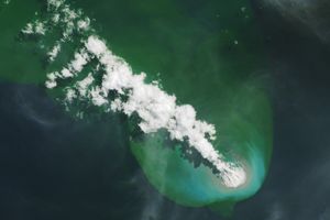
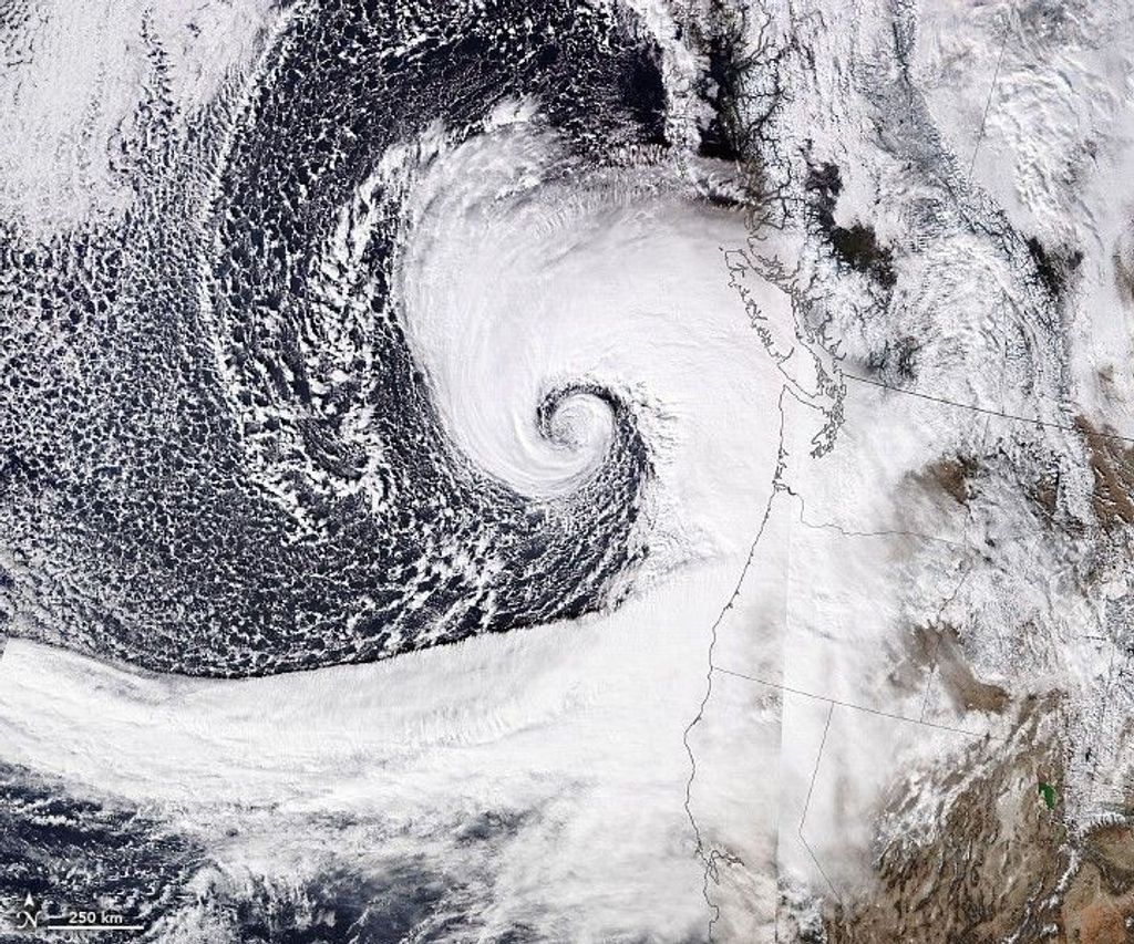
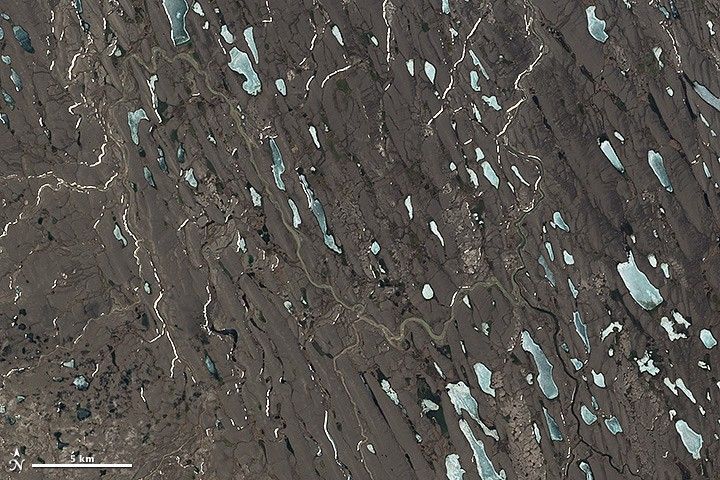
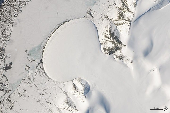
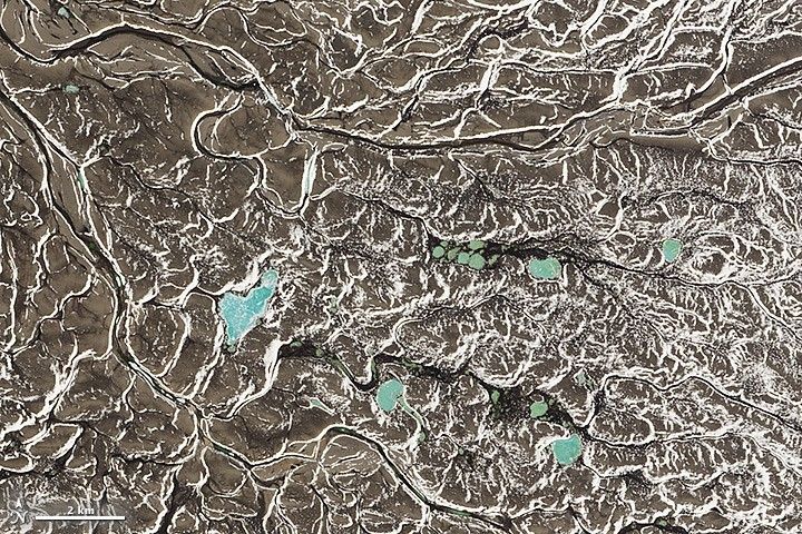
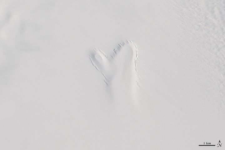
Watch the video (above) to fly along on a tour of Arctic landscapes. Or go on a self-guided tour using GigaPan (below). We have highlighted eight favorite scenes at the bottom of this page. Some features, such as the subglacial lake, are the focus of ongoing research. Others were selected simply for their striking beauty.
Highlights


References and Related Reading
- Landsat Science at NASA (2015) The Landsat Program. Accessed February 11, 2015.
- Landsat Science at USGS (2015) Landsat Missions. Accessed February 11, 2015.
- NASA Earth Observatory (2013, May 15) Come Fly With the Newest Landsat. Accessed February 11, 2015.
- NASA Earth Observatory, Greatest Hits from Landsat. Accessed February 11, 2015.
Visuals and text by Kathryn Hansen, Jesse Allen, Robert Simmon, and Matt Radcliff; design by Paul Przyborski.