Typhoon season in the northwest Pacific has been quiet for most of 2025. Real-time estimates of accumulated cyclone energy from Colorado State University show that the basin was only half as active as usual as of September 23.
However, Typhoon Ragasa (also called Nando) has broken the quiet spell. The storm emerged on September 18 in the western Pacific Ocean a few hundred miles east of the Philippines. After periods of rapid intensification that brought it to Category 5 strength, the storm lashed northern Luzon and Taiwan on September 22, causing floods, landslides, and damage to crops and property. With sustained winds that reached more than 145 knots (270 kilometers or 165 miles per hour) late on September 21, the super typhoon ranked as the strongest typhoon of 2025.
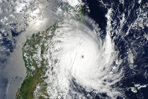
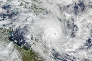
The MODIS (Moderate Resolution Imaging Spectroradiometer) on NASA’s Terra satellite acquired this image of Ragasa at 01:40 Universal Time on September 23, 2025. At the time, forecasters expected the storm to maintain a west-northwestward trajectory, making landfall in southern Guangdong province on September 24 before skirting the coast of the Gulf of Tonkin and moving into northern Vietnam and Laos. As it approaches China, Ragasa is expected to weaken only slightly. According to the Joint Typhoon Warning Center, the storm is moving through a “highly favorable environment characterized by strong radial outflow, warm sea surface temperatures, and low vertical wind shear.”
As of September 23, the storm had displaced tens of thousands of people, caused multiple deaths, and led to power outages and extensive damage in the Philippines, according to news reports. As cleanup efforts began in the Philippines, life in several Chinese cities came to a standstill as people evacuated homes, schools, and workplaces ahead of the storm. Authorities in Vietnam evacuated thousands of households as well, according to news reports.
The Western Pacific typhoon season spans the entire year, but most storms form between May and November, with a peak in activity in late August and early September. As of September 23, nineteen named typhoons had formed in 2025, though only two had achieved Category 3 or higher strength for a sustained period.
References & Resources
- Associated Press, via The Weather Channel (2025, September 23) Super Typhoon Ragasa Leaves Three Dead In Philippines, As China Braces For Landfall. Accessed September 23, 2025.
- BBC (2025, September 23) Super typhoon hits Philippines as thousands evacuate. Accessed September 23, 2025.
- Colorado State University (2025, September 23) Real-Time Northwest Pacific Ocean Statistics by Storm for 2025. Accessed September 23, 2025.
- Gateway to Astronaut Photography (2025, September 22) ISS073-E-764626. Accessed September 23, 2025.
- Hong Kong Observatory (2025) Tropical Cyclone Classification. Accessed September 23, 2025.
- Joint Typhoon Warning Center (2025, September 23) Prognostic Reasoning for Typhoon 24W (Ragasa). Accessed September 23, 2025.
- Manila Bulletin (2025, September 23) Calayan, Babuyan Claro Islands sustain heavy damage from ‘Nando.’ Accessed September 23, 2025.
- NASA Mapping the Impacts of Hurricanes & Cyclones. Accessed September 23, 2025.
- NASA Earthdata (2025) Hurricanes. Accessed September 23, 2025.
- NASA Worldview (2025, September 23) Super Typhoon Ragasa. Accessed September 23, 2025.
- Philippine Atmospheric, Geophysical and Astronomical Services Administration (2025, September 17) Tropical Depression NANDO. Accessed September 23, 2025.
- Reuters (2025, September 23) Taiwan says two dead, 30 missing in east of island after typhoon. Accessed September 23, 2025.
- Yui, K., via X (2025, September 22) Hello everyone! Accessed September 23, 2025.
NASA Earth Observatory image by Wanmei Liang , using MODIS data from NASA EOSDIS LANCE and GIBS/Worldview . Story by Adam Voiland .


