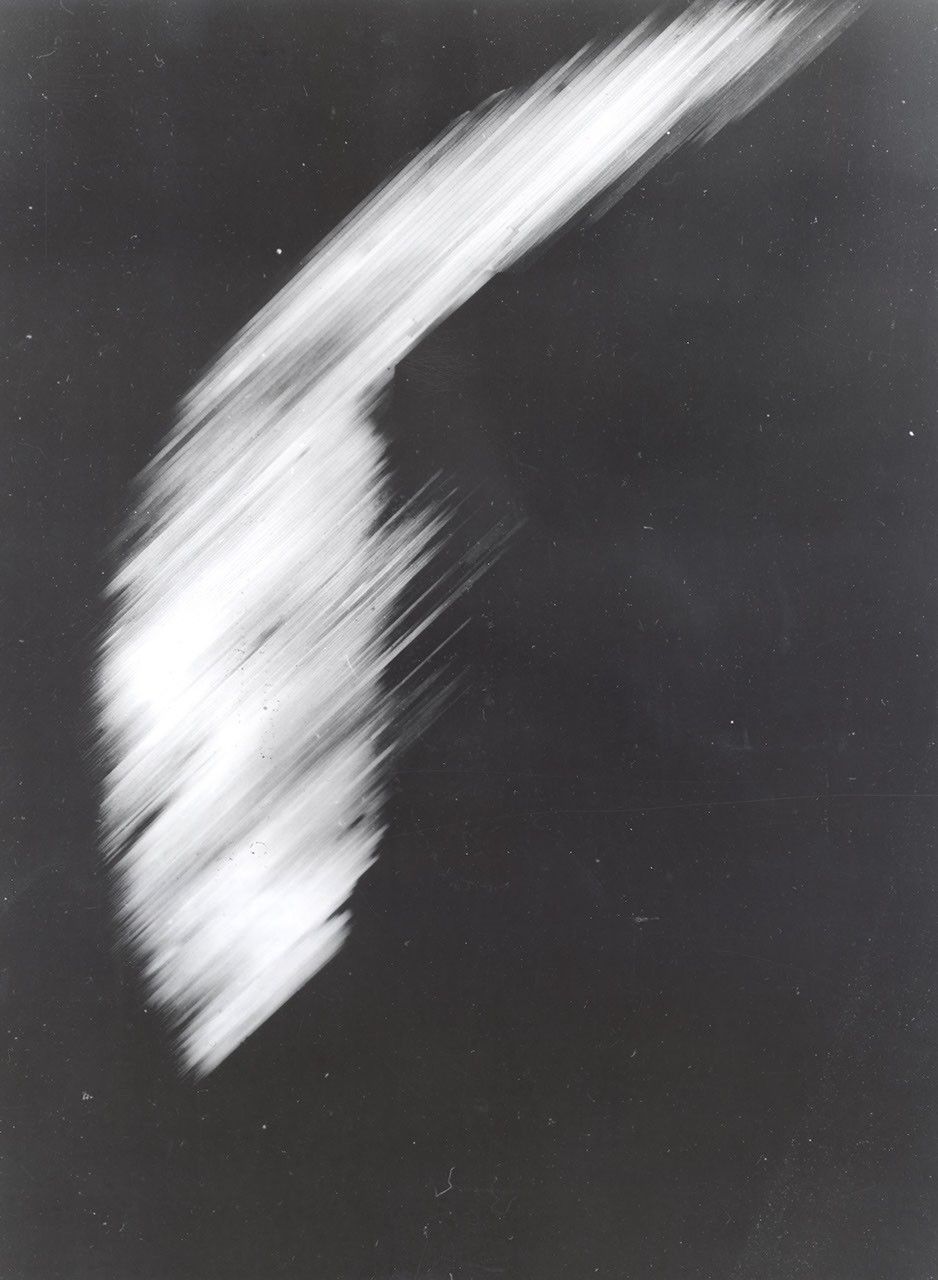
1959: First satellite image of Earth (Explorer VI)
The first picture obtained from the Explorer VI satellite in 1959 shows a sun-lighted area of the Central Pacific ocean and its cloud cover. The picture was made when the satellite was about 17,000 miles above the surface of Earth, crossing Mexico.
Image Credit: NASA
- X
https://science.nasa.gov/image-detail/amf-b3a0d8d2-2e9c-41d5-aa65-630b0d751fab/
Image CreditNASA
Size2212x3016px