


![Request for Information – Potential [Placeholder for Prize]](https://assets.science.nasa.gov/dynamicimage/assets/science/psd/solar/2023/09/s/solarsystem_0.jpg?w=1024)


NASA’s PACE Satellite Provides New Pollution Measuring Product
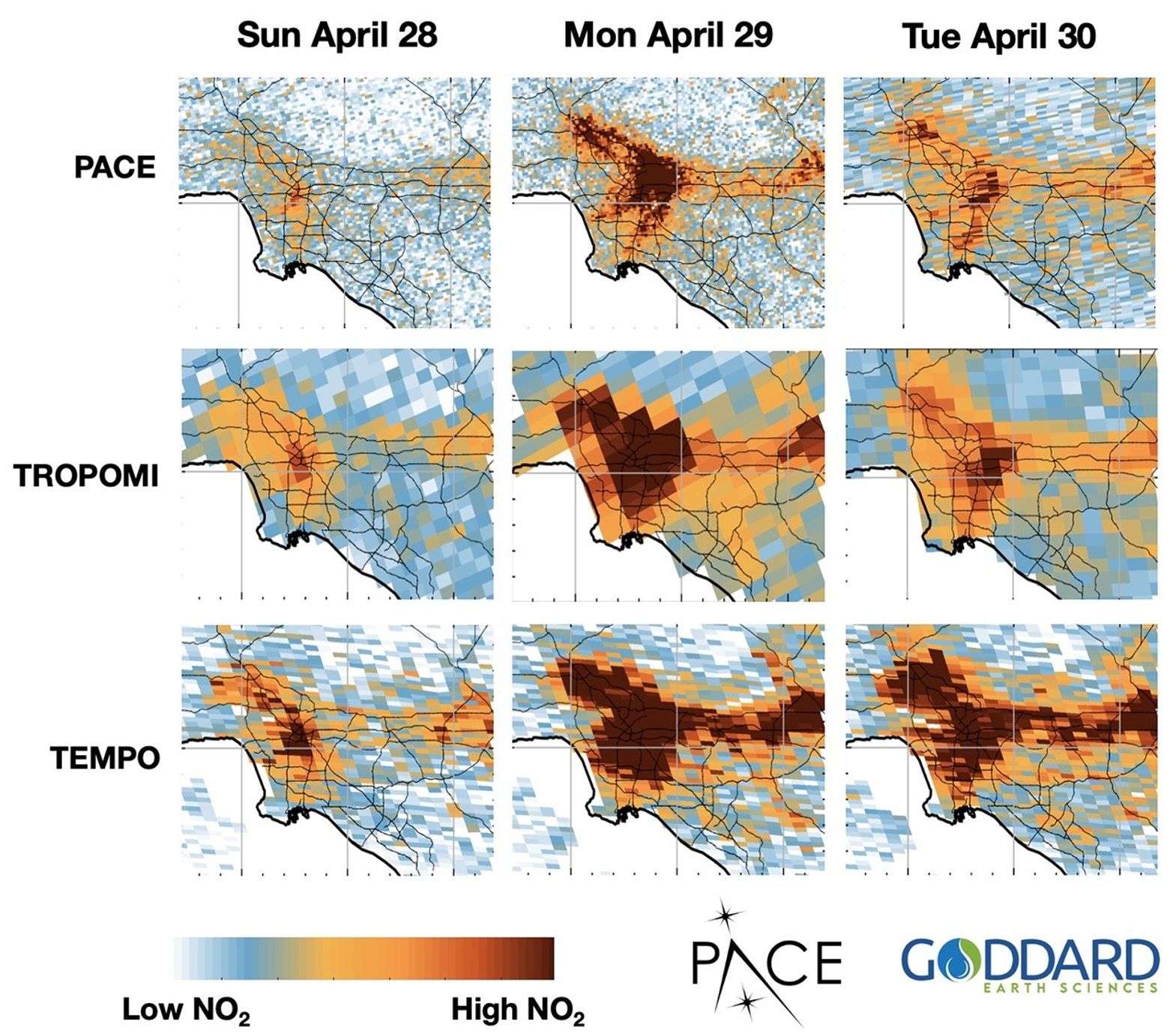
NASA’s Plankton, Aerosol, Cloud, ocean Ecosystem (PACE) satellite, known for measuring tiny organisms in the ocean and particles in the atmosphere, has a new capability: it can track nitrogen dioxide pollution.
Nitrogen dioxide is a harmful air pollutant produced from burning fossil fuels and wood. The trace gas can also react with sunlight and oxygen to make ground-level ozone, which is harmful to people, animals, and plants.
Researchers can now use this new product to pinpoint emission sources as small as an individual factory or vehicle pollution from specific highway corridors, supporting efforts to reduce health risks, optimize urban and transportation planning, and protect agricultural productivity.
The PACE Ocean Color Instrument (OCI) measures a continuous spectrum of light — from ultraviolet through visible to near-infrared light. Like the ocean organisms, nitrogen dioxide has a unique spectral fingerprint which OCI can detect.
To track nitrogen dioxide, scientists tapped into the capabilities of another Earth-observing satellite. The Tropospheric Monitoring Instrument (TROPOMI) on the European Space Agency’s Sentinel-5P satellite monitors air quality and specializes in measurements such as nitrogen dioxide, but at a lower spatial resolution than OCI. Using TROPOMI data, scientists trained PACE to measure amounts of nitrogen dioxide, allowing for emission monitoring at finer scales than other satellite data sets.
This PACE data product is now available on NASA Earthdata along with all other PACE data.
~Erica McNamee
