
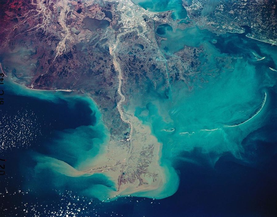
From Texas to Maine, coastal wetlands and marshes are releasing more than 1.45 billion pounds (660,000 metric tons) of carbon into the ocean each year.
NASA-Supported Study Tracks Carbon Cost of Coastal Erosion




























The latest news briefs from NASA science.
From Texas to Maine, coastal wetlands and marshes are releasing more than 1.45 billion pounds (660,000 metric tons) of carbon into the ocean each year.
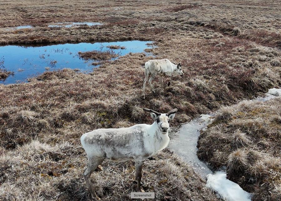
As autumn gives way to winter across the Arctic, the ground doesn’t immediately freeze solid. Instead, soils often linger near the freezing point for days or even weeks in a phase called the zero curtain. In a new NASA-led study, researchers produced high-resolution maps of the Arctic zero curtain. Understanding the duration, intensity and extent […]
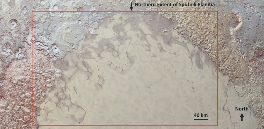
A new analysis of imagery collected during NASA’s New Horizons spacecraft’s 2015 encounter with Pluto provides evidence that liquid nitrogen is rising to Pluto’s surface through cracks in the northern edge of the Sputnik Planitia, part of the massive heart-shaped glacier on the dwarf planet’s surface. This is the first evidence of recently flowing liquid […]
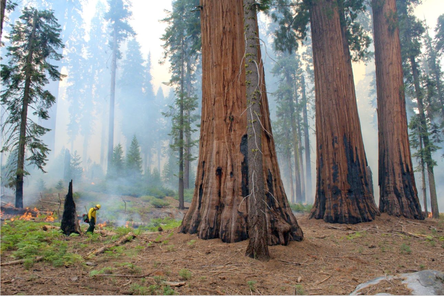
A new study, funded by NASA, found that giant sequoias were nearly four times more likely to survive extreme wildfires in forests that have been managed with prescribed burns, which decrease tree mortality.
![An educational diagram illustrating how measurement uncertainty can distort data regarding Earth's magnetosphere, featuring a detailed space visualization alongside two comparative line graphs. Top Right: Earth is shown surrounded by a complex network of blue magnetic field lines.Far Right: A bright blue, curved line denotes the "Bow shock," which transitions into an orange-red turbulent region labeled the "Magnetosheath." Spacecraft Locations: The "WIND" spacecraft is positioned far to the left in the "Solar wind" stream, connected to a label reading "Measured solar wind strength." The "THEMIS" spacecraft sits closer to Earth inside the magnetosheath, labeled "Corrected solar wind strength. Left Graph: Plots "Earth's response [mV/m]" against "Measured solar wind strength [mV/m]." A blue line initially follows a linear path but then flattens out, marked with the text "illusion of saturation due to measurement uncertainty."Right Graph: Plots "Earth's response [mV/m]" against "Corrected solar wind strength [mV/m]." A pink line continues steadily upward diagonally, labeled as the "True linear response."](https://science.nasa.gov/wp-content/uploads/2026/07/sivadas-2026-explanation-figure-v5-1.jpg?w=900)
For decades, scientists have thought that there is a ceiling to how intensely Earth responds to solar storms. However, a NASA-led paper published Wednesday in Nature suggests this upper limit is an illusion. If so, it means solar storms could have far worse effects on our technology than previously thought. Observations have suggested that electric […]
Editor’s note: This post was updated on July 10,2026, to clarify details on the scientific data visualization, and on July 21, 2026, to correct the description of the illustrated graphic. Researchers working with one of NASA’s DRIVE (Diversify, Realize, Integrate, Venture, Educate) Science Centers are closer to unraveling a long-standing solar mystery surrounding the extreme […]

Led by ESA (European Space Agency) with contributions from NASA, the Euclid space telescope has discovered 31 of the oldest quasars ever documented. In fact, two are the oldest ever observed, dating back to the universe’s infancy, when it was just 5% of its current age. A new study details the results in the journal Astronomy & Astrophysics. A quasar occurs when immense amounts of gas and dust […]

NASA air quality information is supporting CDC planning as World Cup crowds gather across North America.
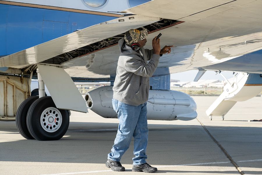
Data from a NASA campaign in Panama and Peru will help communities prepare for tropical floods in cloud-covered areas, improve scientific understanding of forest health, and support planning for spaceborne missions. NASA’s C-20A aircraft from Armstrong Flight Research Center in Edwards, California, flew the Uninhabited Aerial Vehicle Synthetic Aperture Radar (UAVSAR) instrument, developed at NASA’s […]