


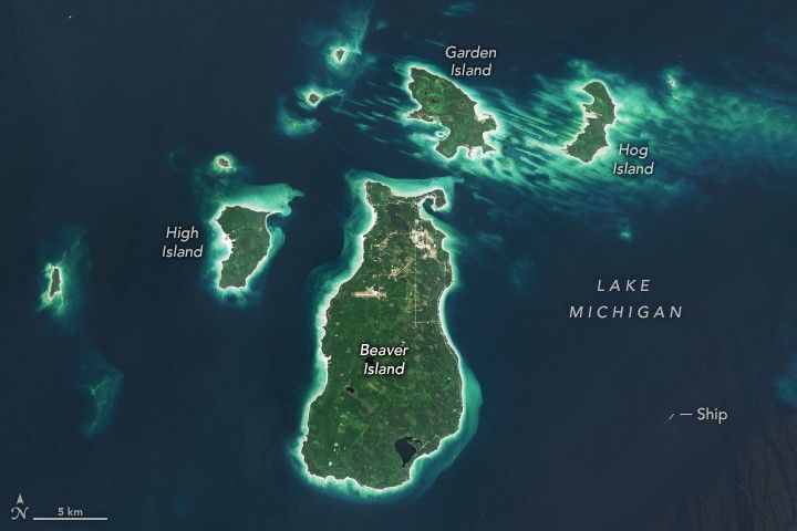
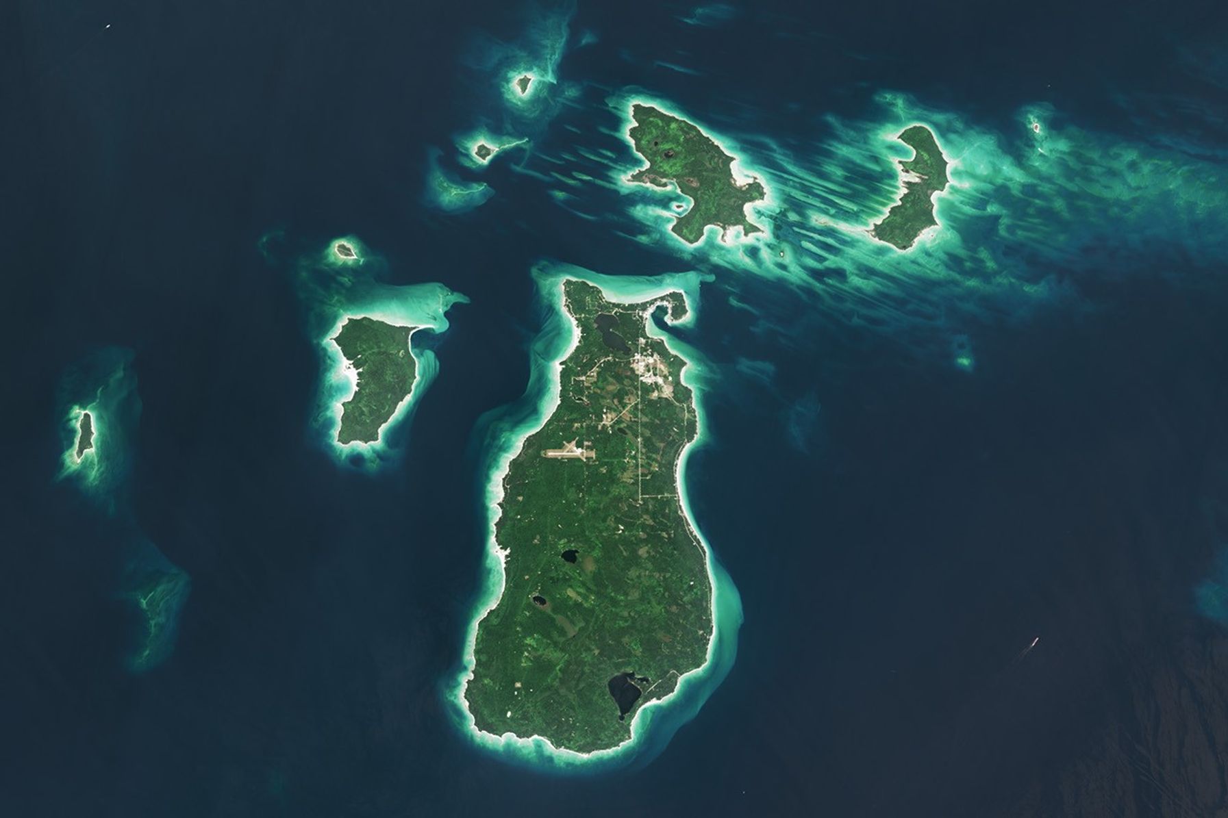
In a process that played out over thousands of years, a retreating ice sheet carved, scoured, and shaped the landscape of the present-day Great Lakes. In northern Lake Michigan, this sculpting left distinct ridges and valleys running north-to-south along the lake floor. Some parts of those ridges, made of erosion-resistant rock, have remained above the waves of the big lake, forming the Beaver Archipelago.
The OLI (Operational Land Imager) on Landsat 9 captured this image of several of the archipelago’s islands on August 2, 2024. These patches of land contain upland forests, dunes, wetlands, and marshes—habitats that support rare plant and bird species and provide spawning grounds for fish. The bright, sandy perimeters of the islands are surrounded by shallow, turquoise waters and deeper, dark blue areas, where depths reach up to about 330 feet (100 meters).
This image centers on Beaver Island, the largest island in Lake Michigan at 13 miles (21 kilometers) long and 6 miles (10 kilometers) wide. It is also the only inhabited island of the Beaver Archipelago, and many of its approximately 600 residents are of Irish descent. In the mid-1800s, scores of immigrants from County Donegal, Ireland, and Irish fishermen from nearby islands and ports in Michigan settled on the island, which subsequently took on the moniker of “America’s Emerald Isle.”
The farming and fishing, in particular, were productive for the new arrivals. In the 1880s, Beaver Island became the largest supplier of freshwater fish in the United States. Due to overfishing, however, such abundance would be short-lived.
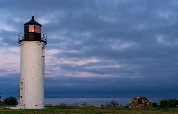
Ship traffic on the Great Lakes was also increasing during this time. Two lighthouses were constructed on the island to help the growing number of vessels traveling between Chicago and the Straits of Mackinac. The Beaver Head Lighthouse operated from 1852 to 1962 on the southern end of the island. On the northern side, the Beaver Island Harbor Light, pictured below, was first lit in 1870 and remains an active beacon more than 150 years later.
Today, people travel to Beaver Island by boat or plane to explore its history and enjoy activities such as biking, fishing, and kayaking. The island’s remote location and minimal light pollution led to the establishment of the Beaver Island State Wildlife Research Area International Dark Sky Sanctuary in 2024. Sky gazers may be drawn to the sanctuary for a chance to glimpse the aurora borealis and other celestial phenomena.
Neighboring islands in the archipelago are more difficult to access and have remained relatively undisturbed. Perched, or cliff-top, sand dunes are found up to 200 feet (60 meters) above the lake level on the western side of High Island. Unique plant species, including the Pitcher’s thistle and Lake Huron tansy, grow in the island’s dunes. On Hog Island, patches of old-growth northern hardwood forest remain. Wetland communities known as Great Lakes marshes along the shoreline provide spawning grounds for perch and smallmouth bass.
NASA Earth Observatory image by Wanmei Liang, using Landsat data from the U.S. Geological Survey. Photo by Kelcie Herald/Unsplash. Story by Lindsey Doermann.
References & Resources
- Beaver Island Historical Society, Beaver Island Historical Society Welcomes You to Our Past. Accessed May 12, 2026.
- DarkSky International (2024, April 8) Beaver Island State Wildlife Research Area. Accessed May 12, 2026.
- NASA Earth Observatory (2013, August 24) Garden and Hog Islands, Michigan. Accessed May 12, 2026.
- NOAA National Centers for Environmental Information, Lake Michigan Geomorphology. Accessed May 12, 2026.
- Northern Michigan History, Beaver Island History: From Ancient Circles to Irish Settlers. Accessed May 12, 2026.
- Wisconsin Sea Grant, The formation of the Great Lakes. Accessed May 12, 2026.


