Editor's note: this list was written in December 2012 as a forecast of upcoming events.
Feb. 17
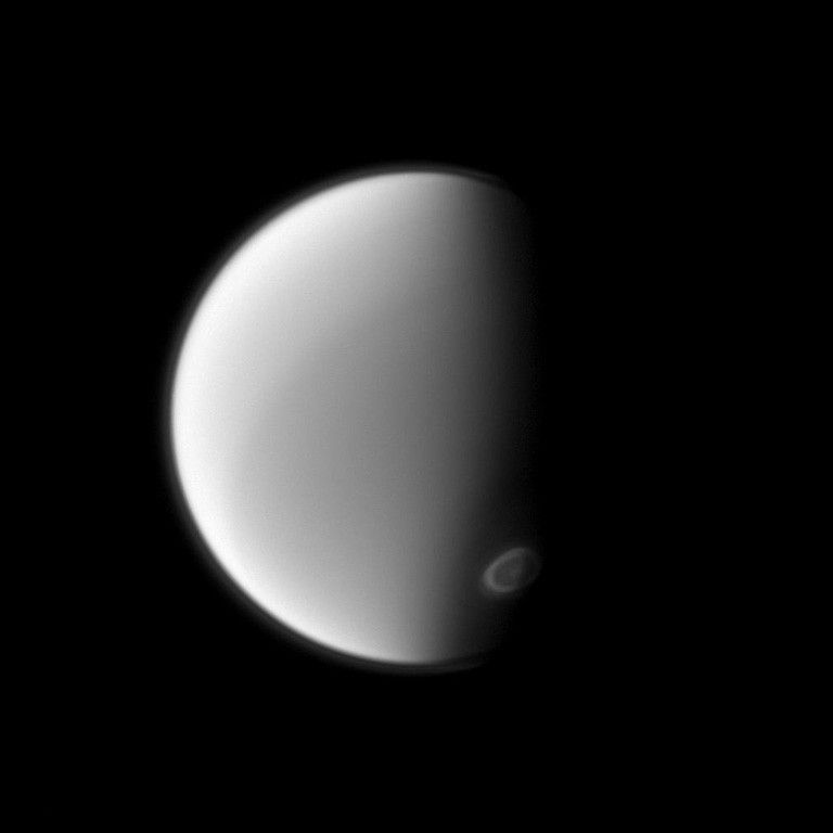
(Feb. 16, 5:57 p.m. PST) –Titan flyby (1,229 miles, or 1,978 kilometers) – T-89: This is one of four radio science (RSS) gravity flybys in the Solstice mission. During the Solstice mission, the main science objectives of measurements of Titan’s gravitational field relate to the so-called Titan Interior Oceans Campaign. Additional gravity-measuring flybys are required to confirm or deny the presence of an ocean and determine whether the interior is soft or rigid. Additional RSS gravity observations will help determine if Titan’s crust is thick and rigid, or still thin. The latter would support the theory that there is ongoing dehydration today.
T-89 is the “outstanding” gravity flyby opportunity during the Solstice mission. Only two bistatic (a type of radio science observation used to determine the nature and composition of Titan’s surface) flybys in the Solstice mission are of higher scientific priority for RSS.
March 9
Rhea flyby (620 miles, or 997 kilometers) – R-4: This gravity flyby of Rhea is designed to understand the internal structure of Rhea. Is Rhea a homogeneous body or did it differentiate into a core, mantle, and crust like the Earth? Fields and particles instruments will also be measuring the dust environment around the moon, and Cassini's cameras will be gathering images of the surface at ultraviolet, infrared, and visible wavelengths.
April 5
Titan flyby (870 miles, or 1,400 kilometers) – T-90: the composite infrared spectrometer (CIRS) performs complementary, high spectral resolution, limb integrations with both the mid and far infrared arrays. Both observations will be situated at low northern latitudes, filling an important gap in recent spatial coverage. Limb aerosol and temperature radial measurements at the same location will also be performed. In addition, CIRS will make a northern scan to determine surface temperature variations with location and local time, and several far-infrared surface integrations including coverage of the enigmatic Xanadu region.
During its prime observation, the visible and infrared mapping spectrometer (VIMS) will image Menrva, (20.1 N, 87.2 W) the western part of Xanadu, including Tui Regio, with resolution of at least three miles (five kilometers) per pixel. Then a challenging observation of Ontario Lacus will be made before capturing a medium resolution (six mile [10 kilometer] per pixel) mosaic centered at southern mid-latitude south of Adiri looking for surface and cloud evolution. The VIMS instrument will also be looking at clouds at northern mid-latitudes that are expected to form during Titan’s spring season, according to global circulation models.
May 23
Titan flyby (602 miles, or 970 kilometers) – T-91: The Radar observations just prior to closest approach are labeled as synthetic aperture radar (SAR, a technique which uses that spacecraft's flight path to simulate a very large radar aperture), but some of that time will be used to perform altimetry (a measure of the height of features on Titan’s surface) over Ligeia Mare, the only altimetry over a lake in the Solstice. This is of considerable importance - the altimetry data is Radar's most sensitive and unambiguous data type for wave detection and the T-61 data on Ontario were lost. The SAR portion is used to go over northern lakes observed in T-16/T-19 for change detection, and will provide stereo of lakes with T-92 SAR. Outbound altimetry after closest approach along the 120 degree longitude line down to the equator will be used to determine Titan’s global shape.
July 10
Titan flyby (599 miles, or 964 kilometers) – T-92: This “10-pointer” Radar flyby (one of the two scientifically most significant Titan flybys for Radar during the Solstice mission) features SAR coverage of small lakes seen in T-18/19. The SAR portion will provide stereo imaging of lakes in conjunction with T-91 SAR data. The instrument will use a variety of observations--inbound and outbound scatterometry/radiometry, HiSAR and altimetry—during the flyby. Inbound, the imaging science subsystem (ISS) will acquire a mosaic of high northern latitudes on Titan's leading hemisphere, approaching northern summer. This area of Titan's surface has not yet been well observed (multiple observations of high northern latitudes may be needed in case of cloud cover obscuring the surface). On the inbound, while riding along with ISS and CIRS, VIMS will observe the North Pole area and will continue to monitor the evolution of the cloud system. The specular reflection geometry happens near Ara Fluctus (55.28 N, 133.9 W)-(55.45 N, 137.2 W) during the period nine to six hours before closest approach. On the outbound, VIMS is prime at about one and a half hours after closest approach and will acquire a mosaic over the southern mid-latitude terrains South of Adiri and Belet with instrument resolution starting at three miles (five kilometers) per pixel.
July 19
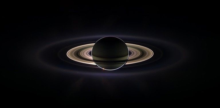
Ring High Phase observation: this is a unique opportunity in the Solstice mission to observe Saturn's rings at extremely high phase angles for a protracted period of time while the Sun is in eclipse behind the planet. This particular solar eclipse is special because it occurs when the spacecraft is roughly 724,000 miles (1,164,640 kilometers) from Saturn (all of the other solar eclipses in the Solstice mission occur at about 470,000 miles [757,000 kilometers] or less). This not only permits the rings to be observed at higher phase angles, it also means that the spacecraft spends more time in the planet's shadow, enabling longer observations.
The primary science goal of these observations is to answer questions raised by the previous distant eclipse, which occurred Sept. 14 – 15, 2006 (during revolution 28 [Rev 28] of the prime mission). The spectacular mosaic obtained at this time revealed that the E ring had unexpectedly large longitudinal asymmetries in its brightness and its color. These likely reflect the influence of various non-gravitational forces on the tiny grains in this ring, but details remain obscure. The Rev 195 observations, which take place between July 15 and July 30, should enable scientists to clarify the processes that are sculpting the E ring, which in turn might have implications for the surfaces of the icy satellites and the inner magnetosphere.
VIMS measurements of the E ring's spectra during the Rev 28 eclipse only covered a restricted range of longitudes on one ansa. The Rev 195 eclipse provides VIMS with the opportunity to obtain spectral data at multiple longitudes in the E ring, which should clarify how its particle size distribution varies with longitude. This observation will also enable VIMS to obtain spectral measurements of the other faint rings, including the D and F rings, which will provide further constraints on the particle size distributions in these rings. Furthermore, since these rings have also been observed to vary dramatically on time scales of years to decades, these data should help clarify if there have been any large-scale changes in the particle size distributions in these rings.
Some of the forces that could be sculpting the E ring, such as solar radiation pressure, should change on seasonal time scales. Indeed, ISS data from an eclipse in Rev 173 (Oct. 6 to Oct. 27, 2012) indicate that the longitudinal structure of this ring has changed significantly over the last eight years. The Rev 195 observations will enable ISS to confirm and clarify these variations. This sequence will also allow ISS to image extremely faint features such as the Pallene and Janus ringlets, as well as the Tendrils in the E ring around Enceladus, which have proven extremely difficult to image in other viewing geometries, and thus still have very uncertain morphologies.
July 26
Titan flyby (870 miles, or 1,400 kilometers) – T-93: VIMS is prime at closest approach and will acquire images of Punga Mare and Ligeia Mare on the inbound. Earlier in this flyby, observations of specular reflection will be possible if liquid bodies are present in the area between near Ara Fluctus (57.3 N, 131.2 W) and (58.4 N, 151.7 W). After closest approach, ISS will acquire high-resolution images of Ontario Lacus on the terminator as the Sun sets for southern winter.
Sept. 12
Titan flyby (870 miles, or 1,400 kilometers) – T-94: Inbound, VIMS will ride along with ISS to acquire a medium resolution mosaic of high northern latitudes. It will also look for clouds over the north pole to monitor the evolution of the cloud system as Titan approaches summer solstice. VIMS will also look for specular reflection in an area located between latitudes 57 N and 60 N and between longitudes 131 W and 161 W. During closest approach VIMS will first acquire a medium resolution map of Punga Mare and the lake area. It will then acquire a high-resolution swath over terrain from high northern latitudes to the equator at the anti-Saturn hemisphere. Then VIMS will ride along with CIRS and the ultraviolet imaging spectrograph (UVIS) instrument to image Titan’s southern hemisphere at high incidence angle. It will also look at clouds to follow the evolution of the cloud system over the South pole.
Oct. 14
(Oct. 13, 9:56 p.m. PDT) – Titan flyby (597 miles, or 961 kilometers) – T-95: This is a highly inclined pass, with closest approach near the equator, providing coverage of equatorial region out to both mid Northern and Southern latitudes. This is the best pass in the Solstice mission to study the effects of solar input on Titan’s atmosphere. This pass is also in the outer flank of the Titan magnetospheric interaction region, which makes it an excellent opportunity to study both the effects of solar activity on the magnetospheric boundary as well as seasonal change.
Lakes on Saturn's moon Titan reflect radio waves in varying ways in this image taken on May 22, 2012. Scientists think the variations in reflectivity, or brightness, have to do with the smoothness or texture of the surface. If a lake is fully liquid, it looks dark, but if it is only partially liquid, it looks brighter.
Radar has ride-along SAR running north to south east of Adiri, across Selk impact structure, and HiSAR of Ontario Lacus and margins of Ligeia Mare for change detection. . Inbound there is an opportunity for high synthetic aperture radar (HiSAR, a method like SAR that can be used when the target is too far away or at the wrong angle for conventional SAR) and altimetry, and outbound is planned scatterometry/radiometry, HiSAR and altimetry.
Dec. 1
(Nov. 30, 4:41 p.m. PST) – Titan flyby (870 miles, or 1,400 kilometers) – T-96: VIMS is prime at closest approach during this flyby. During the inbound wing, VIMS will ride along with ISS to acquire a medium-resolution mosaic of high northern latitudes. It will also look for clouds over the North Pole to monitor the evolution of the cloud system as Titan approaches summer solstice. VIMS will also look for specular reflection in an area located to the east of Ara Fluctus, between latitudes 53 N and 48 N and between longitudes 130 W – 163 W. During closest approach VIMS will first acquire a high resolution map of the northern seas and lakes. It will then acquire a high-resolution swath over terrain from high northern latitudes to the equator along the western edge of Xanadu. Then, at the end of its prime observation, VIMS will stare at Ontario Lacus (72.5 S, 182.5 W), which will be on the terminator. VIMS will then ride along with CIRS and UVIS to image Titan’s southern hemisphere. It will also look at clouds to follow the evolution of the cloud system over the south pole.
Cassini also observes Enceladus' plumes multiple times
- to obtain different viewing geometries that better characterize plume morphology, particle size, and the relationship between plumes and surface features and thermal anomalies. Specific jets are mapped to specific locations. In addition, large distances are required for context and to understand the relationship of the plumes to the E-ring.
- to understand the variability of geologic activity on Enceladus, the same viewing conditions at different times are required.
- for observations of both jets and plumes are required.
Spacecraft Event Time
Dates are listed in Spacecraft Event Time (SCET), which is the time the something happens at the spacecraft based on Coordinated Universal Time (UTC).


