First Maps of Sub-Visual Cirrus in the Upper Tropical Troposphere
Daily global measurements of the location, height and optical thickness of subvisible cirrus show seasonal movements.
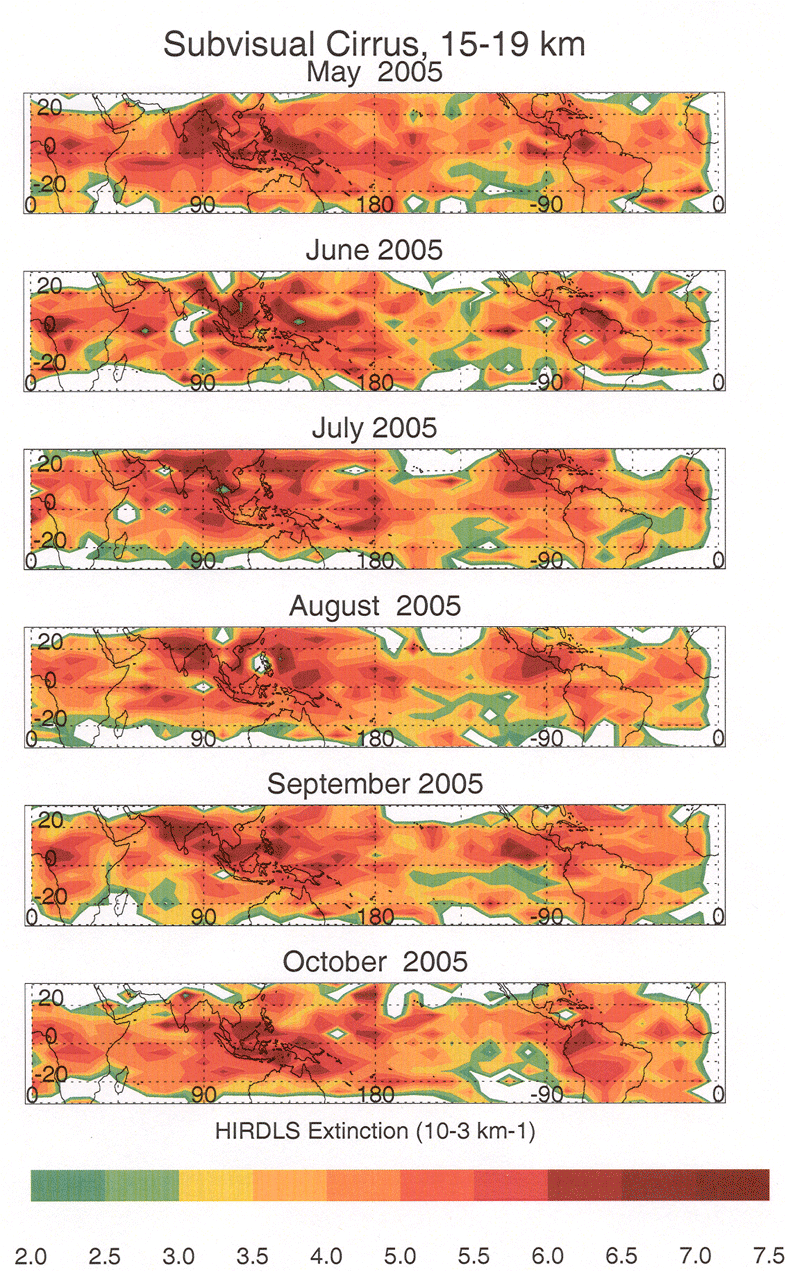
MLS sees cloud ice, but High Resolution Dynamics Limb Sounder (HIRDLS) sees the clouds themselves, even clouds that are so thin that people cannot see them. Just as in the MLS cloud ice map we see large amounts of this cirrus in regions of significant cloud ice. However, the HIRDLS maps show us that thin cirrus is nearly everywhere we look in the tropics but thickest near convection.
- These cirrus layers play an important role in the earth's radiative balance as well as in dehydrating the UT/LS.
- HIRDLS observes these layers at many latitudes, 2 times each day, permitting seasonal and inter-annual variations in this critical parameter to be determined.
- Note movement from SE Asia to India to Indonesia and from Central to South America. This movement is related to the change in the location of deep convection.
HIRDLS cloud maps
HIRDLS
Aura’s High Resolution Dynamics Limb Sounder (HIRDLS) instrument can obtain profiles over most of the globe, both day and night. Complete Earth coverage can be obtained in twelve hours. Observations…
Learn More About HIRDLS