


before
after
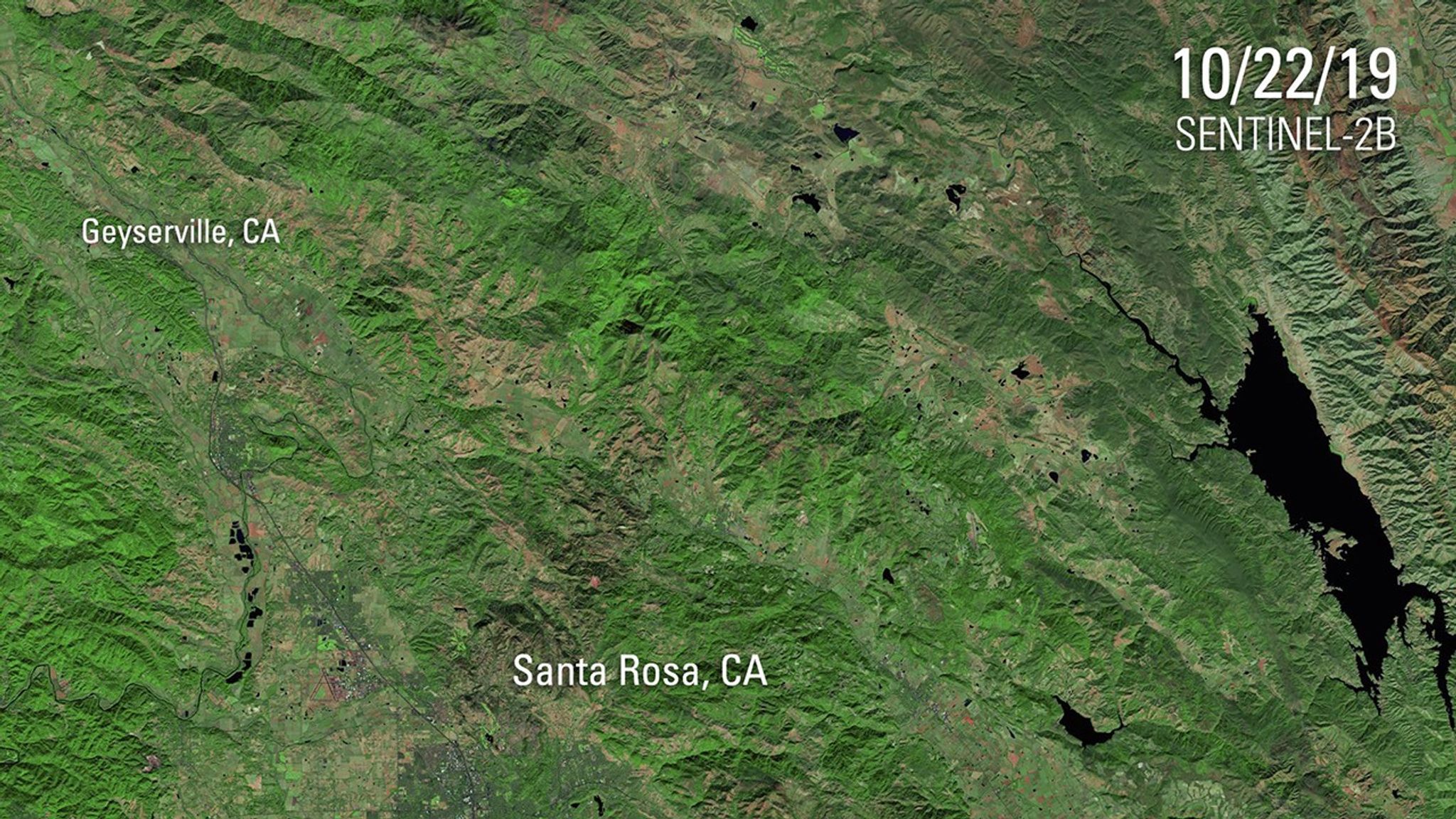
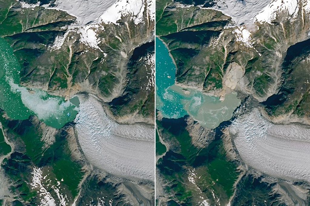
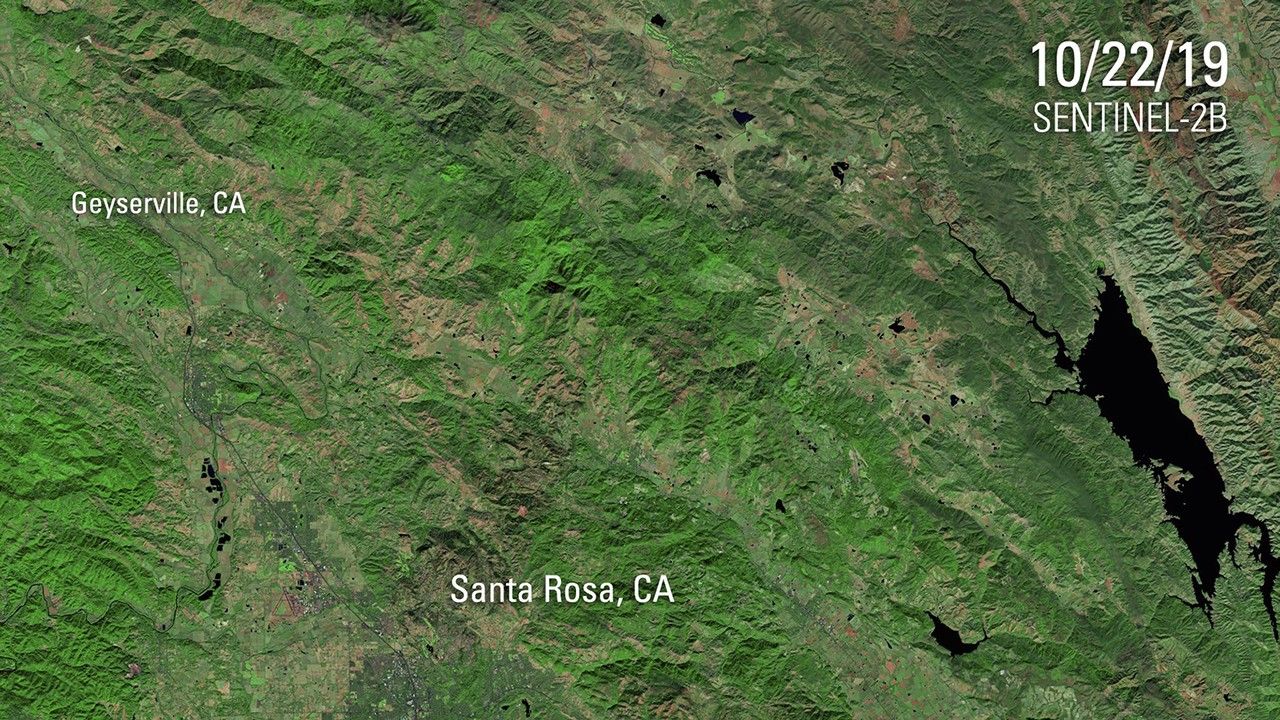
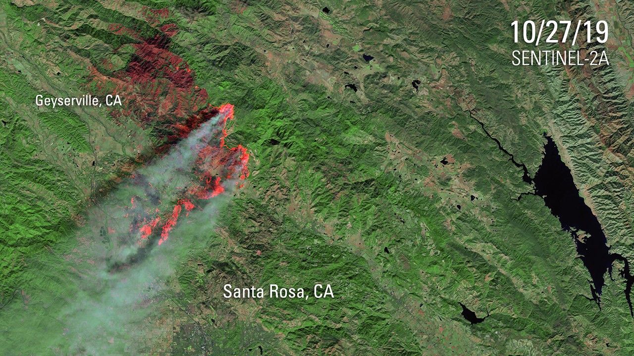
These images show a portion of Northern California before and during the Kincade Fire, which burned nearly 78,000 acres (about 31,500 hectares) from Oct. 23 to Nov. 6, 2019. Evacuation zones included the entire towns of Geyserville, Healdsburg and Windsor, and the northern part of Santa Rosa. Wildfires burned more than 100,000 acres (40,000 hectares) of a nearby area about two years earlier. Images taken by the European Space Agency's Sentinel-2A and -2B satellites. Source: U.S. Geological Survey’s National Land Imaging Image Collections

These images show a portion of Northern California before and during the Kincade Fire, which burned nearly 78,000 acres (about 31,500 hectares) from Oct. 23 to Nov. 6, 2019. Evacuation zones included the entire towns of Geyserville, Healdsburg and Windsor, and the northern part of Santa Rosa. Wildfires burned more than 100,000 acres (40,000 hectares) of a nearby area about two years earlier. Images taken by the European Space Agency's Sentinel-2A and -2B satellites. Source: U.S. Geological Survey’s National Land Imaging Image Collections
Before and After
Kincade Fire, Northern California
Oct. 22, 2019 - Oct. 27, 2019
These images show a portion of Northern California before and during the Kincade Fire, which burned nearly 78,000 acres (about 31,500 hectares) from Oct. 23 to Nov. 6, 2019. Evacuation zones included the entire towns of Geyserville, Healdsburg and Windsor, and the northern part of Santa Rosa. Wildfires burned more than 100,000 acres (40,000 hectares) of a nearby area about two years earlier. Images taken by the European Space Agency's Sentinel-2A and -2B satellites. Source: U.S. Geological Survey’s National Land Imaging Image Collections


