


.jpg?w=1024)


Joint Agency Satellite Division
The Joint Agency Satellite Division (JASD) is an organization within NASA’s Science Mission Directorate that was established in April 2010 to support NASA’s collaborative partnership with the National Oceanic and Atmospheric Administration (NOAA) to develop, launch and manage reimbursable satellite programs, projects, and instruments.
Low Earth Orbit Observations
Low Earth Orbit (LEO) Observations is a collaborative effort between NOAA, NASA, and industry partners to manage and develop NOAA’s portfolio of operational space weather satellites and instruments that fly in a polar orbit.
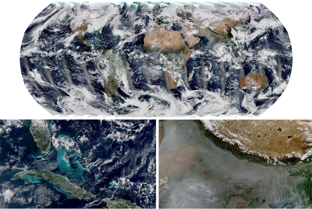
Considered the backbone of the global observing system, these satellites circle Earth from pole to pole and cross the equator 14 times daily—providing full global coverage twice a day. Low and medium Earth observations are critical for weather forecasting, environmental observation, climate monitoring, and public safety. NEON sets the stage for NOAA to manage future polar and other low Earth and medium Earth orbit satellite observations as loosely coupled projects
NOAA’s National Weather Service uses the collected data to increase the accuracy of forecasts three to seven days in advance of a severe weather event. NOAA’s LEO satellites also provide support for operational forecasting. The data collected by these satellites also enables scientists and forecasters to study long-term climate trends by extending the more than 30-year satellite data record. Information from LEO satellites supports every aspect of NOAA’s mission, ensuring a more “Weather-Ready Nation” and providing global measurements of conditions in the atmosphere, in the oceans, and on land.
The Office of LEO Observations is responsible for two programs: the Joint Polar Satellite System (JPSS) and the Near Earth Orbit Network (NEON).
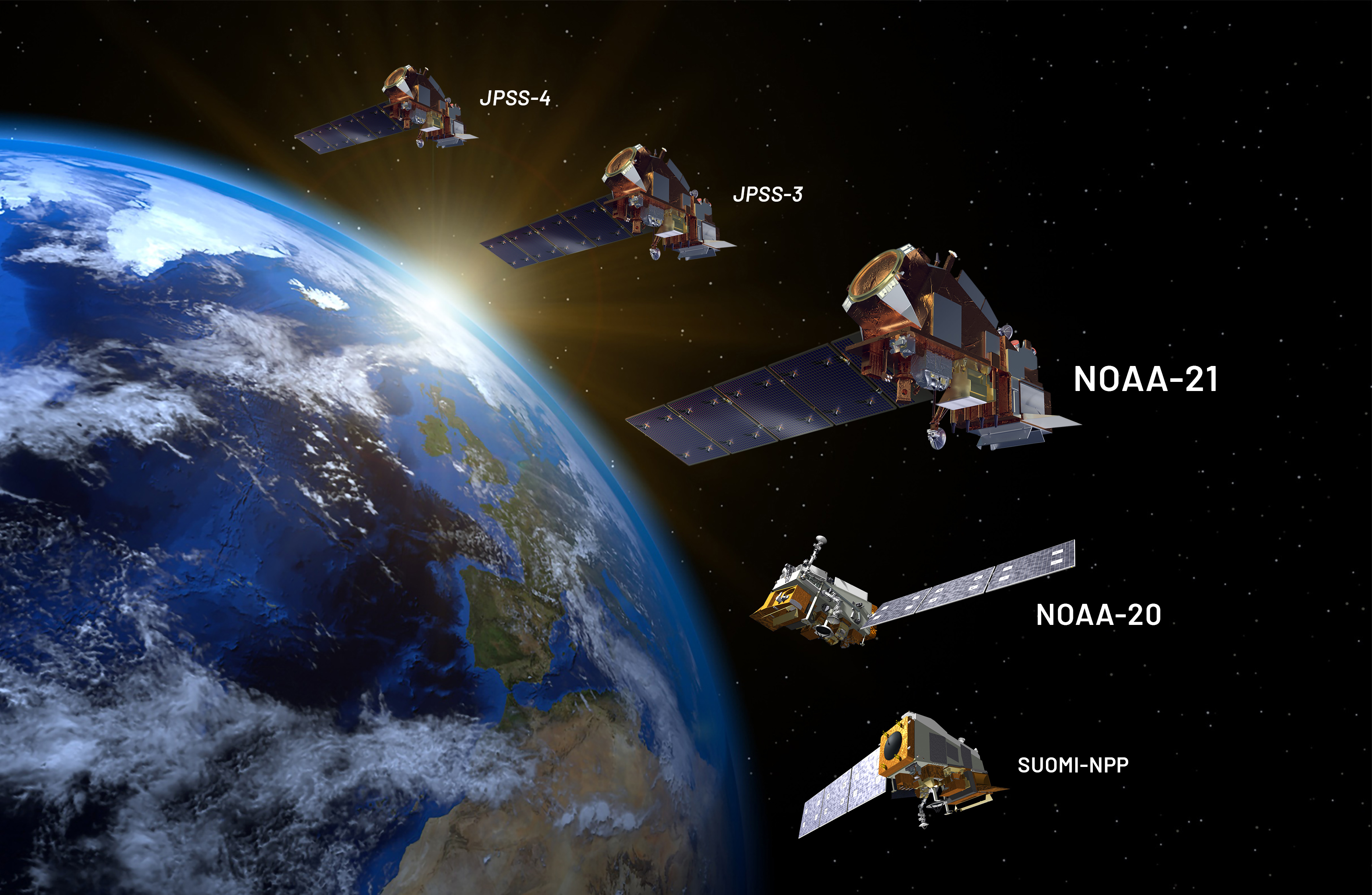
Joint Polar Satellite System (JPSS)
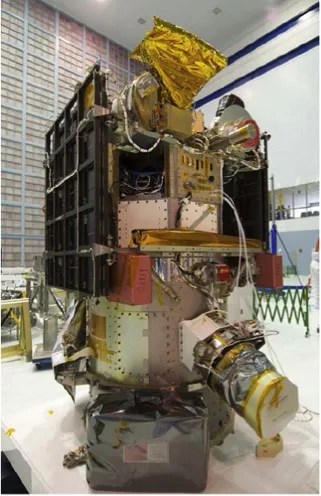
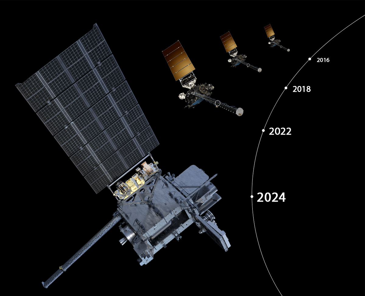
The Joint Polar Satellite System (JPSS) is a four-satellite program. Each satellite includes a suite of instruments to monitor weather and hazards on Earth. NOAA expects that the JPSS satellites will operate into the 2030’s.
Near Earth Orbit Network (NEON)
NOAA’s Near Earth Orbit Network (NEON) program will develop future low-Earth orbit (LEO) environmental satellites. NOAA expects that NEON satellites will begin operating in the late 2020’s and overlap some of the JPSS satellites.
Geostationary Earth Orbit Observations
Geostationary Earth Orbit (GEO) Observations is a collaborative effort between NOAA, NASA and industry partners to manage and develop NOAA’s portfolio of operational environmental satellites in geostationary orbit.
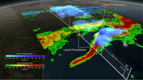
NOAA’s geostationary satellites orbit 22,300 miles above the equator at speeds equal to Earth’s rotation. This means that they remain over the same area as the planet spins around its axis. Because they stay above a fixed area on the surface, the satellites provide constant vigil to identify and track severe weather conditions and environmental hazards like fires, smoke, dust storms, fog, and volcanic ash over time. Information from geostationary satellites is primarily used for short-term (1–2 day) forecasts and for tracking storm systems and environmental hazards in real-time.
Geostationary satellites provide real-time, high-resolution imagery and atmospheric measurements of Earth’s weather, oceans and environment, mapping of total lightning activity, and monitoring of solar activity and space weather. This data supports advanced detection of environmental phenomena that directly affect public safety, protection of property, and our nation’s economic health and prosperity.
The office of GEO Observations is responsible for two programs: the Geostationary Operational Environmental Satellites – R Series (GOES-R) and Geostationary Extended Observations (GeoXO) programs.
GOES-R Series
Geostationary Operational Environmental Satellites (GOES)-R Series is a four-satellite program. Each satellite includes a suite of instruments for monitoring weather and hazards on Earth as well as in space. NOAA expects that the GOES-R series satellites will operate into the 2030’s.
GeoXO
NOAA’s Geostationary Extended Observations (GeoXO) satellite system will advance observations of Earth that the GOES-R Series currently provides from geostationary orbit. NOAA expects that GeoXO will begin operating in the early 2030s as the GOES-R Series nears the end of its operational lifetime.
Space Weather Observations
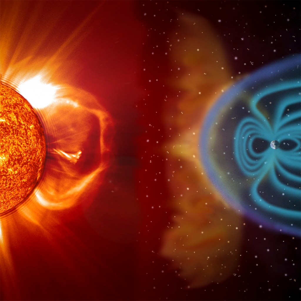
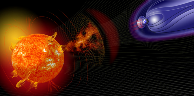
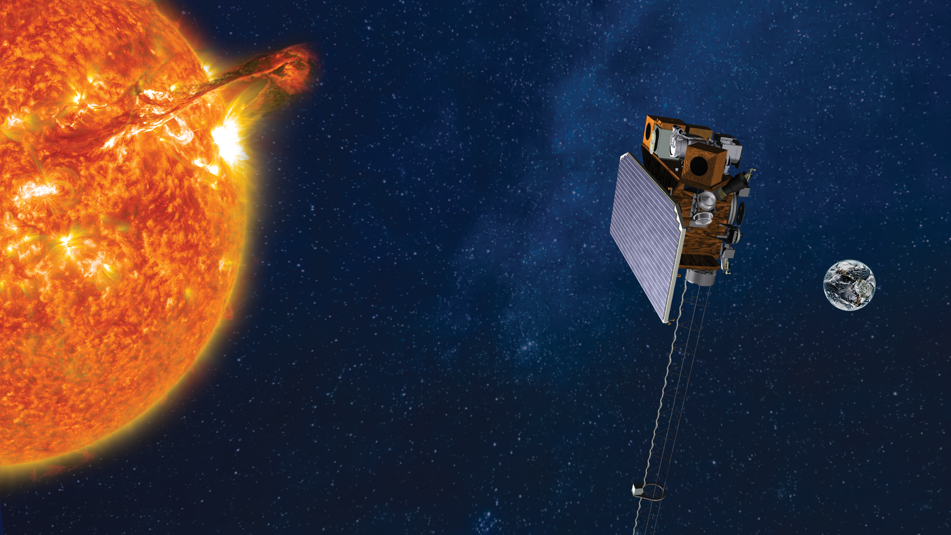
Space Weather Observations (SWO) is a collaborative effort between NOAA, NASA, and industry partners to manage and develop NOAA’s portfolio of operational space weather satellites and instruments that will fly in Geostationary, LEO, and Deep Space Orbits.
NOAA’s space weather missions will maintain observational continuity of real-time solar imagery, solar-wind measurements, and near-earth space environment. These observations are necessary for space weather advisories to keep the world and its assets safe and allow us to better understand and predict changes in solar weather. Space weather imagery and data are critical for the operations of the National Weather Service’s Space Weather Prediction Center alerts and forecasting. Additional consumers of space weather information include the satellite industry providing telecommunications and navigation services, the electric power industry, commercial aviation, as well as the U.S. national security.
The SWO office is responsible for the Space Weather Follow-On program and the SW Next program.
Space Weather Follow-On
The Space Weather Follow-On (SWFO) program sustains NOAA’s foundational set of space-based space weather observations and measurements collected by legacy missions (DSCOVR and SOHO) to ensure continuity of critical data.
Space Weather Next
The Space Weather Next (SW Next) program will maintain and extend space weather observations from a range of different observing points, selected to most efficiently provide comprehensive knowledge of the Sun and the near-Earth space environment.
Reimbursable Projects Program
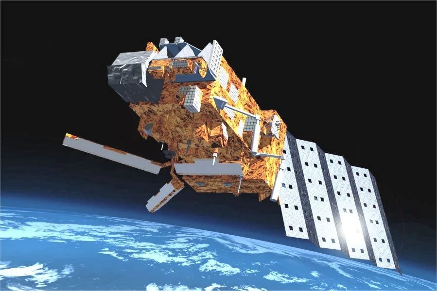
Meteorological Operations (MetOp) Satellite
The MetOp satellites are a series of three European polar-orbiting satellites that provide weather data services to monitor climate and improve weather forecasts worldwide. The U.S. instrument contribution for MetOp C includes the Space Environment Monitor (SEM), the Advanced Very High Resolution Radiometer (AVHRR), and the Advanced Microwave Sounding Unit (AMSU).
Joint Altimetry Satellite Oceanography Network (JASON)-3
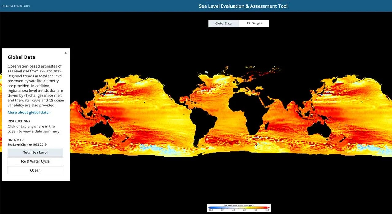
Jason-3 provides continuity of ocean topography measurements including detailed measurements of sea-levels on Earth to gain insight into ocean circulation and climate change. The U.S. instrument contribution for Jason-3 includes the Advanced Microwave Radiometer (AMR), the Laser Retroreflector Array (LRA), and the Global Positioning system Payload (GPSP).

Deep Space Climate Observatory (DSCOVR)
The DSCOVR satellite provides early warning capability from a deep-space orbit to detect space weather and harmful solar wind activity that could impact Earth. It has the secondary mission of serving as an Earth climate observatory by providing a unique continuous view of the “Earth at noon” via multi-spectral imaging and a full-disc irradiance measurement of the light reflected from the Earth’s surface.