


Written by Sharon Wilson Purdy, Planetary Geologist at the Smithsonian National Air and Space Museum
Earth planning date: Monday, Aug. 4, 2025.
We are on the cusp of another anniversary of the Curiosity rover’s successful landing on Mars! The rover has driven over 35 kilometers (about 22 miles) from the Bradbury Landing site, where Curiosity’s scientific journey began 13 years ago. At that time, the boxwork terrain on Mount Sharp seemed impossibly far away — it is hard to believe that these interesting structures are now beneath the rover’s wheels.
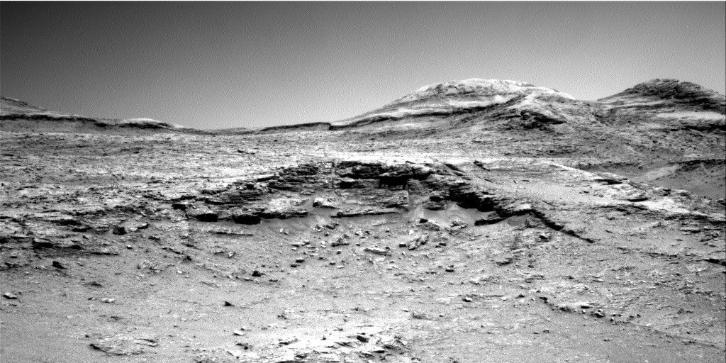
The science team is currently exploring the most well-developed section of boxwork terrain in Gale crater, which is a system of intersecting ridges separated by low-lying depressions, or hollows. The workspace for sols 4620 and 4621 allowed us to assess the nature of a small, raised surface within one of the low-lying hollows that are abundant throughout this area. The science team is particularly interested in understanding the morphology and mineralogy of the networks of thin, cross-cutting filled fractures within the rock.
Today I served as the Geology theme group “Keeper of the Plan” where I compiled the details for the scientific activities that would be incorporated into the master set of instructions for the rover to carry out. The APXS and MAHLI instruments investigated two areas with resistant veins, or filled fractures, at “Pular” and “Socompa,” and ChemCam used its LIBS instrument to determine the chemistry of two similar veins in the workspace bedrock at “El Carrizo” and “Huasco.” In addition to providing documentation images for the LIBS targets, Mastcam also executed several stereo mosaics including “La Guardia” to image a large open fracture, “Cerro Paranal” to investigate a possible future site for contact science, the south face of “Llullaillaco” to obtain a side view of the boxwork structures, and “Arare” to get a closer look at interesting networks of thin, intersecting veins. Several small troughs in the scene were also imaged. A rounded, elevated boxwork ridge roughly 10 meters (about 33 feet) from the rover caught our attention as well, so the ChemCam team planned an RMI image to investigate the exposed network of fine fractures and vein fill.
After completing a cloud movie and dust-devil survey for the Environmental theme group, the rover will drive roughly 15 meters (about 49 feet) to the base of a nearby ridge to investigate the cross-cutting veins that appear pervasive throughout the outcrop. Another busy day on Mars, indeed!


