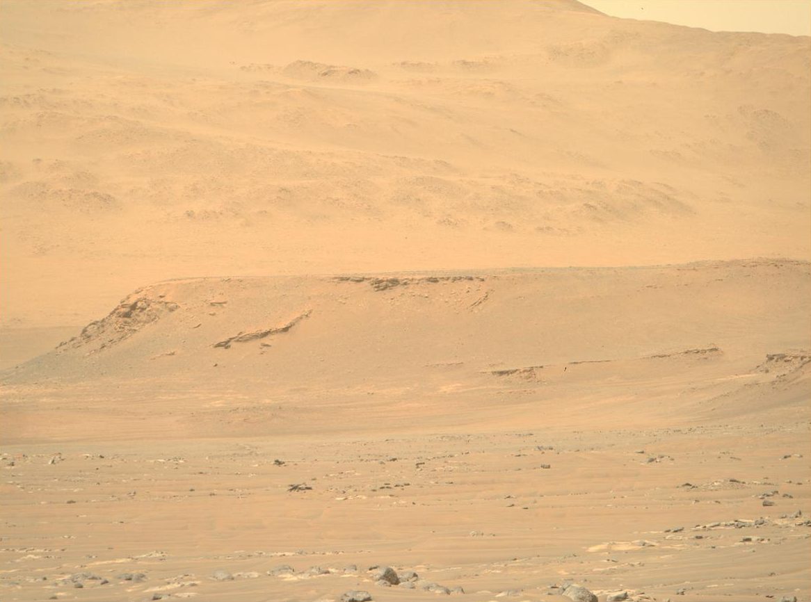
The Perseverance rover is reaching new heights as it ascends the rim of Jezero crater (over 300 meters in elevation higher than the original landing site)! The rover is now enroute to its first campaign science stop Dox Castle (image in the far ground) a region of interest for its potential to host ancient Mars’ bedrock in the exposed rocks on the rim.
Impact craters like Jezero may be the key to piecing together the early geologic history of Mars, as they provide a window into the history of the ancient crust by excavating and depositing deep crustal materials above the surface. Crater rims act as keepers of ancient Martian history, uplifting and exposing the stratigraphy of these impacted materials. Additionally, extreme heat from the impact can encourage the circulation of fluids through fractures similar to hydrothermal vents, which have implications for early habitability and may be preserved in the exposed rim bedrock. With the Perseverance rover we have the potential to explore some of the oldest exposed rocks on the planet.
Exploring such diverse terrains takes a lot of initial planning! The team has been preparing for the Crater Rim Campaign these last few months by working together to map out the types of materials Perseverance may encounter during its traverse up and through the rim. Using orbital images from the High-Resolution Imaging Science Experiment (HiRISE) instrument, the science team divided the rim area into 36 map quadrants, carefully mapping different rock units based on the morphologies, tones, and textures they observed in the orbital images. Mapping specialists then connected units across the quads to turn 36 miniature maps into one big geologic map of the crater rim. This resource is being used by the team to plan strategic routes to scientific areas of interest on the rim.
On Earth, geologic maps are made using a combination of orbital images and mapping in the field. Planetary scientists don’t typically get to check their map in the field, but we have the unique opportunity to validate our map using our very own robot geologist! Dox Castle will be our first chance to do rim science - and we’re excited to search for evidence of the transition between the margin and rim materials to start piecing together the stratigraphic history of the rocks that make up the rim of Jezero crater.
Written by Margaret Deahn, Ph.D. student at Purdue University