I was the Surface Properties Scientist, or SPS, on staff again today. After completing a successful drive, Curiosity arrived at a nice workspace to carry out the weekend plan. Today's planning activities were for a three sol plan, where the weekend activities were scheduled, including several arm activities and a drive for the last sol of the plan.
The two arm activities included the targets "Mingo" and "Jobbies", each of which were located on Murray bedrock exposures. The Mingo target was chosen for a DRT because of its relatively smooth nature, making it suitable to brush the ever-present Martian dust away. The Jobbies target seemed to have a darker, gray toned appearance that intrigued the science team on shift today. Supporting remote sensing science was planned of the scene and will be used to both give context to the contact science and help continue finding a path up the Vera Rubin Ridge.
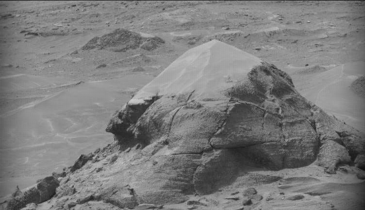
As SPS, today I worked with rover planners to help identify a clear path up the Vera Rubin Ridge, avoiding large, steeply dipping rocks to the left of the rover and dodging a big sand trap to the right of the rover. These features can be seen in the Navcam image shown, where the rover will drive just to right of the layered rock on the upper left side of the image. It turns out the best path forward was to put the rover wheels on either side and drive right over the top of a rock that was about 33 cm in height! This lone rock can be seen on the middle left hand side of the included Navcam image. This rock is no problem for Curiosity since it has plenty of clearance and will drive smoothly over this obstacle.
Written by Christopher Edwards, Planetary Geologist at Northern Arizona University