


Planning for Curiosity this morning was a bit like reading a great mystery novel. There were several twists and turns along the way, but we eventually reached an exciting ending that will reveal "Whodunnit?" - or more accurately -- what geologic forces had done to shape this landscape billions of years ago.
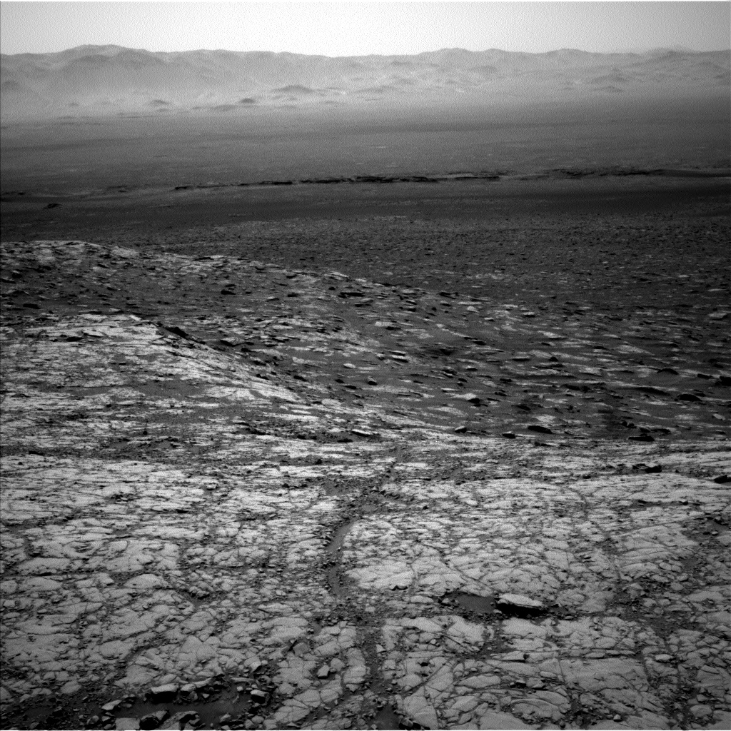
The drive yestersol was successful, and placed us in front of one of many meter-scale factures that criss-cross this area. These fractures are visible in high-resolution orbital images, and on the ground are surrounded by raised broken rocks that appear to be slightly more resistant to erosion than their surroundings. We are interested in understanding how these fractures formed, if they were conduits for ancient water, and why the rocks on their edges are raised. We made a quick decision early in the planning day that these rocks were interesting enough to warrant staying here another couple of days to collect good contact science targets, rather than the single touch-and-go we had originally planned.
<!-- wp:image {"background": {"contentType": "image", "id": 357273, "url": "https://science.nasa.gov/wp-content/uploads/2024/03/NLB_558534349EDR_F0660084NCAM00255M_.jpg", "alt": "", "caption": "This image was taken by Navcam: Left B (NAV_LEFT_B) onboard NASA's Mars rover Curiosity on Sol 1814 (2017-09-13 00:53:16 UTC). Image", "credits": "NASA/JPL-Caltech", "zoom": 0, "fit": "fit", "parallax": "no", "focalPoint": {"x": ".50", "y": ".50"}}, "image_align": "inline", "migrated": true} -->
Once we decided to stay, the geology theme group had to work quickly to figure out what targets would be best to collect MAHLI and APXS data from. This entailed a lot of back and forth between the scientists and rover planners to understand which targets were reachable in the somewhat broken up workspace in front of us, and which were simply too far away or fragmented to access. After some work, we were able to find a great raised rock to examine with APXS and MAHLI, and we named the target "Schoppee." We'll also be taking 25 cm MAHLI standoff images of several other locations near the raised rim of the fracture to give us additional information about targets we could study in the weekend plan.
Forgoing the drive also allowed us to have time for some morning remote sensing before the contact science. During this time, we'll be taking ChemCam observations of targets "Elwell," "Bragdon," and "Graffam," as well as corresponding Mastcam documentation imaging. We have more remote sensing planned on the second sol, including a ChemCam RMI Z-stack observation (used to make a 3D model) of fine laminations in the target "Phoney Island," a corresponding Mastcam observation, and many environmental measurements in the afternoon and early morning.
Written by Abigail Fraeman, Planetary Geologist at NASA's Jet Propulsion Laboratory