


Private Sector Engagement
Transforming NASA's trusted Earth science into powerful business intelligence
Earth Science Private Sector Engagement
NASA Earth science data, tools, and expertise drive economic innovation by providing industry with trusted insights to accurately forecast risk, optimize operations, and advance next-generation business solutions. By connecting, informing, and partnering with businesses, NASA’s Private Sector Engagement Office unlocks new opportunities to reinforce the use of Earth observations in existing markets and broaden adoption across emerging industry sectors, empowering organizations to build powerful and resilient solutions for the future.
Subscribe for Updates
Get the latest industry-relevant news and information direct to your inbox.
We will never share your email address.

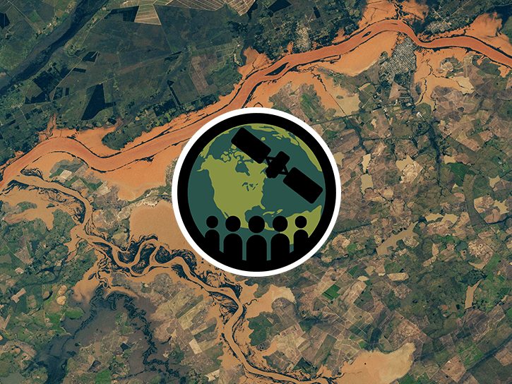
Propose for Innovation Funding
INNOVATE is NASA's innovation funding program designed to accelerate the translation of Earth science into real-world applications. Selected teams receive access to NASA funding, data, and expertise to develop solutions that address commercial and societal challenges. This opportunity is open through August 31, 2026.
Real-Time Flood Inundation Forecasting & Impact Assessment
Investigators & Partners: NASA Goddard Space Flight Center; University of Wisconsin-Milwaukee; University of Colorado; University of Wisconsin-Madison; University of Connecticut; Swiss Re; Munich Re; Eversource
- An AI-powered flood intelligence platform that combines NASA Earth observations with advanced modeling to deliver real-time flood forecasts and impact assessments, including Federal Emergency Management Agency and NOAA end users.
- Designed with insurers and utilities to improve disaster response, risk management, and resilience.
Operational Risk Forecasting for AI Infrastructure
Investigators & Partners: NASA Goddard Space Flight Center; Universities Space Research Association; Meta; Uptime Institute; Open-IX
- A first-of-its-kind system that uses NASA Earth observations to forecast operational risks to data centers, power systems, and water resources up to 14 days in advance.
- Helps critical infrastructure operators anticipate disruptions before they occur.
Fire & Risk Modeling for Property Insurance
Investigators & Partners: National Science Foundation; National Center for Atmospheric Research; Mercury Insurance
- A next-generation wildfire risk platform combining NASA Earth science, physics-based modeling, and AI to improve insurance underwriting and community resilience.
- Developed with industry partners to better understand and manage growing wildfire risks.
Next-Generation Food Security Early Warning System
Investigators & Partners: Space Science Institute; Chapman University; World Food Program; Microinsurance Catastrophe Risk Organization
- An advanced agricultural monitoring system that uses NASA Earth observations to detect food security risks months before traditional warning systems.
- Supports insurers, humanitarian organizations, and agribusinesses with earlier, more actionable insights.
AI-Powered Wildfire Risk Intelligence for Utilities
Investigators & Partners: NASA Jet Propulsion Laboratory; OpalAI; Pacific Gas & Electric; Los Angeles Department of Water & Power
- An AI-enabled wildfire intelligence platform that helps utilities identify asset-level wildfire risks and improve operational decision-making.
- Designed to reduce outages, strengthen grid resilience, and protect communities.
Early Warning & Transparency for Forest Supply Chains
Investigators & Partners: NASA Goddard Space Flight Center; University of Maryland; Science Systems and Applications Inc.; Chainparency
- A NASA-enabled monitoring and forecasting platform that helps forestry and wood-product industries track forest health, detect emerging risks, and improve supply chain transparency.
- Supports more resilient and sustainable forest management at scale.
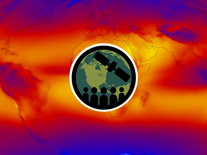
How NASA Helps Industry
How NASA supports agribusiness
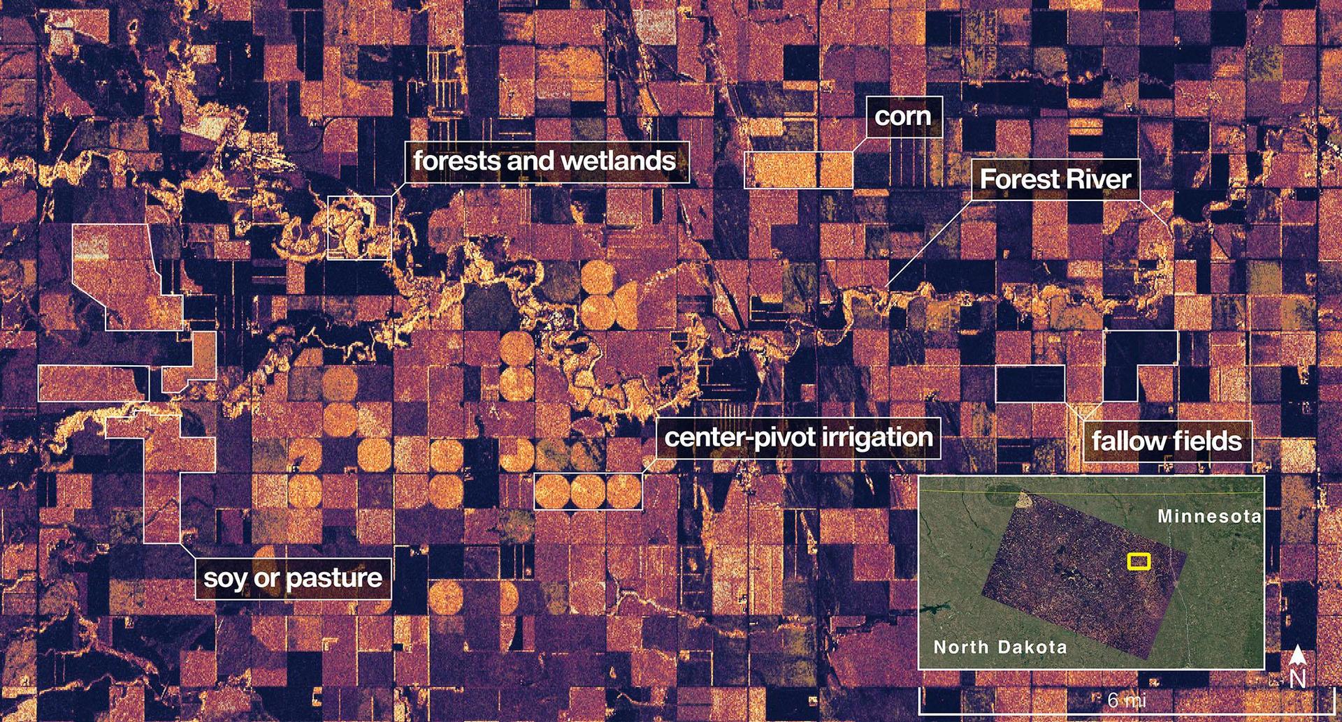
Every day, farmers, food companies, and agricultural producers rely on timely, trusted information to manage their crops, land, water, and supply chains. NASA develops technology and missions to observe agricultural landscapes from space, informing optimal time and location for planting, monitoring of plant growth, best times for harvest, and market readiness assessments. U.S. and international partners use this information to support food security, stabilize markets, and strengthen productive farming.
From space, NASA tracks soil moisture, groundwater, crop condition, water use, heat stress, precipitation, and land change, while also supporting field-level tools and trusted partnerships with producers and agricultural organizations. By transforming satellite data into practical insights, NASA helps agribusiness to anticipate challenges, improve productivity, manage vital resources, and safeguard food systems.
How NASA helps energy & utility companies
Energy providers, utilities, and infrastructure operators need trusted Earth information to plan for demand, protect assets, and keep essential services reliable. NASA Earth science supports decisions related to solar and meteorological resources, extreme heat, wildfire, air quality, flooding, drought, and land movement.
The Prediction Of Worldwide Energy Resources (POWER) project provides solar and meteorological data used by energy, building, and infrastructure communities. NASA Earth insights also help utility companies understand risks to grids, water systems, pipelines, and other critical assets and the Agency engages with partners such as the Center for Weather Innovation, Smart Energy and Resilience to advance Earth observation capabilities for the energy sector. Through data, training, stakeholder engagement, and partnerships, NASA equips energy and utility leaders with trusted information to strengthen resilience and support reliable operations.
How NASA supports insurance & reinsurance
Insurance and reinsurance organizations depend on trusted information to understand hazards, price risk, support claims, and plan for changing risk exposure. NASA Earth science provides observations, models, and long-term records that help characterize events such as wildfire, flood, heat, drought, storms, land change, and infrastructure impacts.
NASA is engaging with the insurance and reinsurance community to better understand where Earth observations can support underwriting, catastrophe modeling, parametric products, claims response, and resilience planning. By participating in pre-competitive industry coalitions like the Center for Innovation in Risk, Catastrophes, and Decisions, as well as sector trainings and industry engagement, NASA helps insurers and reinsurers connect trusted Earth science with the decisions that shape risk, affordability, and recovery.

How NASA helps the finance sector
Financial institutions, investors, and analysts need reliable information to understand physical risk, market exposure, and long-term change. NASA Earth science provides trusted data and models that help organizations to assess risk across assets, portfolios, and supply chains, including wildfire, heat, flood, land change, and infrastructure impacts.
NASA’s engagement with the finance sector focuses on helping users move from awareness to application, identifying relevant datasets, understanding uncertainty, and connecting Earth observations to real business decisions. Through training, collaborative sessions, and sector partnerships, NASA is working to make Earth science more accessible to financial decision-makers seeking trusted, science-based insights.
How NASA helps mining and exploration
Mining and exploration companies rely on trusted geoscience information to understand landscapes, manage risk, and make decisions across the mineral resource life cycle. NASA Earth science observations can support characterization of terrain, land cover, water resources, surface change, environmental conditions, operational risks, and long-term landscape dynamics.
NASA is engaging with the mining and exploration community to better connect Earth observations with industry needs, from early exploration and resource assessment to operations, closure, and reclamation. Through participation in pre-competitive industry efforts such as the Center to Advance the Science of Exploration to Reclamation in Mining, as well as broader technical exchange and stakeholder engagement, NASA helps bring trusted data, models, and Earth system science into decisions that support responsible resource development.

FEbruary 2026
Industry Summit Report
The NASA Earth Science Industry Summit, hosted by the U.S. Chamber of Commerce on February 2, 2026, served as a strategic forum to explore how NASA's Earth Science enterprise contributes to the engines of the American economy and how public and private sectors can work together to unlock greater opportunities in Earth observation.
Explore the summary report for key reflections and takeaways, representing the perspectives of more than 180 participants across finance, insurance, agriculture, energy, utilities, and more.
Image Credit: U.S. Chamber of Commerce

NASA Earthdata
Earthdata is your gateway to find, access, visualize, and download NASA Earth science data. Browse the data catalog, search by topic, discover learning resources including tutorials and trainings, and more.
Explore
Featured Trainings
NASA's Applied Remote Sensing Training Program (ARSET) teaches users how to use remote sensing data for a range of applications. ARSET trainings are available for all levels of experience at no cost, both in person and online.
Fundamentals of Remote Sensing
Earth Observations for Insurance and Finance Sector Decision-Making
NASA Earth Observations for Energy Management
Satellite Remote Sensing for Agricultural Applications
Data Product Highlights


Partnerships & Collaboration
NASA offers 60 years of experience in advanced engineering and testing capabilities, cutting edge research and technology development, as well as unique assets such as land, facilities and laboratories for use by commercial industries, academic institutions, U.S. government agencies and international entities.
Partnerships Front Door
Discover how NASA works with industry, academic, and non-profit partners to advance mutual goals through through strategic, non-procurement partnerships.

Technology Transfer Program
The NASA Technology Transfer program ensures that innovations developed for exploration and discovery are broadly available to the public.
Research Opportunities
NASA Solicitation and Proposal Integrated Review and Evaluation System (NSPIRES) is the official system to submit and manage research proposals.
Data Insignia
Eligible organizations that incorporate NASA data into their products, services, or research can gain significant value by displaying the NASA Data Insignia.
Private Sector Engagement Office
| Nima Pahlevan | Program Manager |
| Janelle Heslop | Project Manager |
| Rachel Vershel | Operations Officer |

