


Written by Conor Hayes, Graduate Student at York University
Earth planning date: Friday, May 23, 2025
In Wednesday's mission update, Alex mentioned that this past Monday's plan included a “marathon” drive of 45 meters (148 feet). Today, we found ourselves almost 70 meters (230 feet) from where we were on Wednesday. This was our longest drive since the truly enormous 97-meter (318-foot) drive back on sol 3744.
Today's plan looks a little different from our usual weekend plans. Because of the U.S. Memorial Day holiday on Monday, the team will next assemble on Tuesday, so an extra sol had to be appended to the weekend plan. This extra sol is mostly being used for our next drive (about 42 meters or 138 feet), which means that all of the science that we have planned today can be done "targeted," i.e., we know exactly where the rover is. As a result, we can use the instruments on our arm to poke at specific targets close to the rover, rather than filling our science time exclusively with remote sensing activities of farther-away features.
The rover's power needs are continuing to dominate planning. Although we passed aphelion (the farthest distance Mars is from the Sun) a bit over a month ago and so are now getting closer to the Sun, we're just about a week away from winter solstice in the southern hemisphere. This is the time of year when Gale Crater receives the least amount of light from the Sun, leading to particularly cold temperatures even during the day, and thus more power being needed to keep the rover and its instruments warm. On the bright side, being at the coldest time of the year means that we have only warmer sols to look forward to!
Given the need to keep strictly to our allotted power budget, everyone did a phenomenal job finding optimizations to ensure that we could fit as much science into this plan as possible. All together, we have over four hours of our usual targeted and remote sensing activities, as well as over 12 hours of overnight APXS integrations.
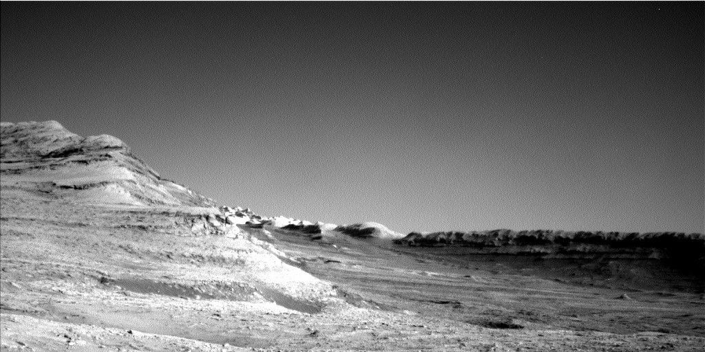
Mastcam is spending much of its time today looking off in the distance, particularly focusing on the potential boxwork structures that we're driving towards. These structures get two dedicated mosaics, totaling 42 images between the two of them. Mastcam will also observe "Mishe Mokwa" (a small butte about 15 meters, or 49 feet, to our south) and some bedrock troughs in our workspace, and will take two tau observations to characterize the amount of dust in the atmosphere.
ChemCam has just one solo imaging-only observation in this plan: an RMI mosaic of Texoli butte off to our east. ChemCam will be collaborating with APXS to take some passive spectral observations (i.e., no LIBS) to measure the composition of the atmosphere. Mastcam and ChemCam will also be working together on observations of LIBS activities. This plan includes an extravagant three LIBS, on “Orocopia Mountains,” “Dripping Springs,” and “Mountain Center.” Both Mastcam and ChemCam also have a set of "dark" observations intended to characterize the performance of the instruments with no light on their sensors, something that's very important for properly calibrating their measurements.
Our single set of arm activities includes APXS, DRT, and MAHLI activities on “Camino Del Mar” and “Mount Baden-Powell,” both of which are bedrock targets in our workspace.
Of course, I can't forget to mention the collection of Navcam observations that we have in this plan to monitor the environment. These include a 360-degree survey looking for dust devils, two line-of-sight activities to measure the amount of dust in the air within Gale, and three cloud movies. As always, we’ve also got a typical collection of REMS, RAD, and DAN activities throughout.


