


NASA Flies Through a Volcanic Laboratory: Rincón de la Vieja
By Milan Loiacono
An ecologist, a volcanologist, and a chemist walk into a forest… It sounds like the beginning of a bad joke, but this very real collaboration between scientists from NASA and the Universidad de Costa Rica (University of Costa Rica) continues decades of cross-disciplinary work that is currently providing insight into the future of the planet.
In summer 2025, a NASA-led team of scientists and engineers gathered in Rincón de la Vieja National Park in Costa Rica. We had a twofold purpose: to test the feasibility of using an uncrewed aircraft system (UAS) to gather data about volcanic emissions, and to use those data to better understand how rising levels of carbon dioxide will impact vegetation across the world.

This project is called the Costa Rica Airborne research on foresT Ecosystem Response to volcanic emissions (CRATER); it is a partnership between NASA, the Universidad de Costa Rica, Chapman University, and Black Swift Technologies.
“Oftentimes in the history of science, the biggest scientific breakthroughs have come at the intersections of disciplines,” said Joshua Fisher, an ecologist with Chapman University and NASA’s Jet Propulsion Laboratory in Southern California. “We’ve been struggling to understand one of the most important scientific questions of our time, which is the response of the tropical biosphere to increasing levels of carbon dioxide in our atmosphere. Now we’re coming together to bridge this impasse and unleash new knowledge about the planet.”
The volcanic system: a ‘crystal ball’ into the planet’s future
Volcanic systems stretch for miles beyond their iconic cones and craters, into forested ecosystems. Small cracks and vents in the Earth’s crust, called fumaroles, passively release gases such as carbon dioxide into the air above. It’s these gases that our team set out to measure.
The Rincón de la Vieja volcanic system extends roughly 100 square miles, including 12 volcanic craters and swaths of protected forests littered with fumaroles. This provides an ideal natural laboratory to study how rising carbon dioxide levels across the planet will impact vegetation.

Carbon dioxide levels in Earth’s atmosphere, measured in parts per million (ppm), have risen from 315 ppm in 1958 to 430 ppm in 2025. We want to understand how plant life will respond to this change.
Trees across the Rincón de la Vieja volcanic system experience higher levels of carbon dioxide than the rest of the planet, with those concentrations spiking near vents and gradually dropping as the carbon dioxide diffuses into the air.

“We’re basically wandering through these volcanic rainforests trying to figure out the secret to the future,” Fisher said. “The whole Earth is going to have concentrations of carbon dioxide that match what this forest is experiencing now. These trees have been exposed to our future atmosphere for the past hundreds or thousands of years, and so whatever they’ve done to adapt, we can expect to see similar behavior in ecosystems the world over.”
How do we measure these gases in a remote area?
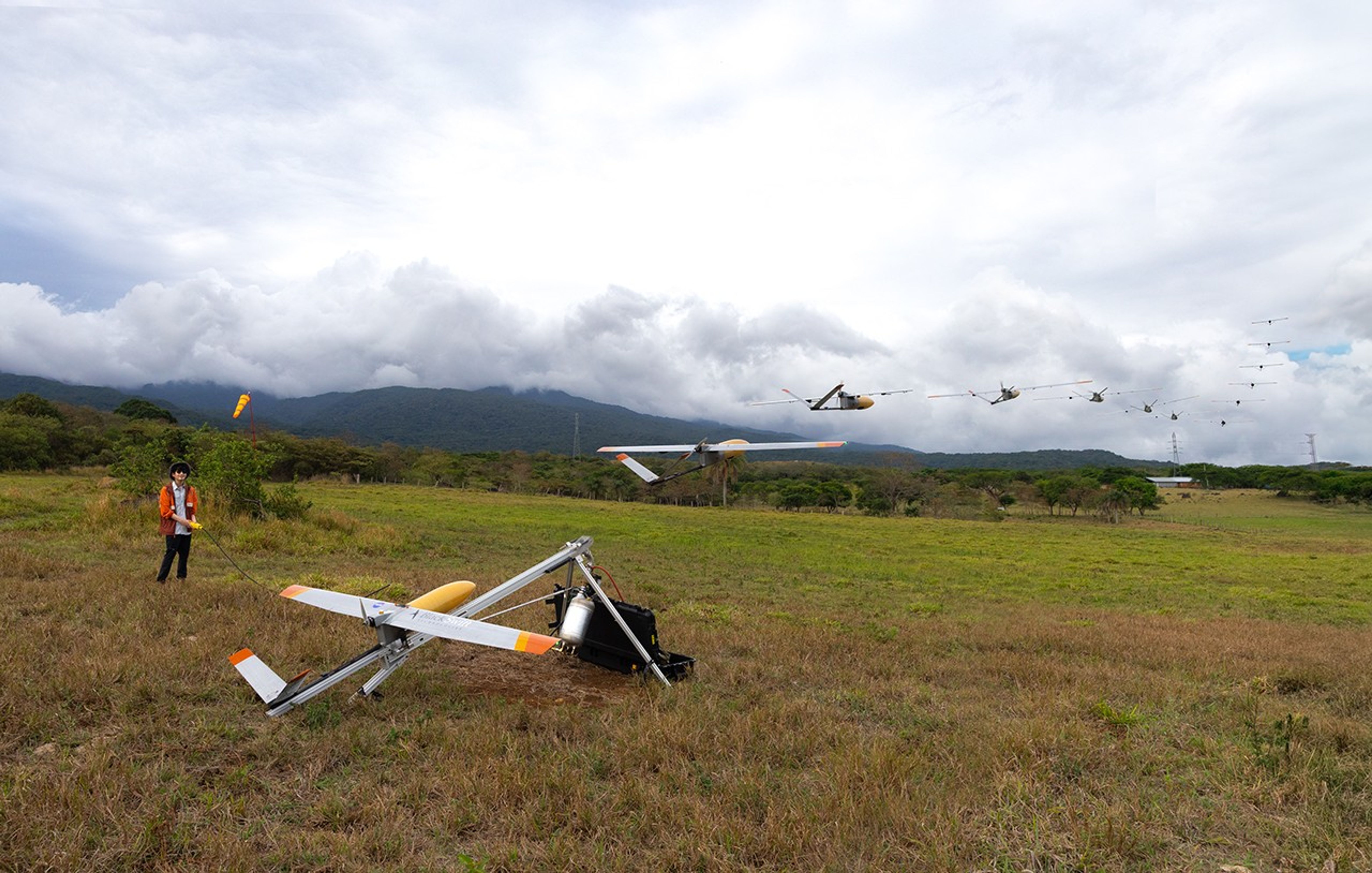
With the natural laboratory established, the next problem facing our team was how to study it: enter the S2 Black Swift UAS.

Black Swift Technologies makes small UAS for a variety of scientific applications, specializing in challenging environments. “We started out tornado chasing,” said Black Swift CEO Jack Elston, who joined the CRATER team in the field as the pilot in command. “This S2 was specifically developed for low-altitude sampling of carbon dioxide, which works well for CRATER’s mission. With even tree height like at Rincón de la Vieja, we can get down to just 30 feet above the canopy.”
Over the course of the campaign, the S2 flew two payloads on six total flights.
The photogrammetry payload contains a normal digital camera to capture high-resolution images and a thermal camera, to capture temperature. By overlapping the images we were able to create detailed maps of the terrain, including elevation and vegetation health.

The trace gas payload uses a common sensor for measuring carbon dioxide and water vapor, modified to be lighter and record data faster.
A system of 15 ground sensors installed across the Rincón de la Vieja forest by Fisher and his ground team validated data from the drone, and provided data points beneath the canopy to better understand how quickly the gases dispersed from the ground to the canopy, then up to the height of the S2.
“Our preliminary analysis shows that the S2’s measurements matched up well with the ground sensors, which means this is a feasible way to study these emission sources,” said Jay Tomlin, the science principal investigator for CRATER. “We can fly lower than normal aircraft and get incredibly detailed maps down to a six-centimeter resolution.”
Tracking gas transport and volcanic activity
In addition to the vegetation impact, we also investigated if the S2 could track how gases move and if gas emissions could serve as an indicator of volcanic activity.
By combining Fisher’s ground sensor data with the S2’s airborne data, our team looked for patterns in carbon dioxide movement to shed new light on how these volcanic emissions behave as they enter the atmosphere.
Carbon dioxide is slightly heavier than the normal atmospheric air, which is a cocktail of nitrogen, oxygen, argon, carbon dioxide, and trace amounts of a few other gases. This means that concentrated carbon dioxide will sometimes move in specific ways, like flowing downhill or pooling in holes or caves, before eventually dissipating into the air.

Imagine adding a drop of food coloring into a glass of water. The drop holds together at first and slowly disperses into the water; that is essentially how carbon dioxide interacts with the atmosphere. Jostling or swirling the cup simulates wind, creating movement that can be difficult to predict.
“In atmospheric chemistry there is a large uncertainty on how gases move in the atmosphere,” Tomlin said. “One benefit from CRATER, outside of the volcanology and ecology fields, is the opportunity to track how carbon dioxide moves from a concentrated source like a vent. This information will contribute to answering bigger atmospheric questions about how gases move and impact our weather patterns.”
Ecosystem responses to rising carbon dioxide may also serve as early indicators of an impending eruption: when magma starts rising to the surface, it pushes out gases above it—like carbon dioxide—which in turn can tell scientists about the magma itself and the status of the underground volcanic complex.
“We’re figuring out how to use gas emission data to assess the condition of a volcano before, during, and after an eruption,” said Jorge Andres Diaz, a professor at the Universidad de Costa Rica’s GasLab. “If we understand these factors, we can better tell when an eruption will happen, and how big that eruption will be. Nature is telling you something, you just need to know how to listen.”
For questions about the project, contact principal investigator Florian Schwandner: florian.m.schwandner@nasa.gov
