![Request for Information – Potential [Placeholder for Prize]](https://assets.science.nasa.gov/dynamicimage/assets/science/psd/solar/2023/09/s/solarsystem_0.jpg?w=1024)


Agriculture
Filters

The first of six new airborne campaigns will hit the skies this summer.
NASA develops technology and missions to observe agricultural landscapes, enhancing food security, stabilizing markets, and supporting productive farming.

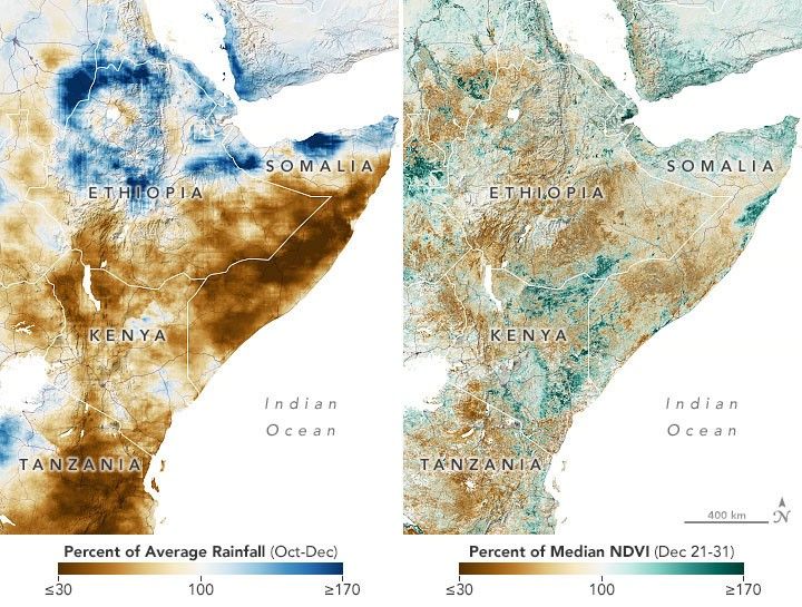
Relentless rains are threatening a lake in Kenya's Great Rift Valley that has become a key hub in the global…

Radar data from an agricultural area in South Africa, shown in a vivid color palette, reveal crop types and how…

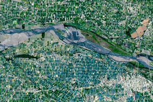
The glacial lake left a layer of silt and clay in southeastern Manitoba, creating fertile farmland that was divided during…
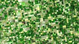
Diversity reigns across the farmland of Yunlin County in southwestern Taiwan—a region that produces an array of crops on small…
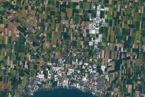
The expansion of greenhouses in southern Ontario is changing the appearance of the land surface—and the night sky.

NASA satellites are helping Maine oyster farmers pick better sites and plan when oysters will be ready to harvest.

The tart berry and state fruit brings a red pop to holiday feasts—and to satellite images of Midwestern marshlands.