Surface Topography and Vegetation (STV)

< Back to Decadal Survey


STV Study Team Report


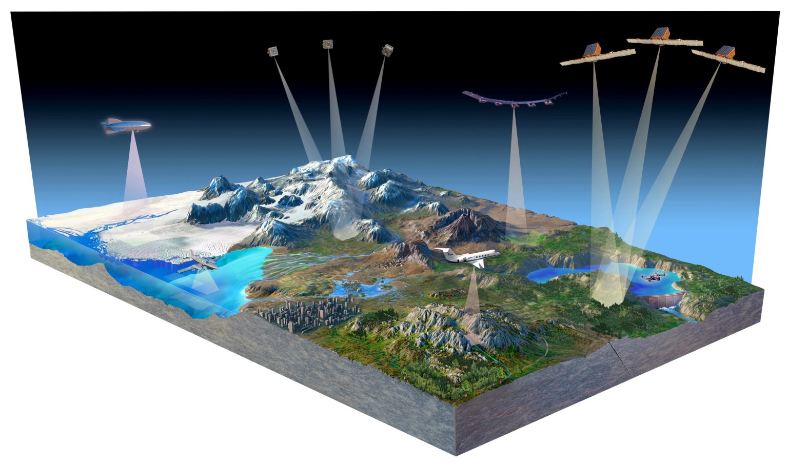
Illustration of satellites and aircraft over earth topography

Overview

The 2017-2027 Decadal Survey recommended high-resolution global topography, including bare surface land topography, ice topography, vegetation structure, and shallow water bathymetry as a targeted observable (TO). Targeted observables address key priorities within and across disciplinary lines for a set of science objectives related to a common aspect of the Earth system. STV science goals call for exploring next-generation measurement approaches that could be ready for spaceborne implementation in 10+ years. The decadal survey recommends focused and sustained attention to these observables to establish the associated prospective scientific and other user communities, and to make progress towards maturing both measurement capabilities and implementation concepts within this decade.

In late 2019 NASA established an STV Incubation Study Team. The objective of the incubation study team was to identify methods and activities for improving the understanding of and advancing the maturity of the technologies applicable to this TO and its associated science and applications priorities. The study team developed a report outlining potential future methods and activity areas, such as modeling, Observing System Simulations Experiments (OSSEs), field campaigns, data analysis and evaluation of a range of potential observing system architectures utilizing emerging sensor, platform and information technologies, and activities to advance those technologies to the point where they could support future space-based STV observations. The team produced a preliminary Science and Applications Traceability Matrix (SATM) that includes relevant societal or science questions, Earth science and application objectives, geophysical observables, and draft concepts of associated measurement approaches. The team solicited input from the broader scientific community including academia, government agencies, and private industry through online questionnaires and a series of virtual workshops.

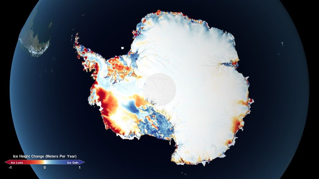
STV research areas include bare-surface land topography, ice topography, vegetation structure, and shallow water bathymetry. High-resolution characterization of surface topography would allow for improved understanding of geologic structure, tectonic and volcanic activity, geomorphic processes, sea-level rise and storm surge in coastal areas, glacier and ice sheet mass balance and flow characteristics, and other dynamic processes that could provide new insights into forecasting of natural hazards. In a similar manner, high-resolution characterization of vegetation structure could lead to significant improvement in the understanding of ecosystems, including carbon stocks and fluxes, as well as the relationships between biodiversity and habitat. Improved measurements of inland and coastal shallow water bathymetry could further inform studies of sea-level change, ice discharge near the grounding line, nautical navigation, and other science and applications objectives at the land-water interface. The team considered improved lidar, radar, and stereo photogrammetry techniques for producing repeat global topography and vegetation structure data products at desired resolutions to meet scientific and application goals.  As a part of that, the team considered the potential benefits of coordinated observing using a mixture of sensors on aerial and satellite platforms along with needed improvements in platform capabilities and information technologies.


Workshops

AGU 2020 STV Town Hall

STV Technology Breakouts

STV Science Breakouts

First Plenary STV Workshop


STV Team

Donnellan
Andrea Donnellan
NASA/JPL/Caltech
Study Lead Solid Earth & Cryosphere
Harding
David Harding
NASA/GSFC
Technology Lead
Vegetation and Hydrology
Gardner
Alex Gardner
NASA/JPL/Caltech
Cryosphere Lead
Jones
Cathleen Jones
NASA/JPL/Caltech
Applications Lead
Lavalle
Marco Lavalle
NASA/JPL/Caltech
Vegetation
Lou
Yunling Lou
NASA/JPL/Caltech
Radar Lead
Lundgren
Paul Lundgren
NASA/JPL/Caltech
Solid Earth Lead
Hydrology
Luthcke.jpeg
Scott Luthcke
NASA/GSFC
Lidar and Cryosphere
Osmanoglu
Batuhan Osmanoglu
NASA/GSFC
Information Systems Lead
Cryosphere and Hydrology
Parrish
Christopher Parrish
Oregon State University
Coastal Processes Lead
Ranson
Jon Ranson
NASA/GSFC
Stereo Photogrammetry Lead
Vegetation
Saatchi
Sassan Saatchi
NASA/JPL/Caltech
Vegetation and Hydrology
Simard
Marc Simard
NASA/JPL/Caltech
Hydrology Lead
Shallow Water Bathymetry
Stoker
Jason Stoker
US Geological Survey
Lidar Lead
Hydrology
Mr. Treuhaft
Robert Treuhaft
NASA/JPL/Caltech
Vegetation
Wessels
Konrad Wessel
George Mason University
Vegetation Structure Lead