STV Precursor Coincident Datasets
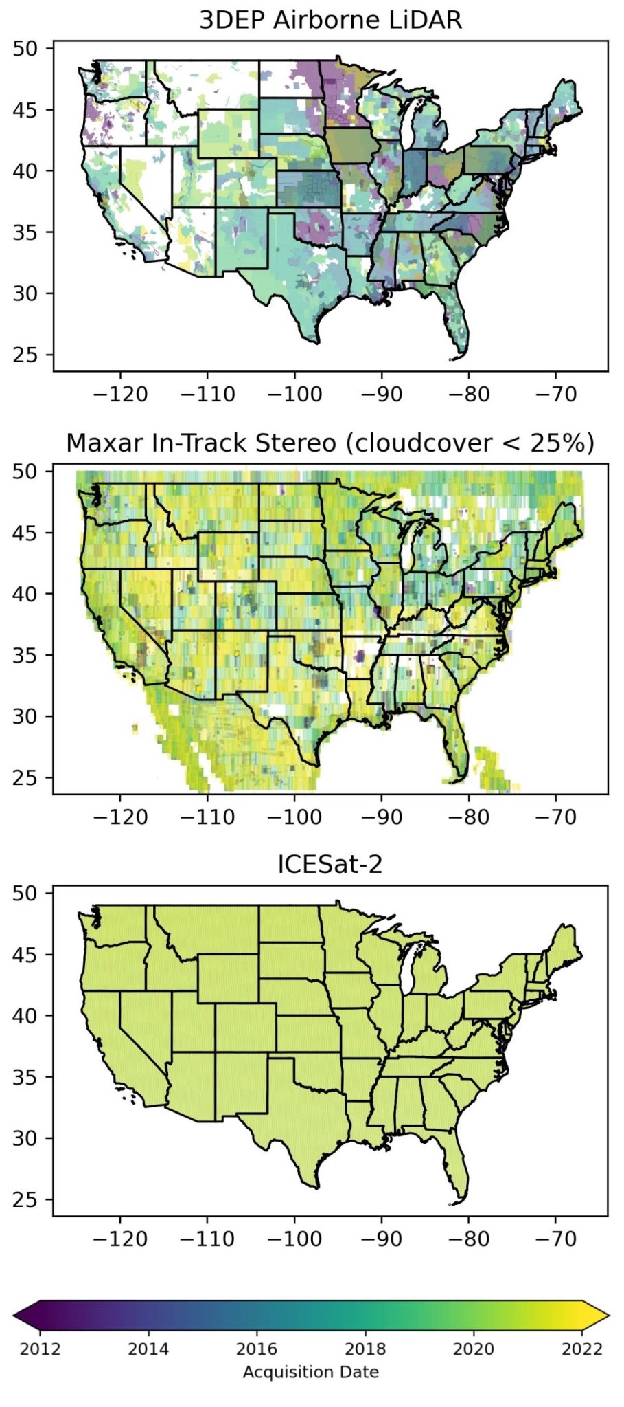
Over the past two decades, large archives of 3D surface elevation measurements have been acquired from a range of airborne and satellite platforms. Many of these datasets are now publicly available from NASA Earthdata Cloud and commercial cloud storage, enabling efficient, on-demand search, subsetting, and data access.
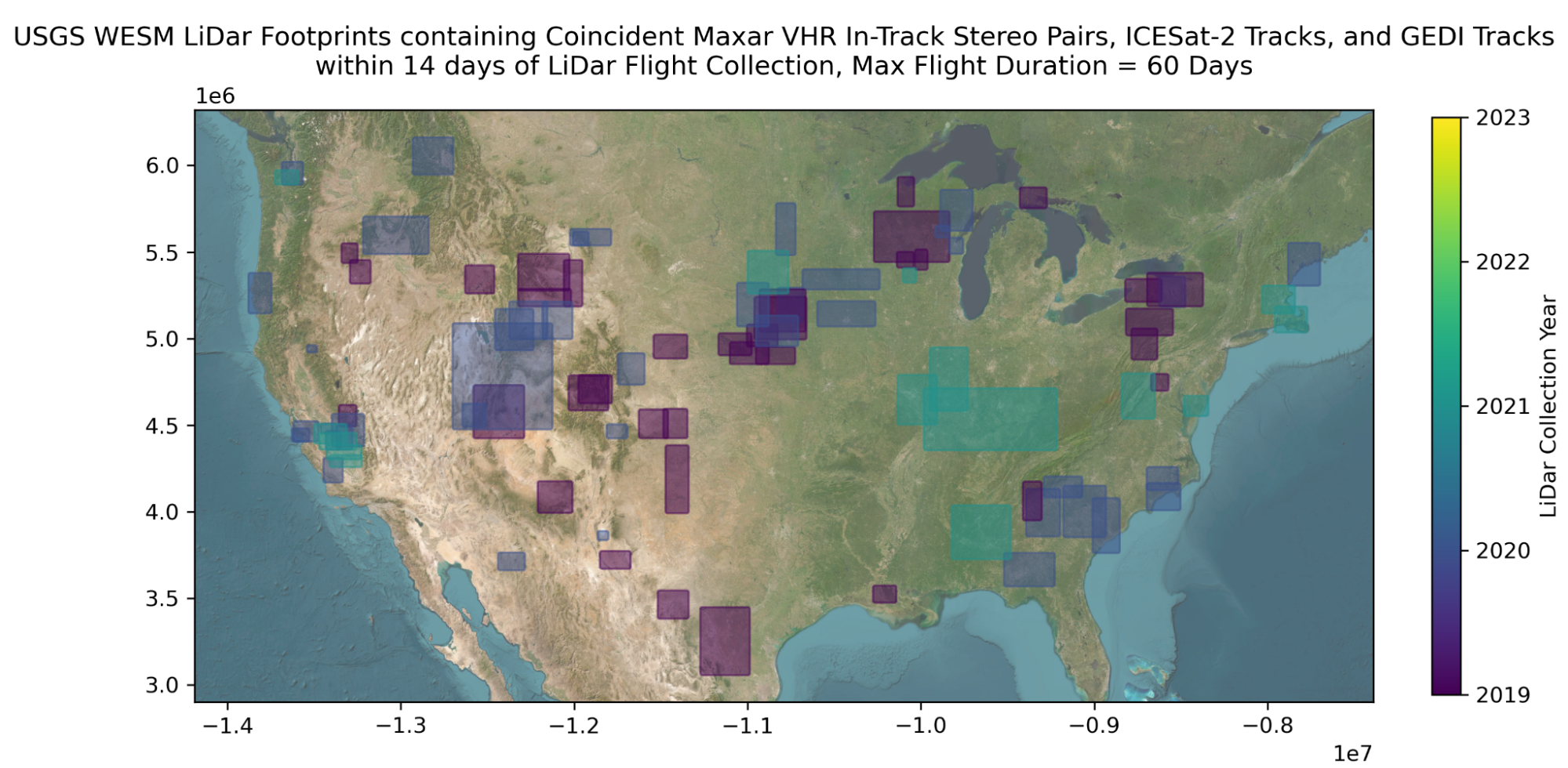
Many "coincident" or near-contemporaneous measurements in these archives were fortuitously acquired over the same location within a short temporal window (e.g., <1-14 days). These archives remain largely untapped for a broader, systematic identification and analysis of spatiotemporally coincident 3D measurements.
We are developing efficient, open-source tools to identify, curate, process and distribute coincident 3D datasets contained within these archives across a range of representative terrain and landcover types. These datasets can be used by the larger STV community for calibration/validation, fusion algorithm development, and discipline-specific scientific analysis.


