Earth Science Missions: Current Fleet
EMIT
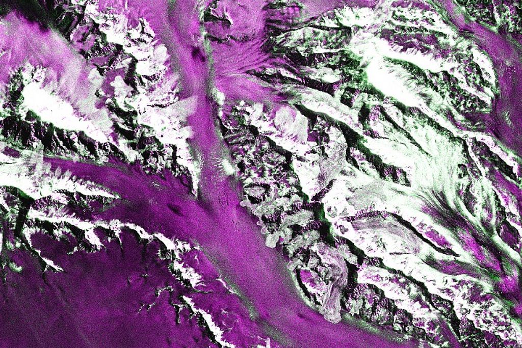
The Earth Surface Mineral Dust Source Investigation (EMIT) instrument will provide critical information about the sources and effects on mineral dust on our atmosphere’s heating and cooling and on human health. EMIT, scheduled to launch to the ISS in 2022, will provide data about dust sources to help scientists better understand how the dust affects Earth and to inform a new mineral map of dust-producing regions, which will improve computer modeling. EMIT’s imaging spectrometer is based on the design of the Snow and Water Imaging Spectrometer (SWIS), which was developed as part of NASA’s Instrument Incubator Program. The EMIT development team is testing its approach using measurements of the Salton Sea, a dust forming region in Southern California taken by an airborne instrument, NASA’s Airborne Visible Infrared Imaging Spectrometer (AVIRIS), which is similar to the data expected from EMIT.
Landsat 9
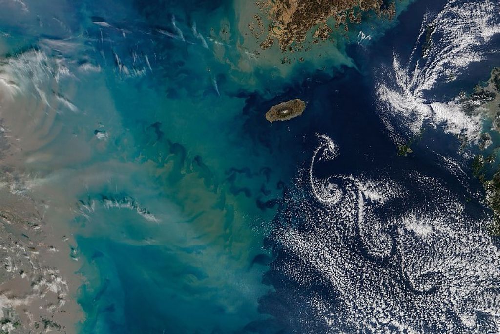
Landsat 9, which launched in September 2021, advances nearly five decades of continuous observations of Earth from space. Landsat 9’s two instruments – the Operational Land Imager (OLI), which detects visible, near-infrared and shortwave-infrared light in nine wavelengths, and the Thermal Infrared Sensor 2 (TIRS-2), which detects thermal radiation in two wavelengths to measure Earth’s surface temperatures and its changes – provide critical data about crop health, irrigation use, water quality, wildfire severity, deforestation, glacial retreat, urban expansion, and other changes to Earth’s surface. Similar in design to Landsat 8, which remains in orbit, Landsat 9 offers several improvements including the ability to detect more subtle differences over darker areas, and the ability to differentiate between more than 16,000 shades of a given wavelength, compared to 256 for Landsat 7, which it is replacing. Landsat is a joint mission between NASA and the U.S. Geological Service (USGS). Landsat 9’s first light images were released in early November 2021, and data from the mission will be publicly available from USGS when Landsat 9 begins normal operations in early 2022.
Sentinel-6 Michael Freilich
Sentinel 6-Michael Freilich, the first of two identical satellites in the Sentinel 6/Jason CS mission to measure the height of the ocean, launched in 2020. It was renamed from Sentinel 6-A in honor of the late Michael Freilich, former director of NASA’s Earth Science Division. Staggering the launches of these satellites will help continue more than three decades of sea-level observations, which are critical to understanding climate change. The missions also will measure temperature and humidity in the troposphere, the atmospheric layer in which we live, and look at the stratosphere, the layer right above the troposphere. NASA is developing the mission with the European Space Agency, the European Organisation for the Exploitation of Meteorological Satellites, and the National Oceanic and Atmospheric Administration. The European Commission is providing funding support. France's space agency, the Centre National d'Etudes Spatiales, is also supporting the mission.
ICESat-2
Launched in September 2018, the Ice, Cloud, land and Elevation Satellite 2 (ICESat-2) measures the height of Earth’s land and sea ice, forests and vegetation, and urban areas, creating a 3D portrait of our planet’s surface. ICESat-2’s bright green laser sends 10,000 pulses per second to the surface, releasing about 20 trillion photons per second, about a dozen of which make it back to the satellite. This provides measurements every 2.3 feet along the satellite’s ground path, a much denser swath covered than its predecessor, ICESat (2003-2010). This enhanced view has found “hidden” lakes under Antarctic Ice, helped inform the first global survey of freshwater fluctuation, and played a critical role in mapping 16 years of ice sheet loss.
GRACE-FO
The twin satellites of the Gravity Recovery and Climate Experiment Follow-On (GRACE-FO) mission continue GRACE’s legacy of tracking Earth’s water movement across the planet. Monitoring changes in ice sheets and glaciers, underground water storage, the amount of water in large lakes and rivers, and changes in sea level provides a unique view of Earth’s climate and has far-reaching benefits for its people. Launched in May 2018, GRACE-FO is a partnership between NASA and the German Research Centre for Geosciences (GFZ). The mission’s predecessor, GRACE, orbited Earth from 2002-2017. Data from GRACE and GRACE-FO have been used, among other things, to show how climate change is affecting the water cycle, to chart sea level rise, and to produce global groundwater maps and U.S. drought forecasts.
CYGNSS
The eight micro-satellites of the Cyclone Global Navigation Satellite System (CYGNSS) mission use existing GPS to measure wind speeds over the ocean in and near the inner core of tropical storms, giving scientists a view beneath the eyewall and the intense inner-rain bands that previously could not be measured from space because of interference from heavy precipitation. CYGNSS, launched in December 2016, has been extended to continue science operations through 2023. In addition to providing critical information about hurricanes, CYGNSS data has been used for other purposes, including by NASA-USAID’s SERVIR program to produce maps explaining locust infestations and by scientists tracking microplastics in the ocean. NASA oversees the mission, and The Space Physics Research Laboratory at the University of Michigan College of Engineering in Ann Arbor leads the overall mission execution, while its Climate and Space Sciences and Engineering department leads the science investigation.
NISTAR, EPIC
NASA’s Earth Polychromatic Imaging Camera (EPIC) is one of several instruments on the Deep Space Climate Observatory (DSCOVR), a partnership between NASA, NOAA and the U.S. Air Force. Launched in February 2015, the satellite is about a million miles from Earth at the neutral gravity point between Earth and the Sun known as Lagrange-1 (L-1). From this truly unique vantage point, EPIC captures 13-22 narrow-band spectral images of the entire sunlit side of Earth every day. NASA makes those daily color images available to the public and has produced a collection of science products including measurements of sulfur dioxide from volcanic eruptions, ozone, ultraviolet (UV) aerosols, cloud and vegetation properties, and natural occurrences such as dust storms.
SMAP
Launched in January 2015, the Soil Moisture Active Passive (SMAP) mission is an orbiting observatory that measures the amount of water in surface soil everywhere on Earth and determines whether the ground is frozen or thawed in colder areas of the world. SMAP measures soil moisture every 2-3 days, enabling observations of global changes from major storms to seasonal variations. These global maps of soil moisture are used to help improve weather forecasts, monitor drought and predict flooding, assist crop productivity, and to track the water, energy, and carbon cycles.
OCO-2
NASA’s first spacecraft dedicated to studying atmospheric carbon, the Orbiting Carbon Observatory-2 (OCO-2), was launched in July 2014 and continues to be critical for scientists studying carbon sources and sinks, as well as variations over seasonal cycles. OCO-2 data has helped measure carbon dioxide over individual cities, for volcano emissions, and even observed plant photosynthesis. It also provides data to power an international Earth Observation Dashboard that, among other things, tracks the impact of pandemic shutdowns on the global environment. Spare materials from OCO-2 build were used to build OCO-3, a carbon-monitoring instrument currently installed on the International Space Station.
GPM
The Global Precipitation Measurement (GPM) mission is an international network of satellites that provide global observations of rain and snow every 3 hours to advance our understanding of Earth's water and energy cycles, improve forecasting of extreme events that cause natural hazards and disasters, and use this accurate and timely precipitation information to directly benefit society. The GPM Core Observatory was developed by NASA and the Japanese Aerospace Exploration Agency (JAXA) and launched in 2014.
Landsat 8
The instruments on Landsat 8, launched in February 2013, represent a significant advance over earlier missions in the Landsat continuum begun in 1972. The Landsat missions – which continue with the September 2021 launch of Landsat 9 – provide essential, continuous observations of our changing planet that inform decision making in myriad applications, including human health, agriculture, climate, energy, fire, natural disasters, urban growth, water management, ecosystems and biodiversity, and forest management. Landsat is a joint mission of NASA and the U.S. Geological Service (USGS).
Suomi-NPP
he NASA-NOAA Suomi National Polar-orbiting Partnership (Suomi-NPP) is the first in a series of polar-orbiting weather satellites known as the Joint Polar Satellite System, a mission to provide valuable weather and environmental data into the 2030s. Launched in 2011, Suomi NPP’s five instruments acquire a wide range of land, ocean, and atmospheric measurements for Earth system science while simultaneously preparing to address operational requirements for weather forecasting. Suomi-NPP’s data help inform science including: climate change, health of the ozone layer, natural disasters, weather predictions, vegetation, global ice cover, air pollution, Earth’s energy budget, and a global record of land surface and sea surface temperatures.
CALIPSO
The Cloud-Aerosol Lidar and Infrared Pathfinder Satellite Observation (CALIPSO), a joint mission between NASA and the French space agency CNES, was launched in 2006 as part of the “A-Train,” but exited that constellation of Earth observing satellites in 2018 to continue an independent orbit. CALIPSO uses an innovative lidar and imaging system that allows us to see natural and human-produced aerosols and thin clouds that are invisible to radar, and sometimes even to the human eye. The global 3D perspective from CALIPSO gives us a unique chance to learn about height, amount, and type of aerosols and clouds and the role they play in regulating Earth's weather, climate, and air quality.
CloudSat
Launched in 2006 at the same time as CALIPSO, CloudSat uses advanced radar to examine the inner structure of clouds, helping researchers better understand how severe tropical cyclones as well as climate changes related to clouds occur. Similar to CALIPSO, CloudSat was part of the “A-Train” satellite constellation until it was moved into its own orbit in 2018. Among its other applications, CloudSat has helped scientists understand the effect of clouds and sea ice on climate change.
Aura
The four instruments on Aura have monitored Earth's changing atmosphere chemistry and provided data on the ozone layer, air quality, and greenhouse gases associated with climate change since the mission launched in 2004. Aura measurements also provide critical data for predictive climate models. Recently, Aura data helped researchers track air quality impacts from the COVID 19 pandemic.
Aqua
Aqua, named for the large amount of information that the mission is collecting about the Earth's water cycle, launched in May 2002. Aqua was originally developed for a six-year design life and has far exceeded that goal as it continues transmitting high-quality data from four of its six instruments. Among Aqua’s measurements are aerosols, natural hazards, vegetation cover on the land, phytoplankton and dissolved organic matter in the oceans, and air, land, and water temperatures. Aqua was the first satellite launched to form the “A-Train” constellation.
Terra
After more than 20 years in orbit, Terra began drifting in February 2020 and will slowly get closer to Earth. Nevertheless, five instruments on this workhorse of a satellite continue to collect meaningful science data, producing one of the longest continuous climate data records collected by a satellite. This international mission – which carries instruments from the U.S., Japan, and Canada – was the flagship mission of NASA’s Earth Observing System when it launched in 1999. Terra data has been used to document the connections between Earth systems in areas including atmospheric composition, carbon cycle and ecosystems, climate variability and change, Earth surface and interior, the water and energy cycle, and weather.
Landsat 7
Landsat 7, launched in 1999, is part of a long history of land remote sensing spacecraft, spanning five decades of multispectral imaging of the Earth’s surface, starting with the launch of Landsat 1 in 1972. Landsat 7 is joined in orbit by Landsat 8, launched in 2013, and Landsat 9, launched in 2021. Landsat is a joint mission of NASA and the U.S. Geological Service (USGS).


