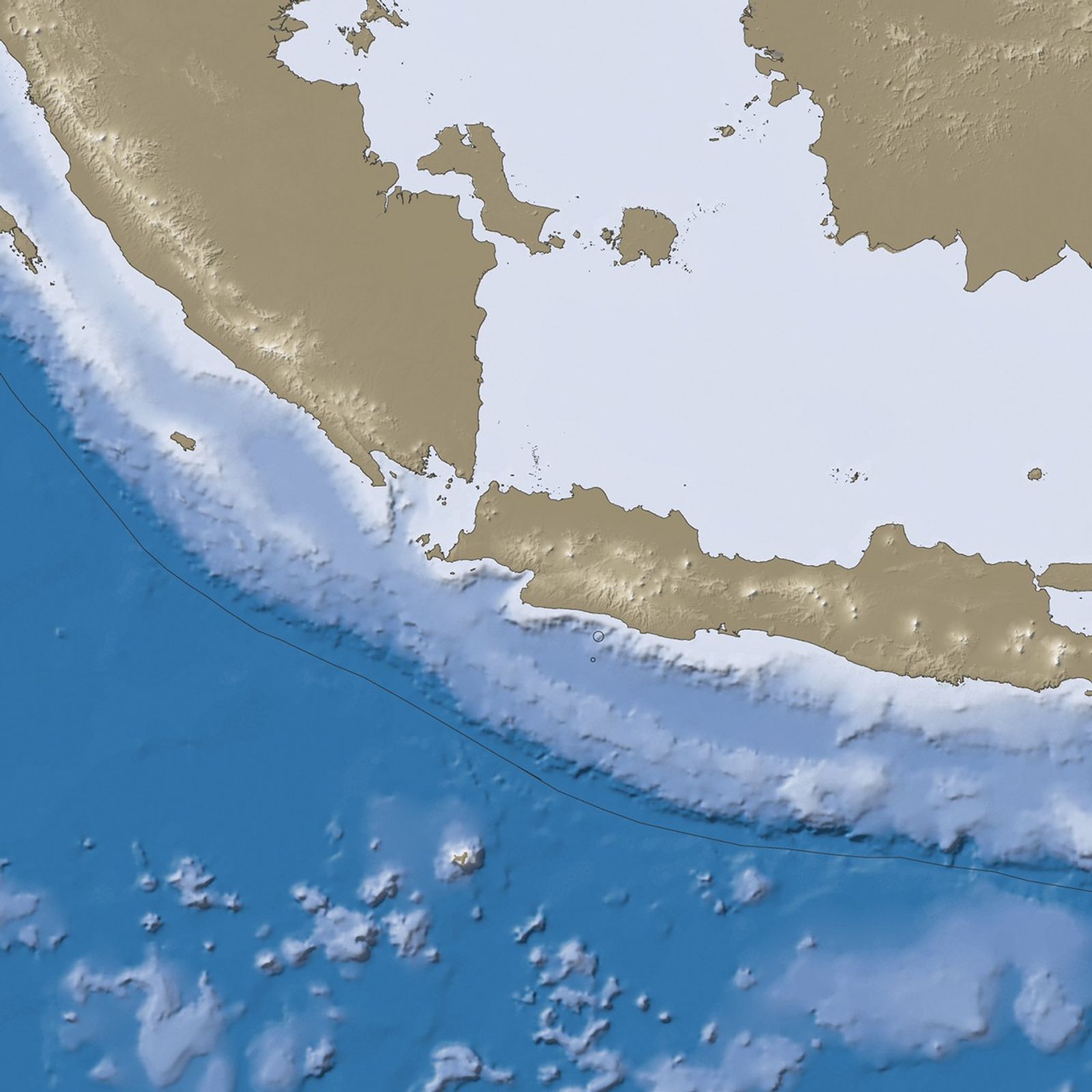


At 2:55 p.m. local time (7:55 UTC) on September 2, 2009, a 7.0-magnitude earthquake struck off the southern shore of western Java (Jawa). The quake occurred at a depth of nearly 50 kilometers (31 miles), approximately 190 kilometers (120 miles) south-southeast of the capital city, Jakarta. This image shows the region’s bathymetry in shades of blue and topography in shades of brown. Black circles mark quake locations.
The earthquake triggered landslides in Cianjur District south of Jakarta. On September 3, Agence France-Presse (AFP) reported that at least 57 people had been killed and dozens more were trapped under rubble. Police, rescue workers, and local residents used garden hoes and bare hands trying to reach those who had been trapped. Meanwhile, a Javanese disaster agency official said that roughly 18,000 buildings in Indonesia had been damaged. Throughout Java, some 5,000 residents had been displaced.
The USGS reported that, where the quake occurred, the Australia plate travels toward the north-northeast, and subducts into Earth’s mantle below the Sunda plate. The seismic waves from this quake, however, indicated that the subduction process didn’t lead to the quake. Instead, the earthquake likely resulted from a reverse fault within the Australia plate.
References & Resources
- Berry, A. (2009, September 3). Dozens trapped as Indonesia quake toll rises to 57. ReliefWeb. Accessed September 3, 2009.
- Earthquake Hazards Program. (2009, September 2). Magnitude 7.0 – Java, Indonesia. USGS. Accessed September 3, 2009.
NASA image created by Jesse Allen, using earthquake and plate tectonics data from the USGS Earthquake Hazard Program, elevation data from the Shuttle Radar Topography Mission (SRTM) courtesy of the University of Maryland’s Global Land Cover Facility, and ocean bathymetry data from the National Oceanic and Atmospheric Administration’s (NOAA) ETOP1 global relief model of Earth’s surface. Caption by Michon Scott.