Mexico City has one of the world’ s most serious air pollution problems.The city is located atop a high plain at an altitude of 2200 meters, and issurrounded on three sides by mountains and snow-capped volcanoes. Since incidentsolar radiation does not vary significantly with season at tropical latitudes,photochemical smog is produced much of the year. In winter, air quality canworsen significantly when thermal inversions keep polluted air masses close tothe surface.
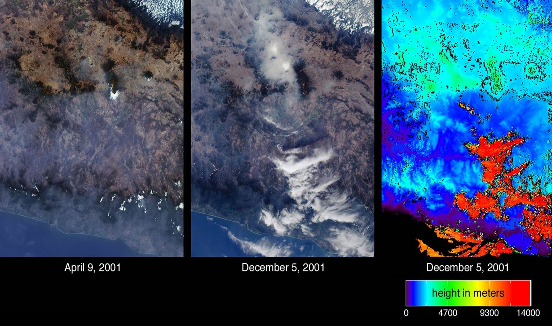
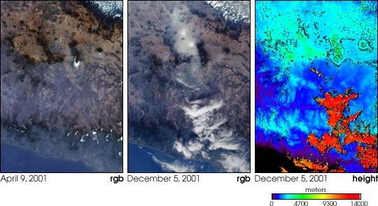
Atmospheric particulates (aerosols) are readily visible at oblique viewangles, and differences in aerosol amount on two days are indicated by theseimages of central Mexico from the Multi-angle Imaging SpectroRadiometer (MISR).The images at left and center are natural color views acquired by MISR’ s70-degree forward-viewing camera on April 9 and December 5, 2001, respectively.Mexico City can be identified in the center panel by the large area of hazeaccumulation above image center. Two small brighter patches within the hazy areaindicate low fog. In the left-hand panel, the city basin appears significantlyclearer, but some haze remains apparent across the Sierra Madre mountains in thelower portion of the images. On the right is an elevation field corresponding tothe December 5 view. Automated MISR stereoscopic retrievals reveal the clouds atlower right to be at very high altitudes, in contrast to the low-lying haze andfog near Mexico City. When the stereo retrieval determines that a location isnot covered by clouds, digital terrain elevation data are displayed instead.High clouds appear as the orange and red areas, and mountainous areas appearlight blue and green. The position of the clouds within the 70-degree image areslightly southward of their location in the elevation map as a consequence ofgeometric parallax.
Major sources of air pollutants within the basin enclosing the Mexico Cityurban area include exhaust from 3.5 million vehicles, thousands of industries,and mineral dust. The ancient lakebed valley in which Mexico City is situatedbecame a major source of dust when it was drained in the 16th century. The citybasin stretches approximately 70 kilometers wide; it is reported that the localair quality causes the surrounding mountains to be rarely visible from the urbancenter.
The Multi-angle Imaging SpectroRadiometer views almost the entire Earth every9 days. These images cover an area of 330 kilometers x 464 kilometers.
References & Resources
Image courtesy NASA/GSFC/LaRC/JPL, MISR Team.