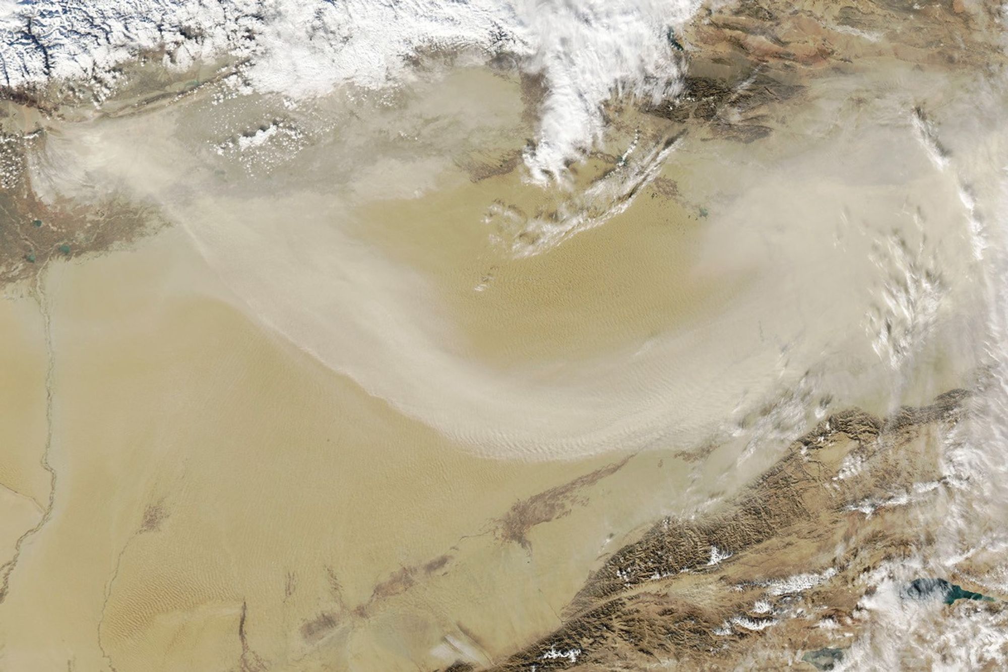


The Taklamakan desert in China’s Tarim Basin is one of the driest, most barren expanses on Earth. Flanked by mountain ranges on three sides and parched by the resulting rain shadow, many parts of it receive between 10 and 40 millimeters (less than two inches) of rain per year.
November through March is particularly dry, and passing weather systems often stir up walls of dust that race across the basin. The MODIS (Moderate Resolution Imaging Spectroradiometer) sensor on NASA’s Aqua satellite acquired this image on November 11, 2023, as a cold front passed through the region and blew dust toward the east. The storm dropped snow in the Tien Shan range to the north, visible amid the clouds in the top-left of the image.
To combat the spread of deserts and reduce the number of dust storms, Chinese authorities are engaged in a tree-planting campaign to establish forests along the edges of the Taklamakan and Gobi Deserts. The project, called the Three-North Shelter Belt or the Great Green Wall, began in 1978. Since then, tens of billions of trees have been planted; the aim is to plant around 100 billion by 2050.
References & Resources
- Britannica (2023) Takla Makan Desert. Accessed November 13, 2023.
- The Business Standard (2023) Fighting desert sandstorms: China’s Aksu shows the way. Accessed November 13, 2023.
- Reuters (2021, July 19) The Great Green Wall. Accessed November 13, 2023.
- Royal Geographical Society (2015) China’s Great Green Wall. Accessed November 13, 2023.
- Turner, M. et al. (2023) Great Green Walls: Hype, Myth, and Science. Annual Reviews, 48.
- United Nations Three-north shelterbelt program. Accessed November 13, 2023.
- Zhai, J. (2023) Assessing the effects of China’s Three-North Shelter Forest Program over 40 years. Science of the Total Environment, 857, 1.
NASA Earth Observatory image by Wanmei Liang , using MODIS data from NASA EOSDIS LANCE and GIBS/Worldview . Story by Adam Voiland .