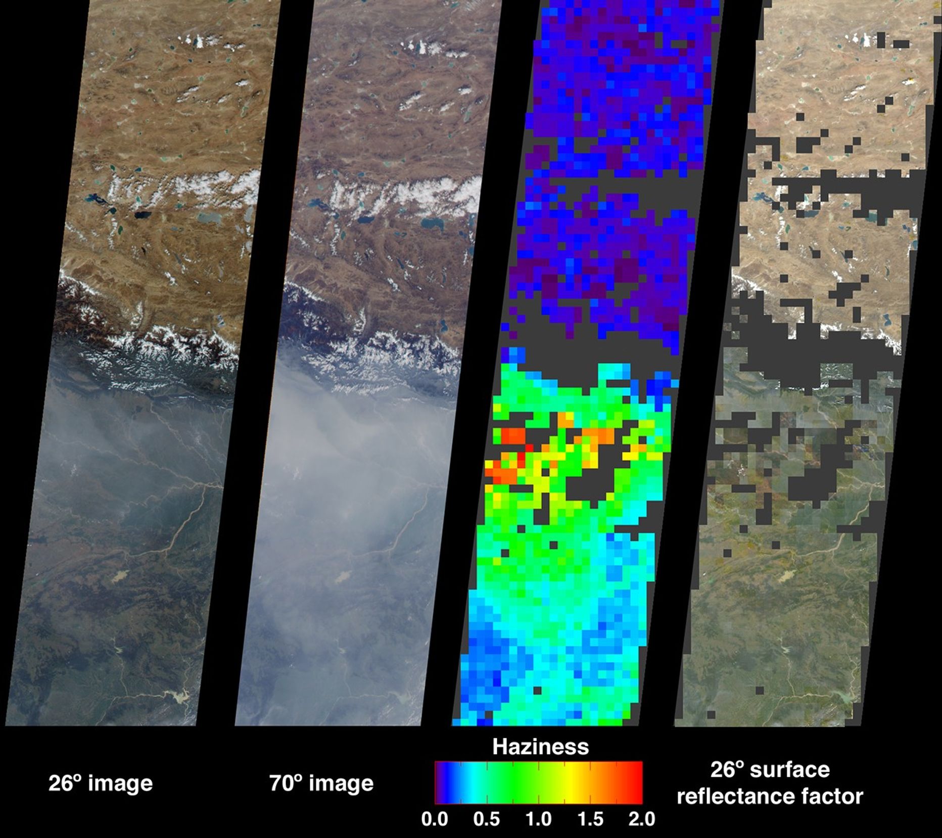


Large abundances of aerosols, or airborne particulates, over thelow-lying plains of northeastern India appear in dramatic contrastwith the relatively pristine air of the high-altitude Tibetan Plateau.This contrast is illustrated in these Multi-angle ImagingSpectroRadiometer images from October 15, 2001. These data represent an area of about 400 kilometers wide by 1600 kilometers long. The aerosols thatcontribute to poor air quality over much of the Indian subcontinentare believed to originate from industrial smoke, vehicle emissions,and biomass burning.
The two images at left show the scene from MISR's 26-degree and70-degree forward viewing angles, respectively. The high levels ofaerosols are accentuated in the 70-degree forward image, due to thelonger atmospheric path length associated with the more obliqueviewing angle. The abundance of aerosols is derived from the variationof scene brightness and contrast as a function of observation angle,and is displayed in the third panel from the left as optical depth.This quantity is logarithmically related to the atmosphere's abilityto transmit light, and is one of several variables used to characterizethe climatic and environmental influence of aerosols. Areas whereretrievals were not obtained, such as the topographically complexHimalayas in Nepal, and cloudy or very turbid areas, are shown indark gray.
Surface calculations for the 26-degree view direction are shown in therightmost panel. These calculations use the optical depth field toestimate surface reflectances as if the intervening atmospherewere not present. Making corrections for atmospheric scattering isimportant when using reflectances measured from space in surfaceclassification and physical process studies. Note that the algorithmsused to produce these results are still being refined, and futureproduct versions may show some differences from the preliminary valuesdisplayed here.
MISR was built and is managed by NASA's Jet Propulsion Laboratory,Pasadena, CA, for NASA's Office of Earth Science, Washington, DC.The Terra satellite is managed by NASA's Goddard Space Flight Center,Greenbelt, MD. JPL is a division of the California Institute ofTechnology.
References & Resources
Image courtesy NASA/GSFC/LaRC/JPL, MISR Team