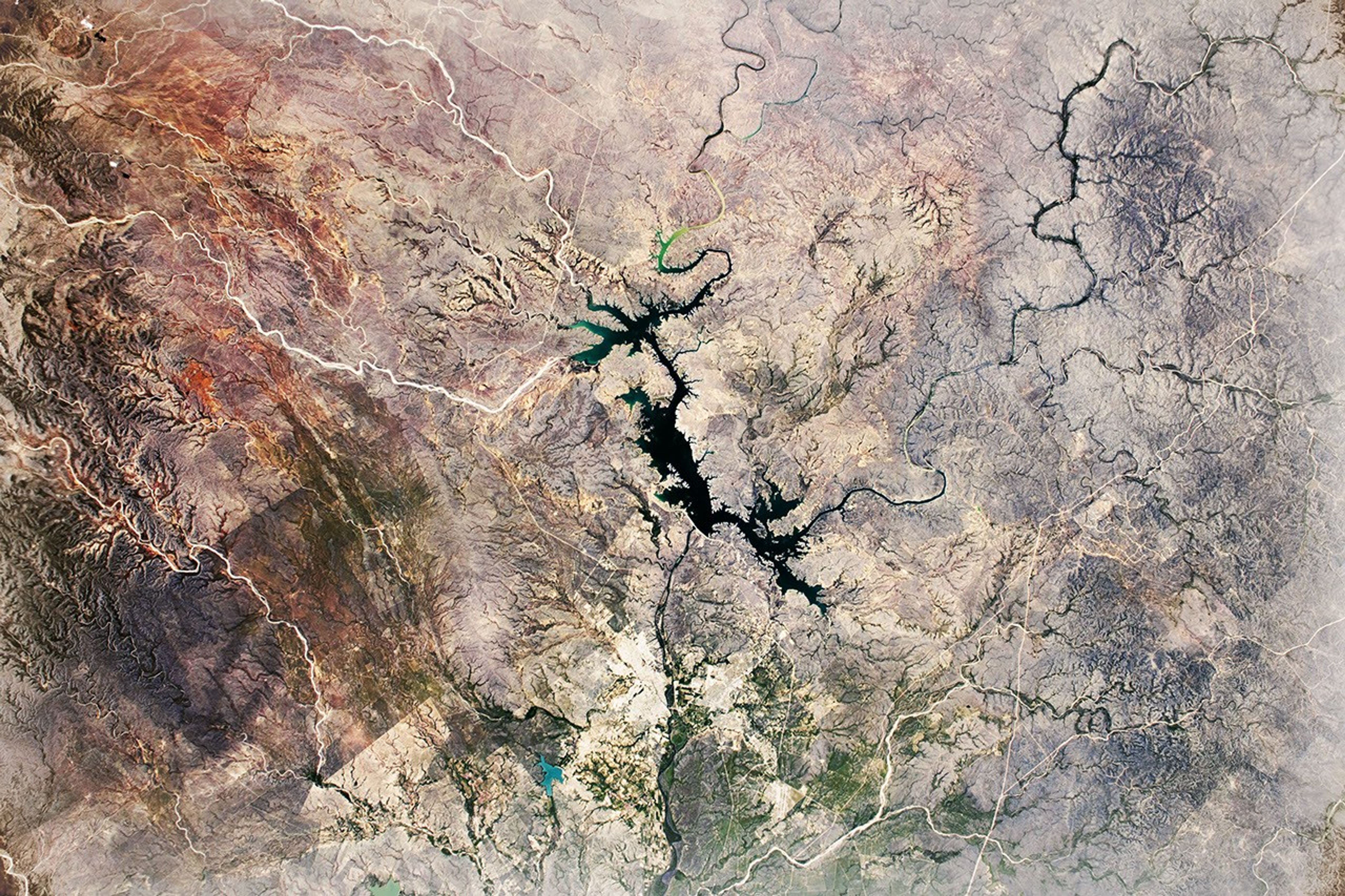
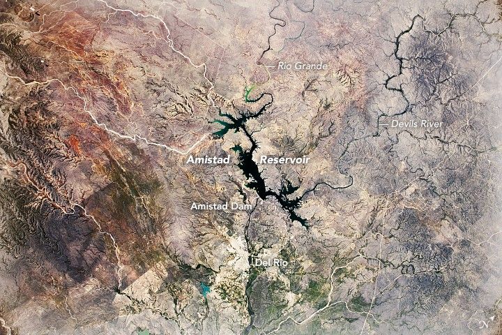
An astronaut onboard the International Space Station (ISS) captured this downward-looking (nadir) photograph of the Amistad Reservoir, which is on the border of Mexico and Texas. The reservoir is located just west of the city of Del Rio. It was created in 1969 with the completion of the Amistad Dam, built at the confluence of the Rio Grande and Devils River in order to store water and prevent local flooding.
The lake and river levels regularly fluctuate due to rainfall or drought. When water depth is at the conservation pool level, Amistad is the second largest lake in Texas. However, the last time the reservoir hit conservation pool level was in 2011. The area is currently abnormally dry (according to the U.S. Drought Monitor), and the reservoir level is 32 feet below the 2011 level (data as of June 4, 2019.)
The U.S. portion of the reservoir and surrounding land is known as the Amistad National Recreation Area, and it is home to a unique combination of flora and fauna. There are three major plant communities in the area—Tamaulipan Shrubland, Chihuahuan Desert, and Edwards Plateau—as well as two major climate zones (temperate and tropical), making for significant biodiversity in the park. The area is also a waypoint for seasonal migrations of animals and insects, with the most significant being Monarch butterflies. Thousands of Monarchs pass through the area each October on their way to the mountains of central Mexico.
References & Resources
Astronaut photograph ISS059-E-35758 was acquired on April 25, 2019, with a Nikon D5 digital camera using a 116 millimeter lens and is provided by the ISS Crew Earth Observations Facility and the Earth Science and Remote Sensing Unit, Johnson Space Center. The image was taken by a member of the Expedition 59 crew. The image has been cropped and enhanced to improve contrast, and lens artifacts have been removed. The International Space Station Program supports the laboratory as part of the ISS National Lab to help astronauts take pictures of Earth that will be of the greatest value to scientists and the public, and to make those images freely available on the Internet. Additional images taken by astronauts and cosmonauts can be viewed at the NASA/JSC Gateway to Astronaut Photography of Earth. Caption by Sarah Deitrick, Jacobs, JETS Contract at NASA-JSC.