


Ancient Troy was once a mythical city, known only throughthe text of Homer’s Iliad. In 1870, however,the German archeologist Heinrich Schlieman discovered theruins of Troy (and several cities above and beneath it) innorthwest Turkey. He located the city by scrutinizing thetext of the Iliad, and laboriously exploring the area on foot.
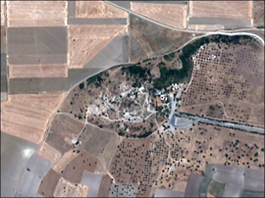
Modern scientists and archeologists use high technologysuch as satellite imagery to aid their search for ancient historical sites. This image of the ruins of Troy from the IKONOS satellite uses four meter resolution color data.
For more information about IKONOS, visit theSpace Imagingweb site.
To learn about another way to study the Earth’s past using satellite data,read Finding Fossils from Space.
References & Resources
Image processing by Robert Simmon. Data copyright Space Imaging.
None


