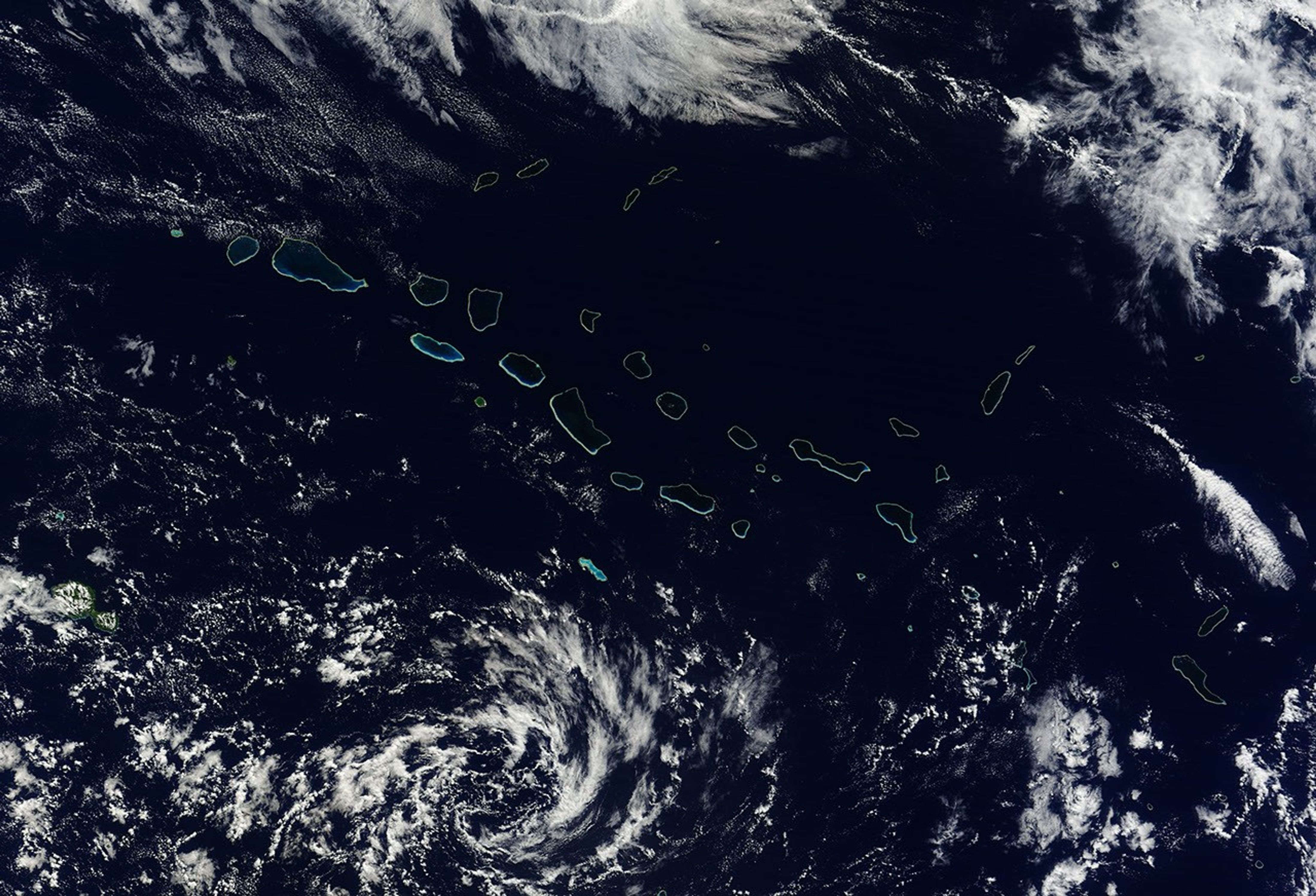
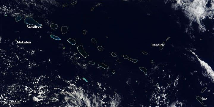
Aligned vaguely like the bones of a fossil flipper, islands in the Archipel des Tuamotu (Tuamotu Archipelago) sprawl across the South Pacific. On May 19, 2010, the Moderate Resolution Imaging Spectroradiometer (MODIS) on NASA’s Terra satellite acquired this natural-color image of the northwestern portion of the archipelago, including the largest coral atoll in the group, Rangiroa. Delicate rings of iridescent blue-green surround deep blue waters and clouds float overhead.
The Tuamotu Archipelago consists of 73 true atolls (coral islands encircling lagoons), four low-elevation coral islands, one raised coral island (an atoll later elevated by volcanic forces), and one complex of island and barrier reef structures. Altogether, the archipelago has a total land area of 885 square kilometers (342 square miles). The islands and atolls of the Tuamotu Archipelago are reefs sitting atop summits of mountains that rise from the sea floor. At the northwestern extent of the island chain—including islands shown in this image—rocks date to roughly 65 million years ago. Younger rocks predominate in the southeast and east, dating to roughly 36 million years ago.
The largest coral atoll in the Tuamotu Archipelago is Rangiroa: 20 tiny islets surrounding a large lagoon. Southwest of Rangiroa is Makatea, a raised coral island. Rising some 80 meters (260 feet) above sea level, this island is only 7.5 kilometers (4.7 miles) long. Unlike other members of this island chain, Makatea sports fresh, potable water. East-southeast of Rangiroa is Raroira, where the famed Kon-Tiki expedition concluded in 1947.
The Tuamotu Archipelago is part of French Polynesia, and most island villages are located near lagoons where fishing and black pearl cultivation support the local population.
References & Resources
- Encyclopedia Britannica. (2010). Tuamotu Archipelago. Accessed May 21, 2010.
- Oceandots.com. (2010). Tuamotu Archipelago. Accessed May 21, 2010.
- Wikipedia. (2010, April 18). Makatea. Accessed May 21, 2010.
NASA image by Jeff Schmaltz, MODIS Rapid Response Team. Caption by Michon Scott.