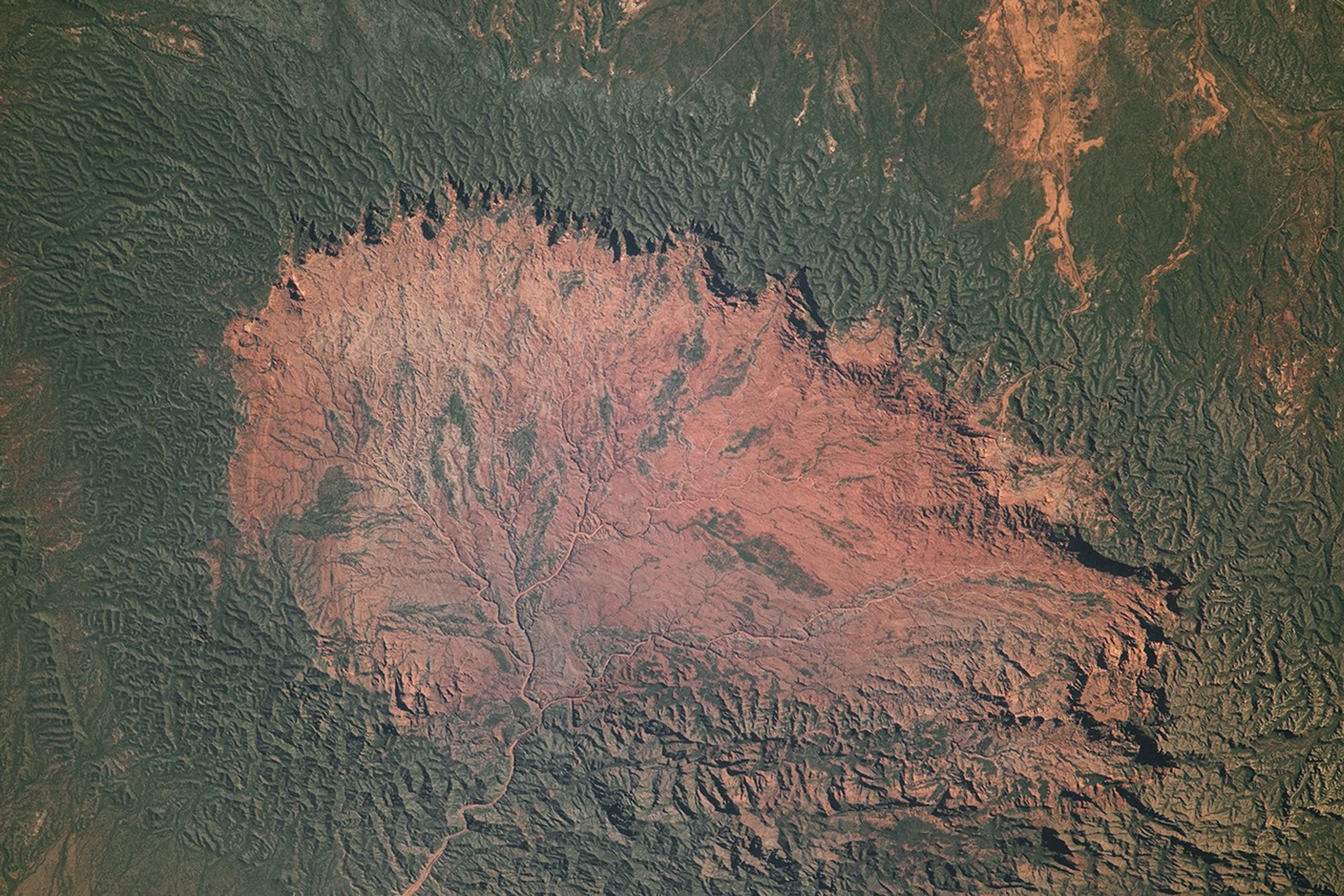


An astronaut aboard the International Space Station captured this photograph of an arid basin in Argentina’s Sierra de Las Quijadas National Park. Located in northwestern San Luis Province, the mountainous area is approximately 200 kilometers (120 miles) east of the Andes Mountains and part of the warm temperate Monte Desert ecoregion. In addition to its striking topography, the national park is known for having fossils of flying reptiles called pterosaurs.
The cliffs and canyons shown here were shaped over millions of years by tectonic, erosional, and sedimentary processes. Harder rocks, more resistant to erosion, make up the high walls surrounding this large depression known as Potrero de la Aguada. The shadows cast by the rocky cliffs along the eastern edge of the feature—reaching up to 300 meters (1,000 feet) tall—indicate that the photo was taken before noon local time. (Note: An optical illusion known as relief inversion may cause the basin to appear higher than the surrounding mountains to some viewers.)
The Sierra de Las Quijadas are situated within a rain shadow created by the towering Andes Mountains (out of frame to the west) and the Sierra de Córdoba (out of frame to the east), contributing to the region’s aridity. The basin has very little vegetation, visible as green patches in the image. In contrast, the mountain slopes surrounding the basin are covered in vegetation, owing in part to the cooler and damper conditions at higher elevations. When water does flow through Potrero de la Aguada, typically in the rainier months of October through April, it is funneled through a labyrinth of seasonal river channels toward a common point at the bottom of the photo.
References & Resources
Astronaut photograph ISS070-E-96945 was acquired on January 30, 2024, with a Nikon D5 digital camera using a focal length of 1150 millimeters. The image was provided by the ISS Crew Earth Observations Facility and the Earth Science and Remote Sensing Unit at Johnson Space Center. The image was taken by a member of the Expedition 70 crew . It has been cropped and enhanced to improve contrast, and lens artifacts have been removed. The International Space Station Program supports the laboratory as part of the ISS National Lab to help astronauts take pictures of Earth that will be of the greatest value to scientists and the public and to make those images freely available on the Internet. Additional images taken by astronauts and cosmonauts can be viewed at the NASA/JSC Gateway to Astronaut Photography of Earth . Caption by Wilfredo García López, Amentum JETS II Contract at NASA-JSC.