


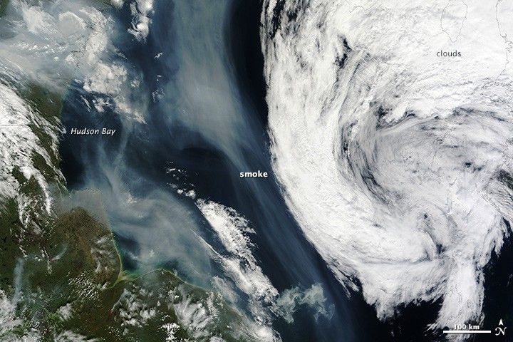

In late July 2013, numerous wildfires burned through boreal forests in northern Canada. On July 29 and 30, 2013, the Moderate Resolution Imaging Spectroradiometer (MODIS) on NASA’s Aqua and Terra satellites acquired these images of a large smoke plume spreading south over Hudson Bay. The Canadian Interagency Forest Fire Center reported 21 uncontrolled fires burning in Manitoba and six burning in Nunavut on July 30.
The satellite images from MODIS and other sensors got the attention of a community of wildfire and remote sensing experts who monitor fires for signs of pyrcocumulus clouds, towering clouds that can send smoke as high as the stratosphere.
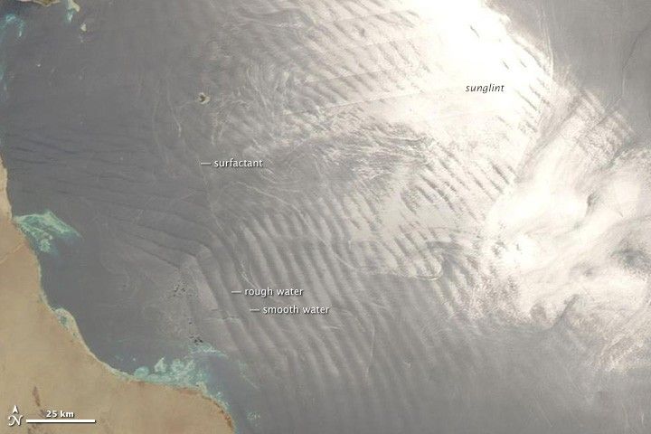
When Raymond Hoff saw the images, he saw no evidence of pyrocumulus clouds. But the atmospheric scientist from the University of Maryland at Baltimore County saw something peculiar: it looked like the smoke had cut a strip of fair weather through the otherwise cloudy scene. Images from MODIS, which only show the top of the smoke and clouds, are not enough to definitively confirm his suspicion, but the physics of the phenomenon are understood well enough to think it was a possibility.
For more than a decade, atmospheric scientists have noticed and reported examples of smoke and other pollution particles suppressing clouds. Andrew Ackerman, a scientist at NASA’s Goddard Institute for Space Studies, was among the scientists to describe the “cloud burning” effect of dark soot particles within haze over the northern Indian Ocean. In a study published in 2000, Ackerman and colleagues explained how particles known as black carbon, readily absorb sunlight, warming the layer of smoky air and reducing the relative humidity of smoke plumes. This causes existing clouds to break down more rapidly than they would otherwise. The particles also can interfere with the normal rising and cooling of moist air, one of the key processes that fuels cloud formation.
But is that what was happening over Hudson Bay in July 2013? After reviewing the MODIS imagery, as well as data collected by CALIPSO, Ackerman was not convinced. The CALIPSO data revealed that smoke was mingling with clouds to the south of the plume, but the layer of clouds to the north was significantly higher, suggesting the clear area may simply be a gap between the two cloud layers.
“Bottom line: It is possible that we’re simply looking at a coincidence,” explained Ackerman.
References & Resources
- Ackerman A. et al (2000, May 12) Reduction of Tropical Cloudiness by Soot. Science, 288 (5468), 1042-1047.
- Kaufman, Y. & Koren, I. (2006, July 13) Smoke Pollution Aerosol Effect on Cloud Cover. Science, 313 (5787), 655-658.
- Koch, D. & Del Genio A. (2010, March 6) Black Carbon semi-direct effects on cloud cover: review and synthesis. Atmospheric Chemistry and Physics, 10, 7685-7696.
- Koren, I. et al (2008, August 15) Smoke Invigoration Versus Inhibition of Clouds over the Amazon. Science, 321 (5891), 946-949.
- NASA (2006, July 13) NASA Explains Puzzling Impact of Polluted Skies on Climate. Accessed August 7, 2013.
- NASA Earth Observatory (2004, July 27) Clouds are Cooler than Smoke.
- NASA Earth Observatory (2006, July 14) Impact of Polluted Skies on Clouds and Climate.
- NASA Earth Observatory (2012, July 11) When Wildfire Smoke and Thunderstorms Collide. Accessed August 7, 2013.
NASA image courtesy the LANCE/EOSDIS MODIS Rapid Response Team at NASA GSFC. Caption by Adam Voiland.


