On August 13, 2005, the Ayles Ice Shelf on Ellesmere Island in northern Canada broke away from the island and floated out to sea. According to news reports, the break took less than an hour, and Luke Copland, director of the University of Ottawa’s Laboratory for Cryospheric Research, described the break as evidence of the Arctic’s rapid response to warming temperatures.
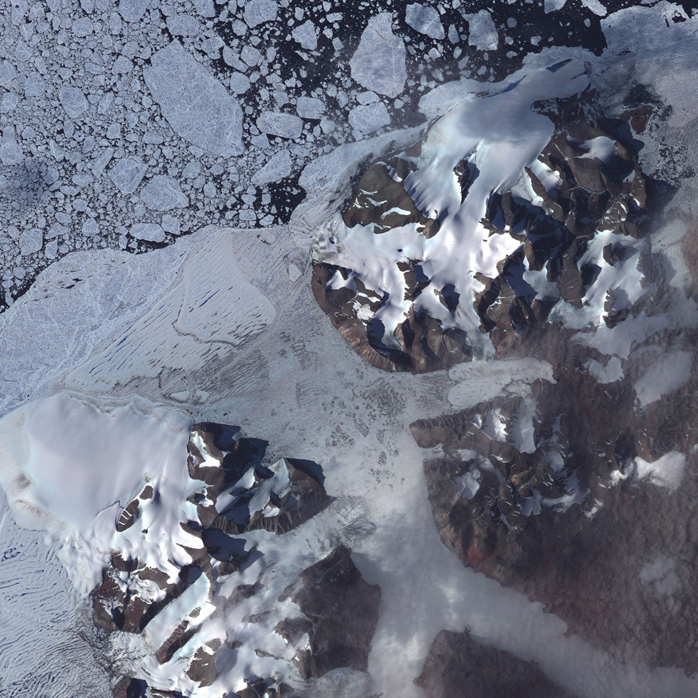
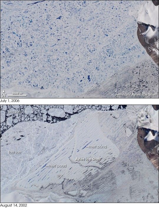
The Advanced Spaceborne Thermal Emission and Reflection Radiometer (ASTER) on NASA’s Terra satellite observed the area before and after the ice shelf breakup. The bottom image, acquired on August 14, 2002, shows the area three years before the ice shelf broke free. In this image, melt ponds mark the surface of the shelf. The parallel configuration of the melt ponds suggests that the ice had been compressed like an accordion into ridges against the coastline. Beyond the ice shelf is ice known as fast ice—sea ice that holds fast to a coastline or ice shelf. Farther out to sea is loose sea ice, floating on the ocean’s surface in plates of varying size.
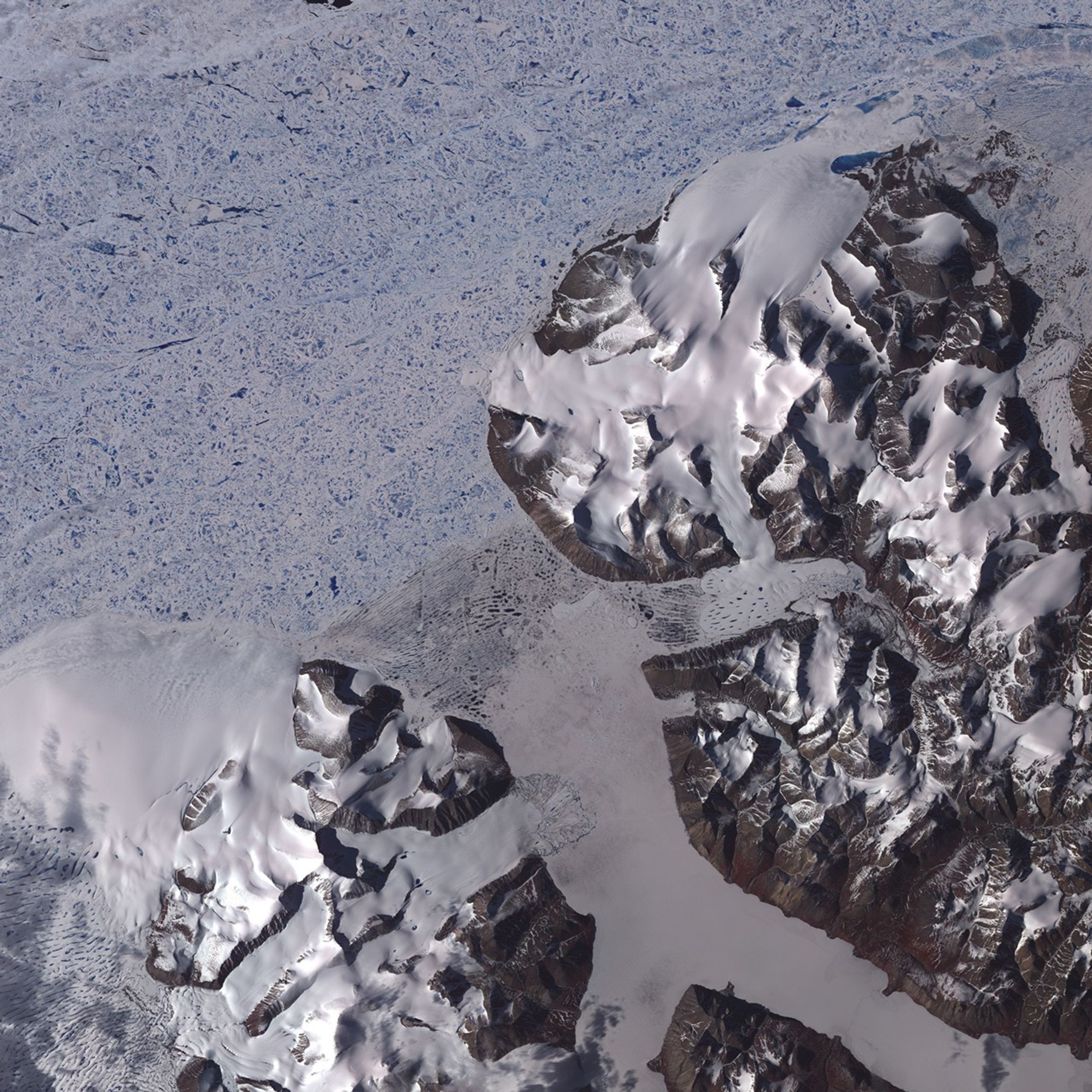
The top image shows the area on July 1, 2006, almost a year after the ice shelf broke free. In this image, what remains of the ice shelf is also littered with melt ponds, but without the parallel pond configuration. Beyond the shelf remnant is compressed sea ice, which makes a blue-and-white mosaic. At image left, snow or glaciers on Ellesmere Island appear smoothly white against the bare, brown ground.
The Moderate Resolution Imaging Spectroradiometer (MODIS) on NASA’s Terra satellite captured additional images of the ice shelf.
References & Resources
NASA image created by Jesse Allen, Earth Observatory, using data provided courtesy of the NASA/GSFC/MITI/ERSDAC/JAROS, and U.S./Japan ASTER Science Team .