![Request for Information – Potential [Placeholder for Prize]](https://assets.science.nasa.gov/dynamicimage/assets/science/psd/solar/2023/09/s/solarsystem_0.jpg?w=1024)


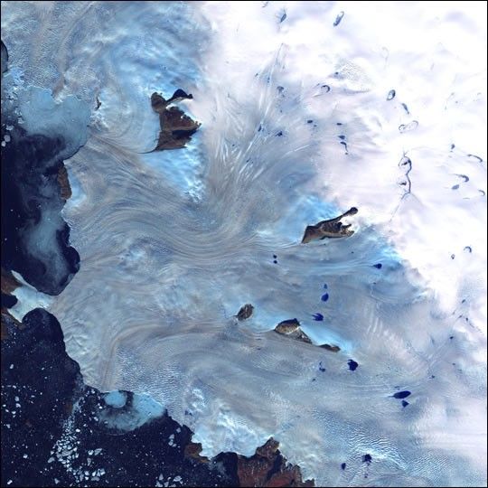
Along Greenland's western coast, a small field of glaciers surrounds Baffin Bay.
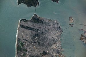
This image was acquired byLandsat 7's Enhanced Thematic Mapper plus(ETM+) sensor on September 3, 2000. This is a false-color composite image made using near-infrared,red, and blue wavelengths. The image has also been sharpened using the sensor's panchromaticband.
References & Resources
Image provided by the USGS EROS Data Center Satellite Systems Branch