large images:
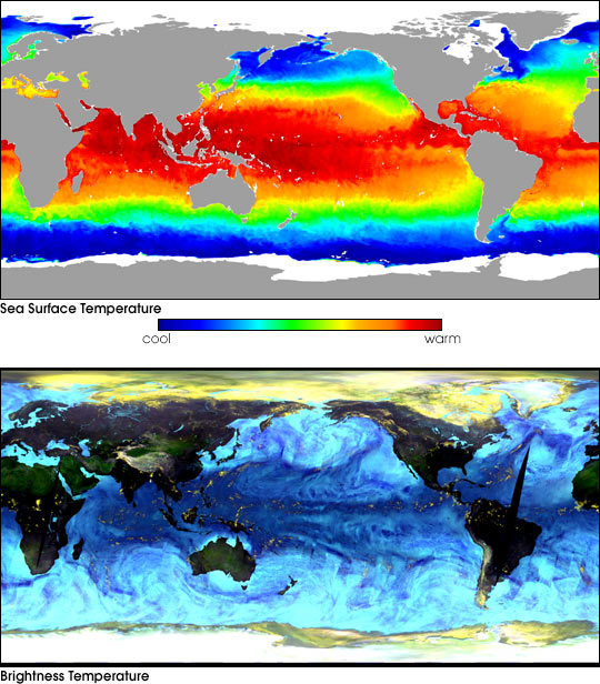
Sea Surface Temperature
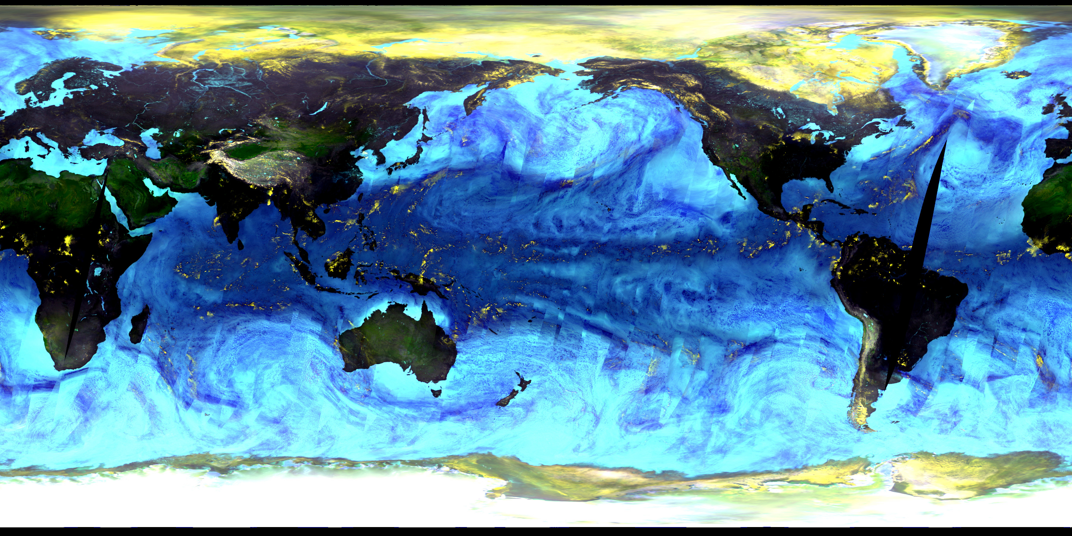
Brightness Temperature
The National Space Development Agency of Japan's (NASDA) Advanced Microwave Scanning Radiometer for the Earth Observing System(AMSR-E), onboard NASA’s Aqua spacecraft, began sending high quality data onJune 1, 2002. Initial (uncalibrated) data gathered from the AMSR-E has deliveredimpressive pictures of the planet’s sea surface temperature from the 6.9 Ghzvertical polarization channel (top image) and brightness temperatures (bottomimage) from the 89.0 Ghz vertical and horizontal polarization channels and the23.8 Ghz vertical polarization channel, averaged over the 3-day period June 2-4,2002. The sea surface temperature image is indicative of the high level ofdetail the microwave imager will routinely provide even in the presence ofsubstantial cloud cover. In the brightness temperature image, ice and snow coverin white and yellow, desert areas in shades of green, other land areas in darkcolors, and oceans in shades of blue.
References & Resources
Images courtesy AMSR-E Science Team, National Space Development Agency of Japan
None