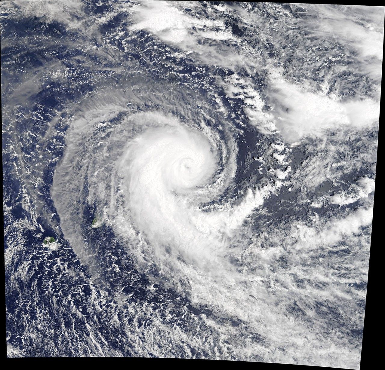
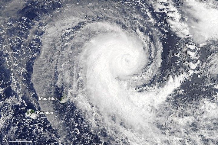
After several days marching across the Indian Ocean, Tropical Cyclone Berguitta approached the islands of Mauritius and Réunion, to the east of Madagascar. On January 16, 2018, the Moderate Resolution Imaging Spectroradiometer (MODIS) on NASA’s Terra satellite captured these images of the cyclone it neared the islands.
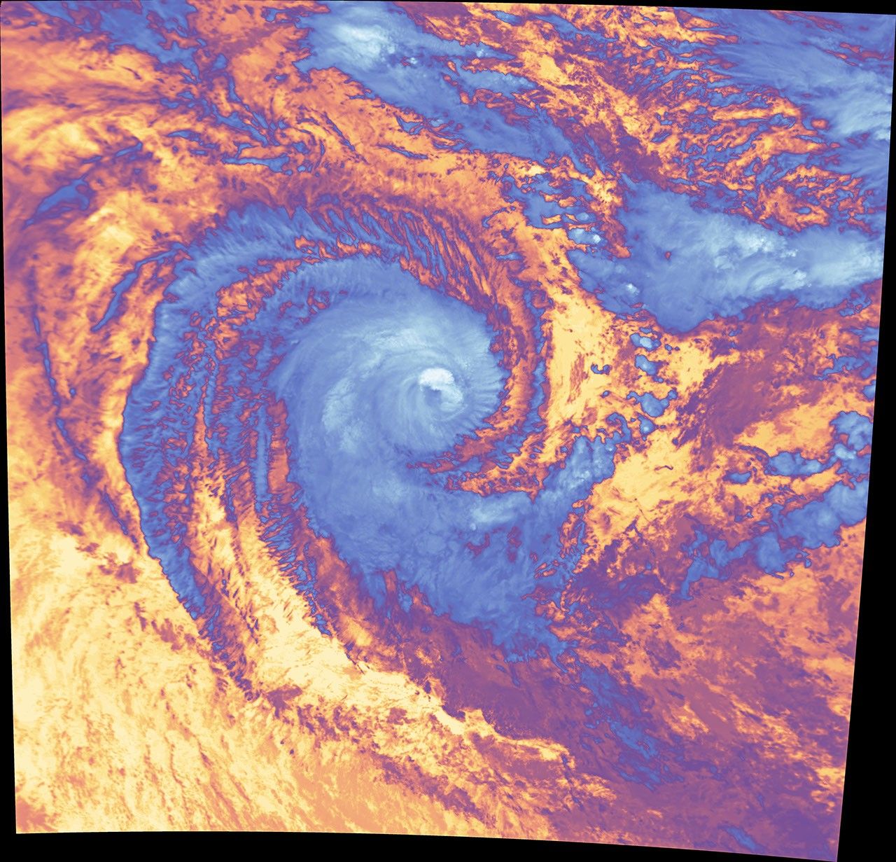
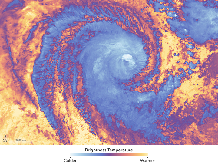
The natural-color image (top) shows the location of Berguitta at 10:10 a.m. local time (06:10 Universal Time). The cyclone’s intensity had just weakened from a category 3 storm to category 2 on the Saffir-Simpson wind scale, with maximum sustained winds of 110 miles (175 kilometers) per hour. The false-color view (bottom) uses MODIS band 31, which measures infrared signals known as “brightness temperature.” This is useful for distinguishing cooler (white) cloud tops from the warmer (purple and yellow) surface below.
Berguitta further weakened to a category 1 storm, with 75-mile-per-hour winds reported at 7 p.m. local time on January 17. Still, winds of that strength were enough to lead authorities to close the port and airport in Mauritius, according to news reports.
References & Resources
- Joint Typhoon Warning Center (2018, January 17) WARNING NR 020. Accessed January 17, 2018.
- Precipitation Measurement Missions (2018, January 16) IMERG Reveals Rainfall Rates With Tropical Cyclone Berguitta. Accessed January 17, 2018.
- Reuters (2018, January 17) Mauritius on alert for tropical cyclone Berguitta, port and airport closed. Accessed January 17, 2018.
- Weather Underground (2018, January 17) Tropical Cyclone Berguitta. Accessed January 17, 2018.
NASA Earth Observatory images by Joshua Stevens and Jeff Schmaltz, using MODIS data from LANCE/EOSDIS Rapid Response . Caption by Kathryn Hansen.