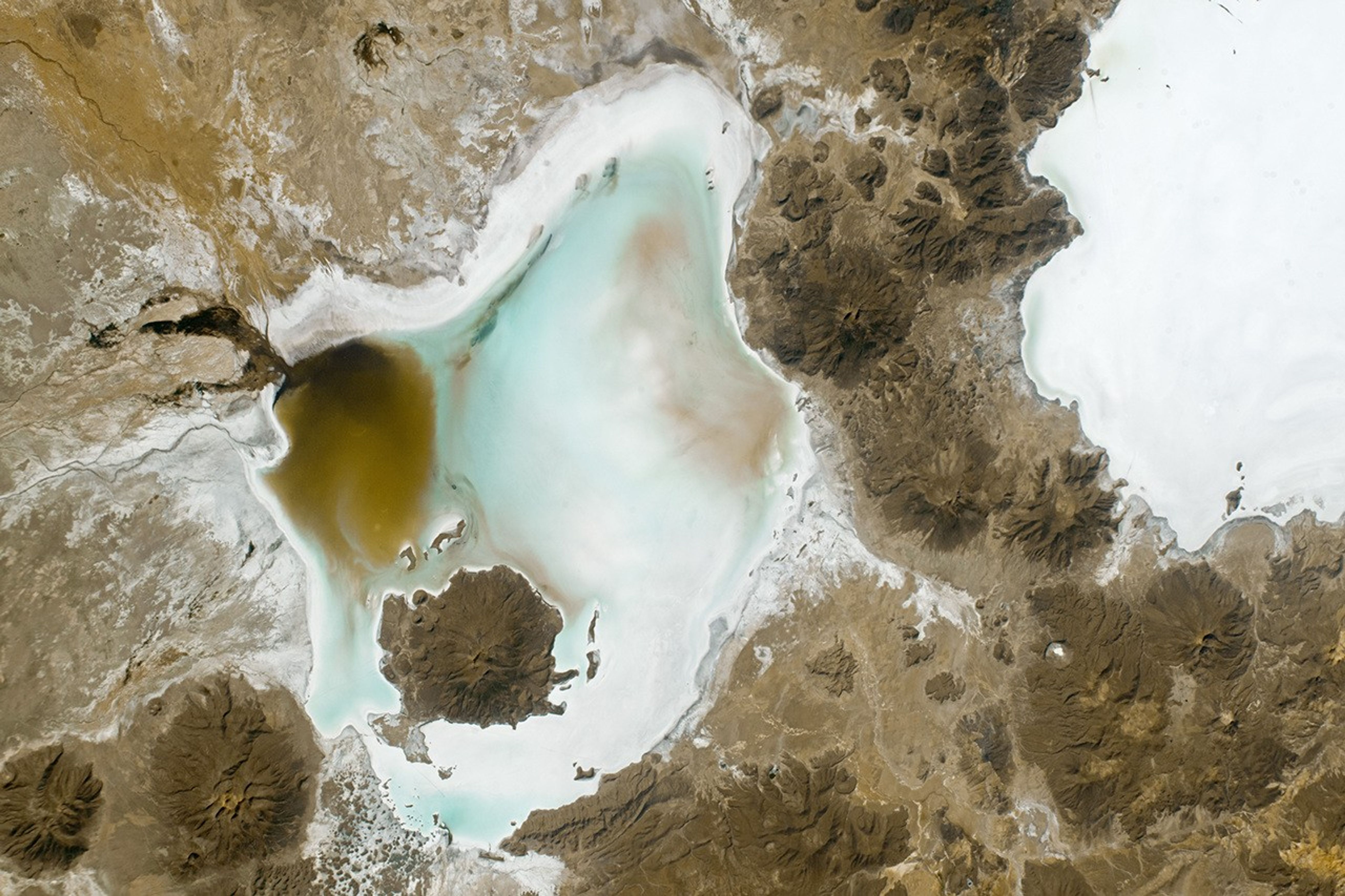

An astronaut aboard the International Space Station captured this photograph of Salar de Coipasa and neighboring Salar de Uyuni in the Bolivian Andes. Visible from low Earth orbit, the salt flats display stark white hues that contrast with the darker surrounding rock. Various volcanic cones are scattered through the image, such as Cerro Tetivilla, which divides the two salt lakes; Wila Pukarani, located within the Coipasa Salt Flat; and Paryani, on the northern edge of Coipasa.
In recent years, Andean salt flats have been the subject of climate and space-based analog studies, serving as a proxy for Earth’s climate history and the Martian environment. Salt textures tell the story of the landscape’s climatic and geologic history, while saltwater brines and hydrated clays beneath the salt crust are of interest to both Earth and Mars scientists.
For Earth climate researchers, salts are markers of previous paleoenvironments. Layers that contain mostly halite (NaCl) and gypsum (CaSO4)—dry salts that are often used for mining and agriculture—represent periods of dryness on the South American continent. Layers that are more mud-like in consistency, and include organic material and microfossils, represent wet periods.
For Mars researchers, Uyuni and Coipasa are natural laboratories for studying the Martian environment. Uyuni’s brines and clays are comparable to Martian brines and clays and provide insight into fluvial and aeolian processes on Mars. Uyuni’s geology and geochemistry can be seen as analogous to Aureum Chaos—a large basin on the Martian surface.
References & Resources
Astronaut photograph ISS067-E-36221 was acquired on May 7, 2022, with a Nikon D5 digital camera using a focal length of 140 millimeters. It is provided by the ISS Crew Earth Observations Facility and the Earth Science and Remote Sensing Unit, Johnson Space Center. The image was taken by a member of the Expedition 67 crew. The image has been cropped and enhanced to improve contrast, and lens artifacts have been removed. The International Space Station Program supports the laboratory as part of the ISS National Lab to help astronauts take pictures of Earth that will be of the greatest value to scientists and the public, and to make those images freely available on the Internet. Additional images taken by astronauts and cosmonauts can be viewed at the NASA/JSC Gateway to Astronaut Photography of Earth. Caption Amber Turner, JETS Contract at NASA-JSC.