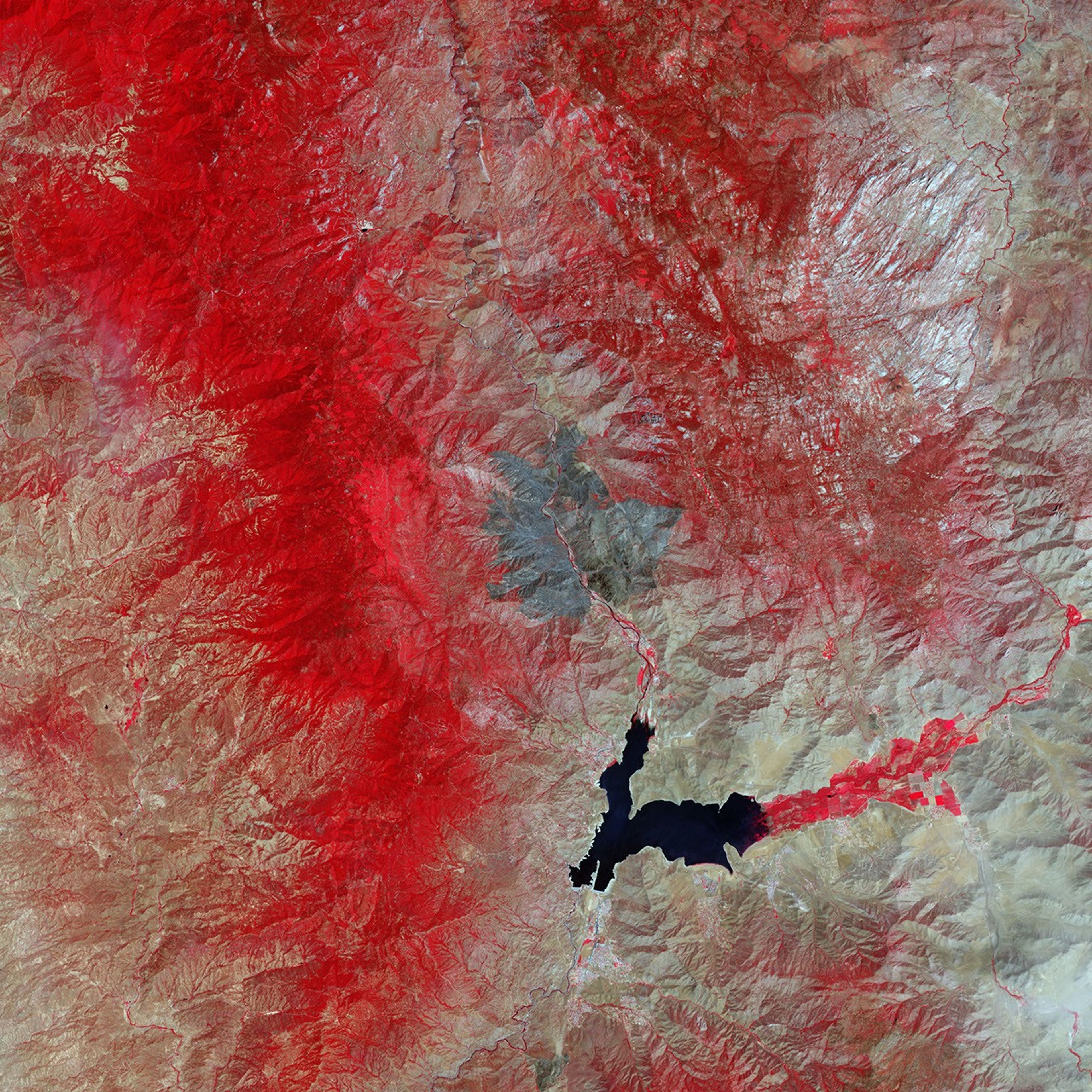


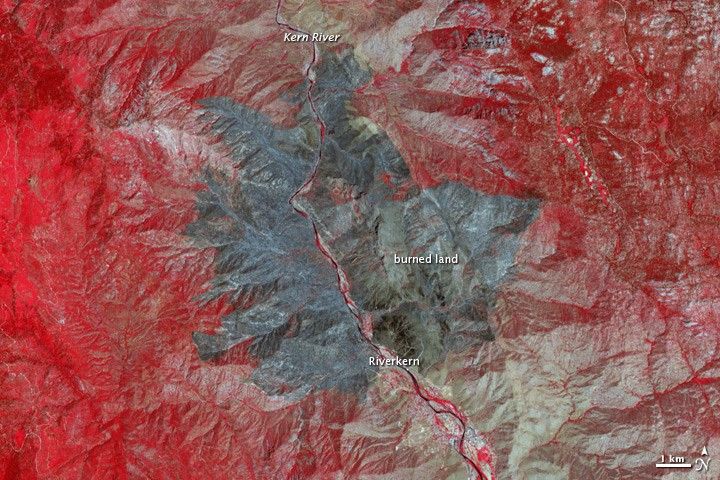
The Bull Fire was nearly contained when the Advanced Spaceborne Thermal Emission and Reflection Radiometer (ASTER) on NASA’s Terra satellite acquired this false-color image on August 1, 2010. The fire had been burning through grass, brush, oak, and pine along the southern boundary of the Sequoia National Forest. The image shows the challenge the terrain posed to firefighters. Steep slopes surround the Kern River Valley where the fire burned. By August 2, when the fire was 95 percent contained, the Bull Fire had burned 16,442 acres.
The freshly burned land is charcoal black in this image. Unburned vegetation is red, and bare or sparsely vegetated ground is light tan. The fire burned both east and west of the Kern River. It also surrounded Riverkern, a small community along the banks of the river. The light reflected off buildings and paved surfaces gives these areas a silver-blue color in the image.
References & Resources
- InciWeb. (2010, August 2). Bull Fire. Accessed August 2, 2010.
NASA image courtesy NASA/GSFC/MITI/ERSDAC/JAROS, and U.S./Japan ASTER Science Team. Caption by Holli Riebeek.