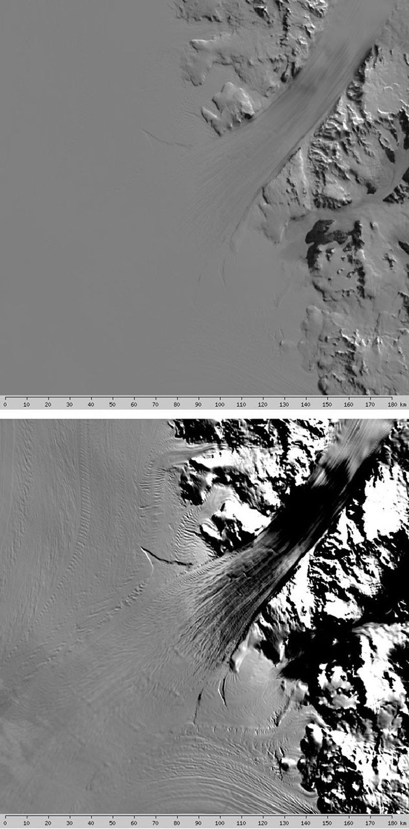
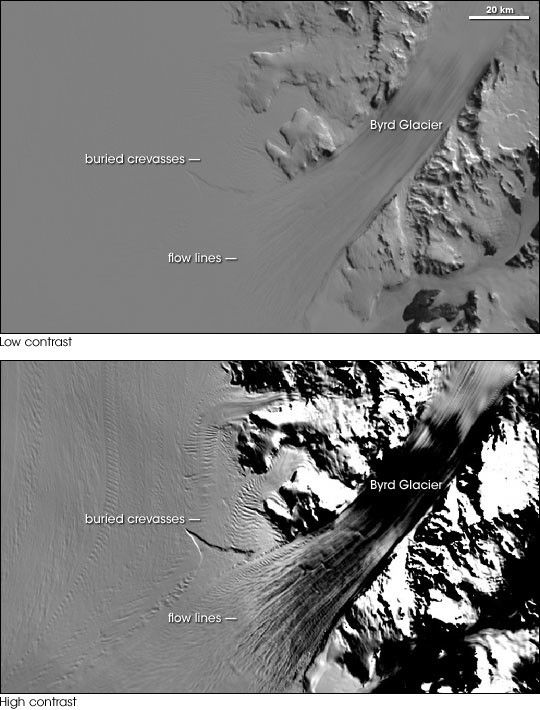
Named after American Antarctic explorer Richard E. Byrd, West Antarctica’s Byrd Glacier flows through a deep valley in the Transantarctic Mountains, covering a distance of 180 kilometers (112 miles) and descending more than 1,300 meters (4,300 feet) as it flows into the Ross Ice Shelf. The fast-moving stream is one of the largest contributors to the shelf’s total ice volume.
This pair of satellite images shows the Byrd Glacier with low contrast (top) and high contrast (bottom). The low-contrast version is similar to the level of detail the naked eye would see in an airplane flight over the area. In this scene, the ice sheet seems smooth and almost featureless. The bottom image uses enhanced contrast to highlight flow lines on the ice sheet and bottom crevasses. Bottom crevasses are cracks in the ice that form in the underside of the ice surface. Locating such crevasses through satellite imagery can help ensure the safety of researchers on the ground. The high-contrast version also accentuates the ruggedness of the mountains that surround the glacier.
These images are part of the MODIS Mosaic of Antarctica data set. Researchers at the National Snow and Ice Data Center and the University of New Hampshire compiled the map from 260 images of Antarctica acquired by the Moderate Resolution Imaging Spectroradiometer (MODIS) sensors on NASA’s Terra and Aqua satellites between November 20, 2003, and February 29, 2004. Available through the National Snow and Ice Data Center’s Website, a map server enables anyone interested in MOA data to generate images from the map at different levels of magnification and contrast.
- Further Reading:
- Mosaic of Antarctica from the Earth Observatory
- Mosaic of Antarctica imagery download and documentation from the National Snow and Ice Data Center
- State of the Cryosphere from the National Snow and Ice Data Center
- Byrd Glacier Exhibit from Goddard Space Flight Center’s Scientific Visualization Studio
References & Resources
Image courtesy the National Snow and Ice Data Center, based on data from NASA’s Aqua and Terra MODIS sensors.