Suggested Searches

1 min read

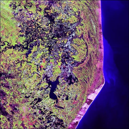
Cabo San Antonio, Argentina


Several hundred kilometers southeast of Buenos Aires, Cabo San Antonio juts outinto the Atlantic Ocean along the Argentinean coast.

This image was acquired by Landsat 7’sEnhanced Thematic Mapper plus (ETM+) sensor.

References & Resources

Image provided by the USGS EROS Data Center Satellite Systems Branch as part of the Earth as Art II image series


You may also be interested in:

Stay up-to-date with the latest content from NASA as we explore the universe and discover more about our home planet.

Sizing Up the Sargassum Belt
6 min read

Seaweed composing the Great Atlantic Sargassum Belt hit near-record levels in June 2026, with the Caribbean Sea and Gulf of…

Article
An Epic View of the Seasons
6 min read

The tilt in Earth's axis of rotation makes the apparent position of continents shift with the seasons in imagery from…

Article
A Moonlit Earth as Seen From Artemis II
4 min read

An astronaut’s photo, taken en route to the Moon, reveals our planet and its place in space in a novel…

Article