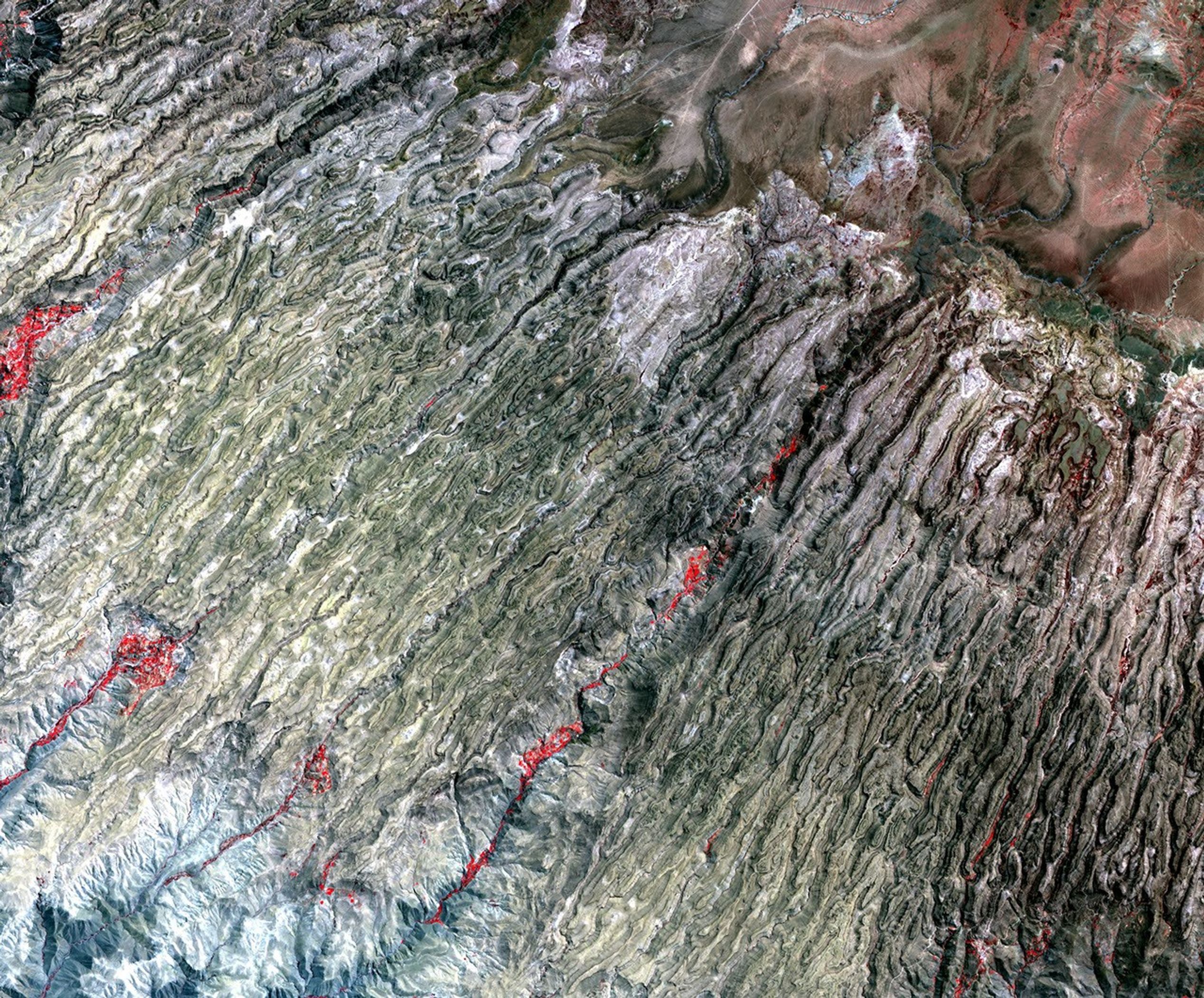
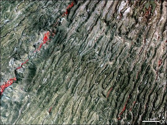
In the arid terrain of the western slopes of the Andes Mountains in southern Peru, very little vegetation exists to soften or obscure the rugged topography. In the central part of the state of Ayacucho, pictured in this satellite image, the mountains are dramatically sliced by dozens of nearly straight, parallel canyons that point southwest toward the Pacific coast.
The image is made from a combination of visible and infrared light, which makes the lush vegetation hugging the banks of some of the larger rivers stand out in bright red compared to the surrounding rock. In some canyons the vegetation is duller red; this is more likely natural riverside vegetation. The very bright red vegetation, for example, in the largest river canyon, is more likely the result of irrigation. This image was captured on September 28, 2004, by the Advanced Spaceborne Thermal Emission and Reflection Radiometer (ASTER) on NASA’s Terra satellite.
References & Resources
NASA image courtesy GSFC/METI/ERSDAC/JAROS, and the U.S./Japan ASTER Science Team. Caption by Rebecca Lindsey.