


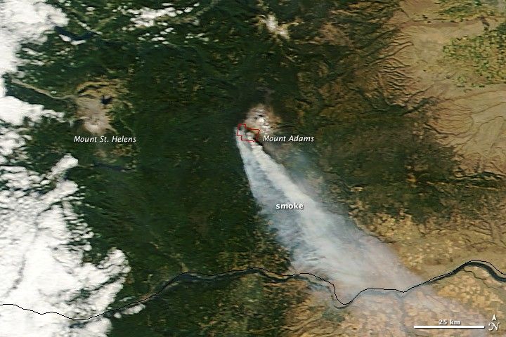
On September 8, 2012, lightning sparked more than 200 wildfires in Washington. This natural-color satellite image shows smoke from one of those fires—the Cascade Creek fire—streaming toward the southeast. The fire is located on the south slope of Mount Adams. The image was acquired by the Moderate Resolution Imaging Spectroradiometer (MODIS) aboard the Terra satellite on October 2, 2012. Actively burning areas, detected by MODIS’s thermal bands, are outlined in red.
By September 11, 2012, more than 8.79 million acres (3.56 million hectares) had burned throughout the United States, in what has proven to be one of the most severe wildfire seasons in the last decade. The only year in the last decade when more acres had burned by October 2 was 2006 (nearly 9.09 million acres).
References & Resources
- Inciweb. (2012, October 2). Cascade Creek. Accessed October 2, 2012.
- National Interagency Fire Center. (2012, October 2). Year-to-Date Statistics. Accessed October 2, 2012.
NASA image courtesy LANCE MODIS Rapid Response Team at NASA GSFC. Caption by Adam Voiland.


