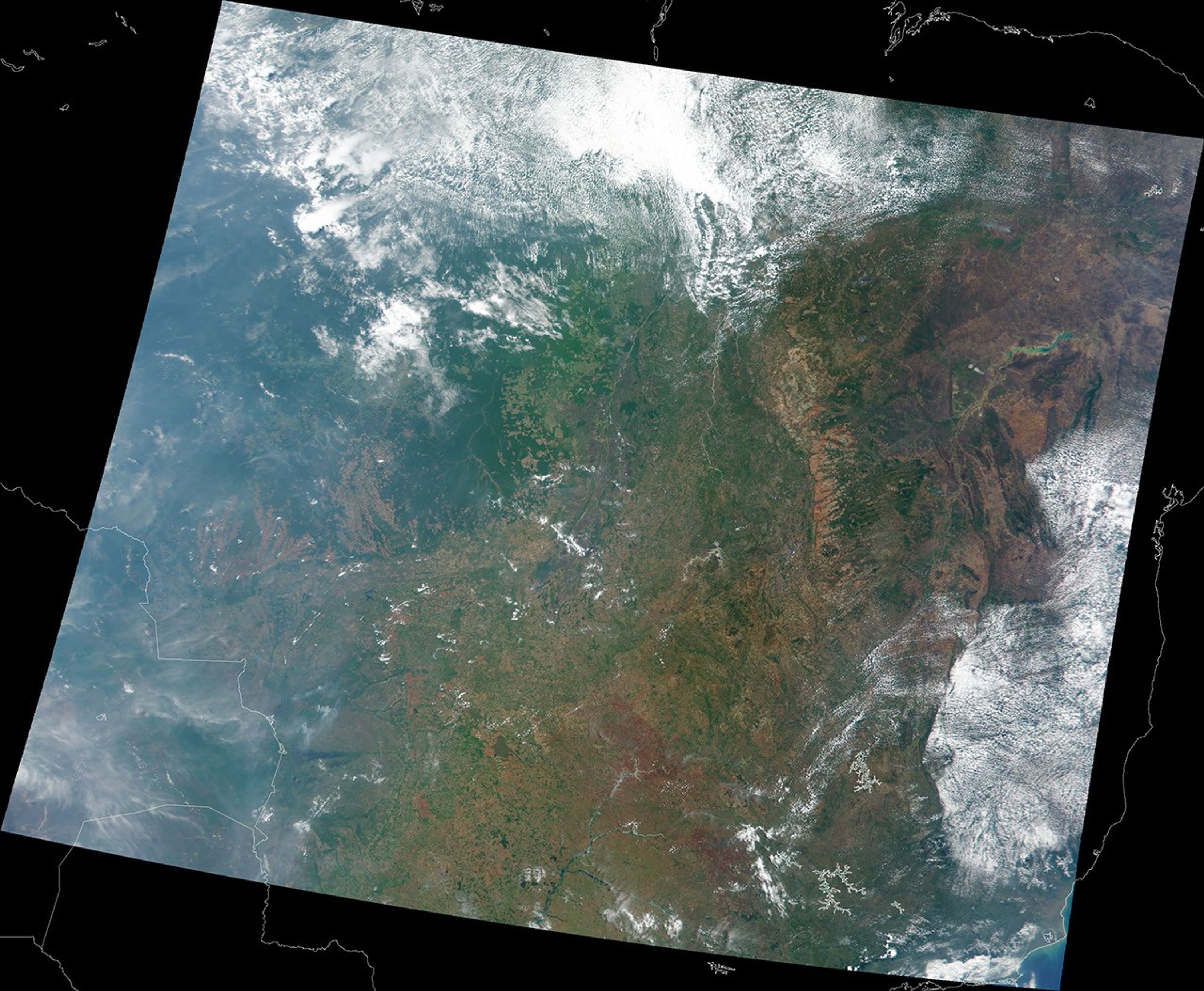
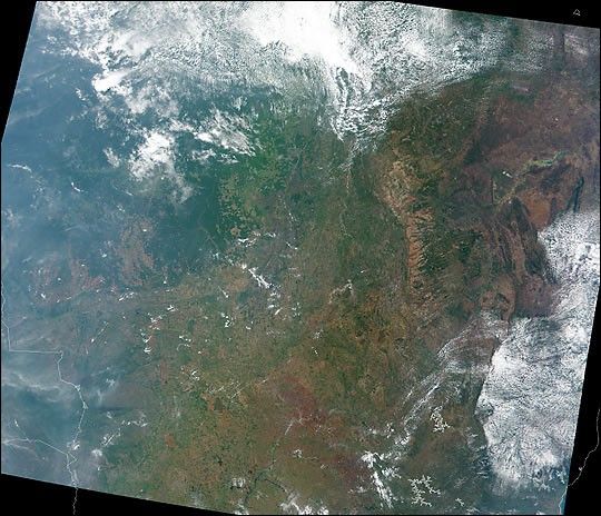
This Moderate resolution Imaging Spectroradiometer (MODIS) true-colorimage was acquired on October 19, 2000, over a region in Brazil large enough toshow much of the country’s diverse landscape. Spanning some 8.5 millionsquare kilometers (3.2 million square miles), Brazil is by far thelargest South American nation--both in terms of land and population.
The region known as the Amazon Basin lies to the northwest (upper left) and extends well beyond the northern and western edges of thisscene. Typically, from this perspective Amazonia appears as a lush,dark green carpet due to the thick canopy of vegetation growing there.Some of the Amazon Basin is visible in this image, but much is obscuredby clouds (bright white pixels), as is the Amazon River. This region ishome to countless plant and animal species and some 150,000 native SouthAmericans. The clusters of square and rectangular patterns toward thecenter of the image (light green or reddish-brown pixels) are wherepeople have cleared away trees and vegetation to make room fordevelopment and agriculture.
Toward the western side of the scene there is considerable haze andsmoke from widespread biomass burning in parts of Brazil and Bolivia,which shares its eastern border with Brazil. Toward the east in thisimage is the highland, or “cerrado,” region, which is more sparselyvegetated and has a somewhat drier climate than the Amazon Basin. Thecapital city, Brasilia, lies within this region just southwest of theGeral de Goias Mountains (orangish pixels running north-south).
There are two large water reservoirs visible in this scene--theSobradinho Reservoir about 800 km (500 miles) northeast of Brasilia, andthe Paranaiba about 500 km (300 miles) southwest of Brasilia.
MODIS flies aboard NASA’s Terra spacecraft.
References & Resources
Image courtesy Brian Montgomery, Reto Stöckli, and Robert Simmon, based on data from the MODIS Science Team.