
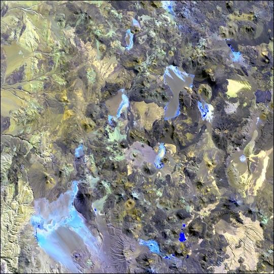
On the border between Chile and the Catamarca province of Argentina lies a vast fieldof currently dormant volcanoes. Over time, these volcanoes have laid down a crust ofmagma roughly 2 miles (3.5 km) thick. It is tinged with a patina of various colorsthat can indicate both the age and mineral content of the original lava flows.
This image was acquired byLandsat 7’s Enhanced Thematic Mapper plus(ETM+) sensor on May 15, 1999. This is a false-color composite image made using shortwave infrared,infrared, and green wavelengths.
References & Resources
Image provided by the USGS EROS Data Center Satellite Systems Branch