


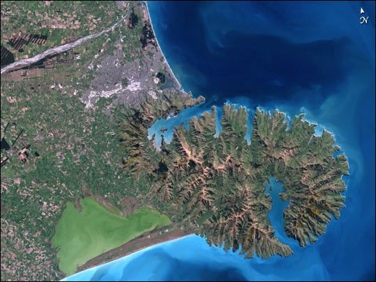
Christchurch City (population 320,000) sits at the base of the long arc ofPegasus Bay, bounded to the north by the Waimakariri River and to thesouth by the old crater complex of the Port Hills and Banks Peninsula.
The heavily braided rivers of the South Island of New Zealand bringgreywacke rock from the Southern Alps to the west, forming the hugealluvial pan (750,000 ha) of the Canterbury Plains. Braided rivers arerare worldwide, found elsewhere only in Alaska, Canada, and the Himalayas.They form a network of ever-changing channels weaving between temporaryshingle islands. In some places, the gravel they have transported from themountains formed by the clash of the Indo-Australian and Pacific Plates isas much as 500 meters deep.
Banks Peninsula, named for explorer Captain Cook’s botanist, consists oftwo overlapping extinct volcanoes, the Lyttelton Volcano and the AkaroaVolcano. Since the last eruptive activity some six million years ago, thevolcanoes have been heavily eroded, dropping them from a peak of 1,500meters down to around 500 meters.
During his quick 1770 visit, Cook mistook the peninsula for an island, butthe build up of the Canterbury Plains has seen it joined to the mainlandfor at least 200,000 years.
Breaches in the crater walls have produced two long harbors: Lyttelton tothe north and Akaroa to the south. The former is the port forChristchurch, and European settlers in the 1860s were quick to bore atunnel through to Christchurch rather than tackle the steep hills and longswampy walk into the early settlement. The original idea was to settle atthe end of Lyttelton Harbour, but the huge mudflats exposed at low tideput paid to that plan.
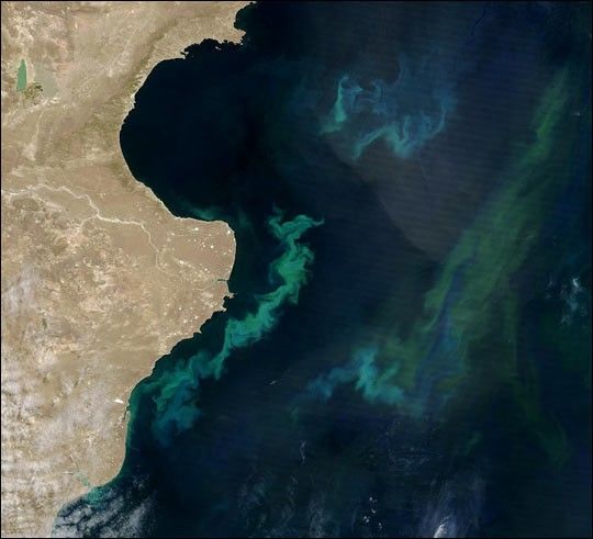
The shallow green waters of Lake Ellesmere (Waihora) to the south of thecity offer a refuge for wildlife. The estuary for the small Avon andHeathcote rivers, just to the north of Lyttelton Harbour, is home togodwits, curlews and other visitors from Siberia and Alaska, as Asian andAmerican birds reach the southernmost point of their annual migrationshere.
This image was acquired by the Enhanced Thematic Mapper plus (ETM+) sensor flying aboard the Landsat 7 satellite on September 25, 2001.
References & Resources
Caption by Vicki Hyde, managing editor of the SciTech Daily Review . Image by Jesse Allen, based on data provided by the Landsat 7 Science Team.


