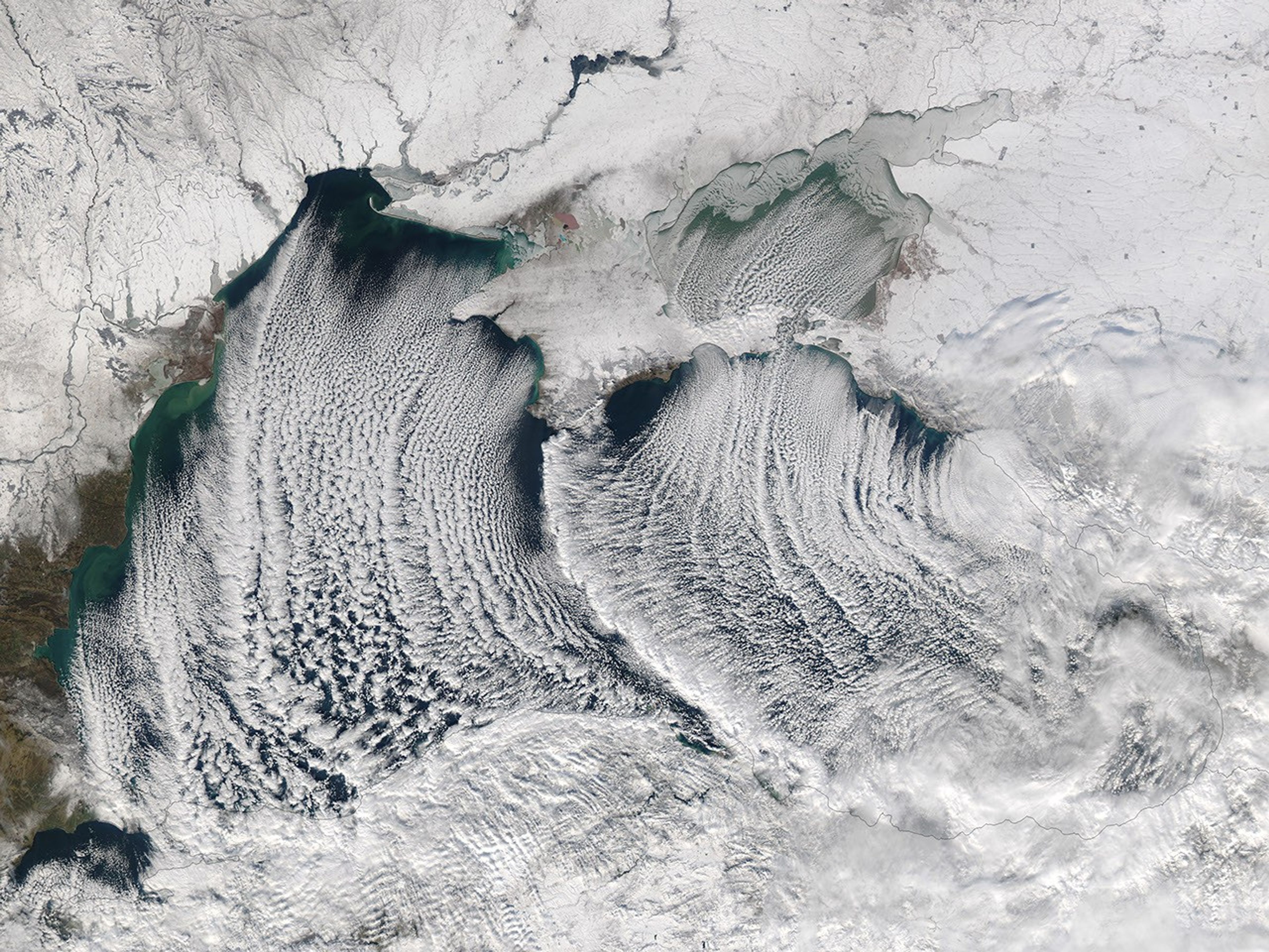

The Moderate Resolution Imaging Spectroradiometer (MODIS) on the Aqua satellite captured this image of cloud streets over the Black Sea on January 8, 2015. Cloud streets are long parallel bands of cumulus clouds that form when cold air blows over warmer waters and a warmer air layer (temperature inversion) rests over the top of both. The comparatively warm water gives up heat and moisture to the cold air above, and columns of heated air called thermals naturally rise through the atmosphere. The temperature inversion acts like a lid. When the rising thermals hit it, they roll over and loop back on themselves, creating parallel cylinders of rotating air. As this happens, the moisture cools and condenses into flat-bottomed, fluffy-topped cumulus clouds that line up parallel to the direction of the prevailing winds.
References & Resources
- EarthSky (2005, April 24) What are cloud streets? Accessed January 10, 2014.
- KNMI Cloud Streets: Meteorological Physical Background. Accessed January 10, 2014.
- NASA Earth Observatory (2011, January 24) Winter Cloud Streets, North Atlantic.
- Weather Underground (2005, April 24) Cloud Streets. Accessed January 10, 2014.
NASA Earth Observatory image courtesy Jeff Schmaltz LANCE/EOSDIS MODIS Rapid Response Team, GSFC. Caption by Adam Voiland.