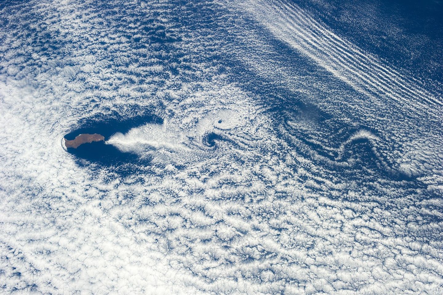
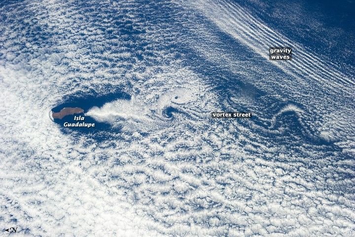
Guadalupe Island is a volcanic edifice that is 35 kilometers (21 miles) long and 240 kilometers (150 miles) off the coast of Mexico’s Baja California peninsula. On the August day when this astronaut photograph was taken, winds were blowing from the north (left) across the island, giving rise to a series of atmospheric eddies that appear as circles and swirls in the clouds downwind.
Obstacles of any kind can set up such vortices—known technically as a Von Karman vortex street—from islands to craters to chimneys. The size of each swirl can be judged from the length of the island. Under ideal conditions, clouds make the swirls visible. However, a vortex street will only form under certain conditions of air speed, atmospheric stability, and obstacle size. Conditions are ideal for production of vortex streets in the vicinity of Guadalupe Island, which is known to produce them almost every day in June, July and August. The phenomenon is named after Theodore von Karman, a Hungarian-American engineer and fluid mechanics expert.
Also visible at image top right is a series of parallel cloud lines. Known colloquially as “gravity waves,” these are ripples at the boundary between atmospheric layers of slightly different density. The same phenomena was recently observed by astronauts onboard the International Space Station while flying over the Great Lakes.
Other examples of vortex streets:
- NASA Earth Observatory (2002, March 14) A Vortex Street in the Arctic.
- NASA Earth Observatory (2000, December 7) Atmospheric Vortices near Guadalupe Island.
- NASA Earth Observatory (2002, July 15) von Karman Vortices.
References & Resources
Astronaut photograph ISS036-E-35665 was acquired on August 24, 2013, with a Nikon D3S digital camera using a 50 millimeter lens, and is provided by the ISS Crew Earth Observations experiment and Image Science & Analysis Laboratory, Johnson Space Center. The image was taken by the Expedition 36 crew. It has been cropped and enhanced to improve contrast, and lens artifacts have been removed. The International Space Station Program supports the laboratory as part of the ISS National Lab to help astronauts take pictures of Earth that will be of the greatest value to scientists and the public, and to make those images freely available on the Internet. Additional images taken by astronauts and cosmonauts can be viewed at the NASA/JSC Gateway to Astronaut Photography of Earth. Caption by M. Justin Wilkinson, Jacobs at NASA-JSC.