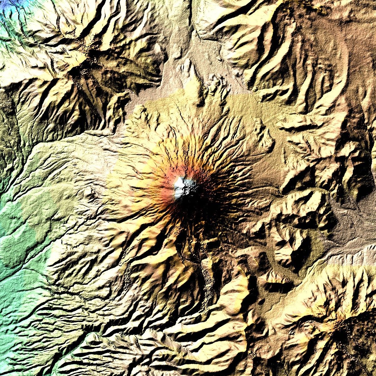
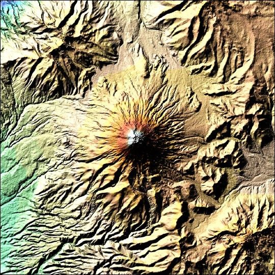
On February 19, 2000, Space Shuttle Endeavour passed over the highly activeand dangerous volcanic zone of the Andes in Equador. Endeavour was mappingelevations on most of the Earth’s land surface during theShuttle Radar Topography Mission (SRTM). There have beenmore than 50 eruptions of Mt. Cotopaxi alone since 1738. With its heightof 5,897 meters it is more than 3,000 meters higher than thesurroundings. The base of this stratovolcano has a width about 23 km.
The digital elevation model acquired by SRTM, with its resolution of 25 m x 25 m, is sorich in detail that you can even make out an inner crater with adiameter of 120 m by 250 m inside the outer crater (800 m x 650 m). Blue and green correspond to thelowest elevations in the image, while beige, orange, red, and white represent increasing elevations.Numerous valleys formed by powerful Lahars (mudflows) are prominent inthe digital elevation model. Lahars can cause severe damage even 300 km away from thevolcano. This poses a high risk to the local population, theirsettlements and fields. Interferometry is especially useful inmonitoring such dangerous volcanoes. Highly accurate observations ofchanges in volcanoes from space can provide vital parameters for earlywarning systems, without risk to the lives of scientists. An operationalsystem, though, would rely on a system of interferometric sensors to mapon a regular basis.
For more information about this image, and a wider-scale view, visitX-SAR/SRTM Elevation Model Shows Highest Active Volcano in the World.
References & Resources
Image courtesy German Remote Sensing Data Center