Suggested Searches

1 min read

Crown Fire, California

Topics:
 

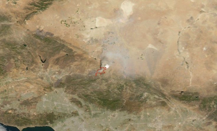
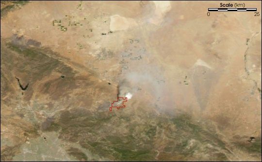
Several fast-moving wildfires have been nipping at the margins of Los Angeles in the third week of July 2004. The Moderate Resolution Imaging Spectroradiometer (MODIS) on NASA’s Aqua satellite captured this image of the Crown Fire on July 21, 2004. The area outlined in red shows the area in which MODIS detected actively burning fire. The Crown Fire had burned about 8,000 acres along the southern edge of the Mojave Desert in the Angeles National Forest as of July 21.

References & Resources

Image by Jesse Allen, based on data from the MODIS Rapid Response Team, NASA-GSFC

You may also be interested in:

Stay up-to-date with the latest content from NASA as we explore the universe and discover more about our home planet.

B.C. Wildfires Send Smoke Skyward
2 min read

Lightning likely ignited several large fires that sent smoke pouring over the Canadian province in early September 2025.

Article
Fires on the Rise in the Far North
3 min read

Satellite-based maps show northern wildland fires becoming more frequent and widespread as temperatures rise and lightning reaches higher latitudes.

Article
Smoke Blankets the Iberian Peninsula
3 min read

Fueled by extreme heat and dry conditions, intense wildfires in Spain and Portugal sent thick smoke across parts of Europe.

Article