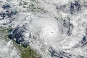
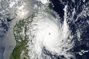
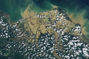
Two different oceans were crowded with tropical cyclones in late February 2025. In the South Pacific, three storms were active at one point—an occurrence that is rare but not unheard of. Simultaneously, a trio of cyclones roiled in the neighboring Indian Ocean.
Five tropical cyclones are visible in this false-color image, acquired on February 26 by the VIIRS (Visible Infrared Imaging Radiometer Suite) sensor on the NOAA-20 satellite. The image depicts infrared signals known as brightness temperature, which are useful for distinguishing cooler cloud structures (white and purple) from the warmer surface below (yellow and orange). The day before this image was acquired, a sixth storm, Tropical Cyclone Rae, was weakening east of the area shown here after bringing heavy rain to Fiji.
Cyclones Alfred and Seru lurked alongside Rae in the South Pacific. Seru lingered offshore of Australia, reaching Category 1 strength on the Saffir-Simpson wind scale for a short time. Alfred was also forecast to stay offshore, according to the Australian Bureau of Meteorology, but was expected to bring hazardous coastal conditions to southern Queensland. The storm was at Category 2 strength on the day of this image but would intensify to Category 4 on February 27.
Off Western Australia, Tropical Cyclone Bianca was on the tail end of its journey, having weakened to tropical storm status on February 26. The previous day, it had intensified to Category 3 but stayed far enough from land that mainland Australia and island communities were not expected to feel its effects.
Bianca’s Indian Ocean cohabitants, Honde and Garance, posed more hazards to land. The island nation of Mauritius, east of Madagascar, shut down its airport on February 26 as Garance approached, according to news reports. The storm would strengthen from Category 2 that day to Category 3 the next, with wind speeds of 190 kilometers (120 miles) per hour. Meanwhile, Honde skirted south of Madagascar as a Category 1 storm. Heavy rain, strong winds, and storm surge were forecast for central and southern Madagascar, Mauritius, and Réunion island.
Meteorologists noted that warm sea surface temperatures and weak wind shear conditions may have contributed to the proliferation of storms. A marine heat wave has lingered off of Western Australia since September 2024, and anomalously high sea surface temperatures warmed in the area in late February 2025. For the South Pacific, the Australian Bureau of Meteorology had predicted a higher-than-average likelihood of severe tropical cyclones this season due to expected warm ocean temperatures. Tropical cyclone season generally runs from November through April in the Southern Hemisphere.
References & Resources
- AccuWeather (2025, February 25) There were 6 tropical storms in the Southern Hemisphere yesterday. Accessed February 27, 2025.
- Met Office Location of tropical cyclones. Accessed February 27, 2025.
- ReliefWeb (2025, February 26) Reunion, Mauritius, Madagascar - Tropical cyclones GARANCE and HONDE, update. Accessed February 27, 2025.
- The Washington Post (2025, February 25) Three tropical cyclones are churning in the South Pacific — all at once. Accessed February 27, 2025.
- Weather Underground (2025) 2025 Southern Hemisphere Tropical Storms. Accessed February 27, 2025.
NASA Earth Observatory image by Michala Garrison, using MODIS and VIIRS data from NASA EOSDIS LANCE and GIBS/Worldview and the Joint Polar Satellite System (JPSS). Story by Lindsey Doermann .

