


![Request for Information – Potential [Placeholder for Prize]](https://assets.science.nasa.gov/dynamicimage/assets/science/missions/a-step/FFR_Earth_Background_20251120%20.png?w=1024)


- March 18, 2007 (5.4 MB JPG)
- March 4, 2007 (6.3 MB JPG)
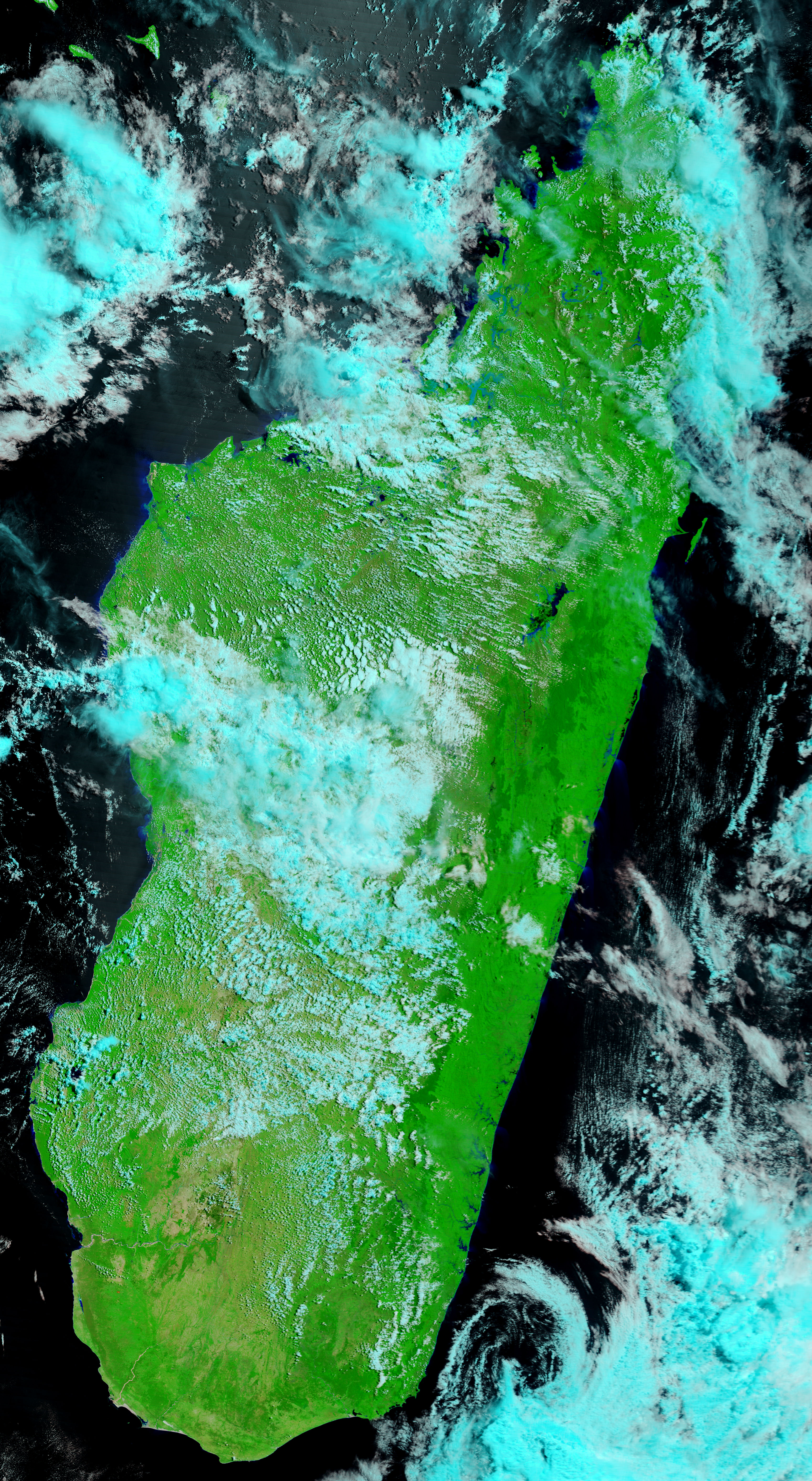
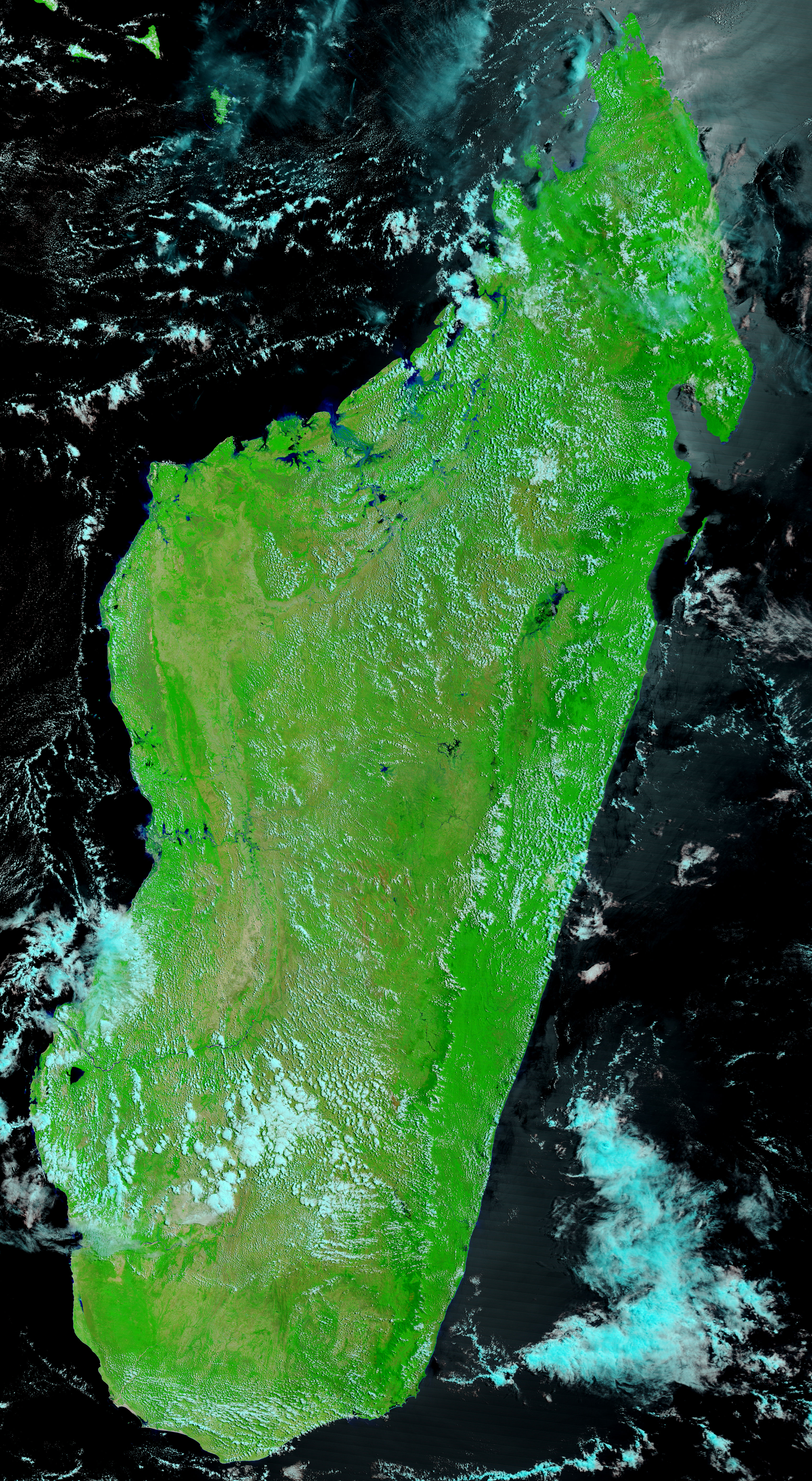
Cyclone Indlala hovered over northern Madagascar for the better part of three days after coming ashore on March 14, 2007, as a Category 3 storm. By March 18, the clouds had cleared enough to reveal the extensive flooding left in the storm’s wake. These images, captured by the Moderate Resolution Imaging Spectroradiometer (MODIS) on NASA’s Terra satellite, show the northern tip of the island country. The images were made with a combination of infrared and visible light, so that water is blue or black, clouds are pale blue and white, plant-covered land is green, and bare ground is tan. Rivers throughout the region are clearly swollen in the wake of the storm. The Xinhua News Agency reported that 14 people had died in the winds and floods, while approximately 14,000 people were affected.
Cyclone season in the Southern Indian Ocean typically runs from November to March. The current season, 2006-2007, has proven to be very active. Indlala was the fourth storm to come ashore over Madagascar since December. Cyclone Bondo struck in December 2006, Clovis in January 2007, and Gamede in February.
References & Resources
NASA images courtesy the MODIS Rapid Response Team at NASA GSFC, which provides daily images of Madagascar.


